/ SERVICE #25
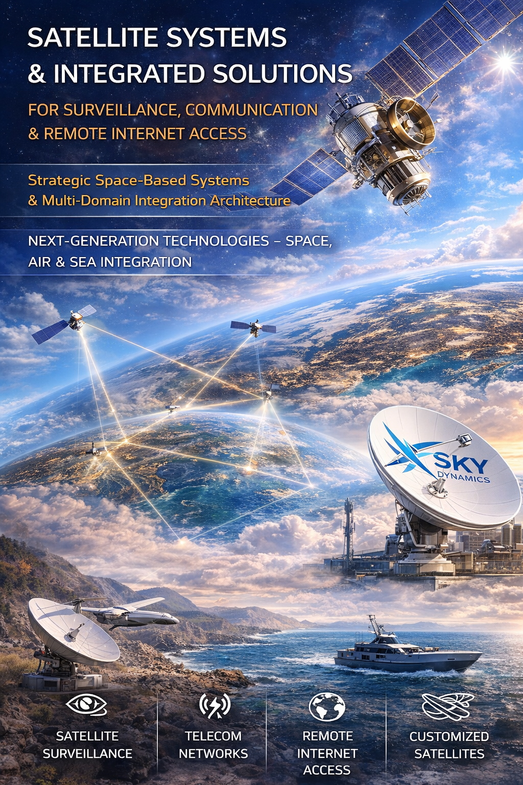
Satellite Imaging, Satellite Design and Integrated Space Systems for Observation, Communication and Connectivity in Remote Areas
Satellite Imaging, Satellite Design Integrated Space Systems for Observation, Communication and Connectivity in Remote Areas Strategic Space-Based Systems Multi-Domain Integration Architecture Next-Generation Technologies – Integration Between Space, Air and Maritime Domains Satellite–Drone–Surface Integrated Systems, enabling continuous monitoring, communication, and real-time response regardless of geographic or infrastructure limitations.
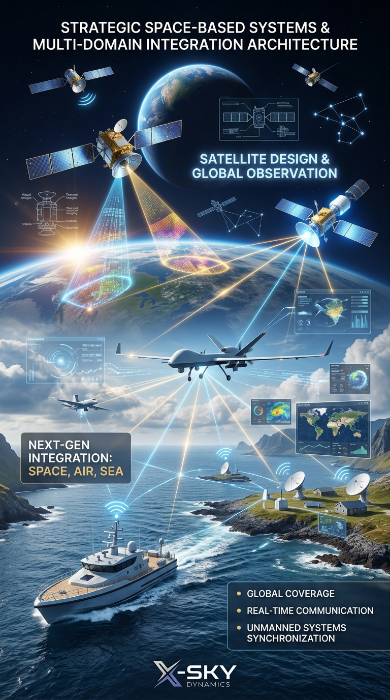
Our company provides integrated solutions for visual and thermal satellite observation, development of satellite telecommunications networks, satellite-based internet connectivity, as well as the design of specialized satellites for navigation, observation, energy, meteorology and other strategic applications. In partnership with leading manufacturers and operators, we deliver fully customized systems – both through proprietary satellite platforms and by leveraging the capacity of existing international constellations. In addition to conventional satellite solutions, X-Sky Dynamics develops a concept for a unified multi-layer operational ecosystem, where satellites, UAVs (drones), unmanned surface vehicles (USVs), and ground systems operate in full synchronization. This integration creates a new class of technology – Satellite–Drone–Surface Integrated Systems, enabling continuous monitoring, communication, and real-time response regardless of geographic or infrastructure limitations.
Strategic Layer – Space-Based ISR & Command Integration
Within the context of modern defense and strategic systems, X-Sky Dynamics satellite solutions can function as:
- Space-based ISR (Intelligence, Surveillance, Reconnaissance) layer
- Command, Control, Communications, Computers, Intelligence (C4ISR) integration node
- Persistent monitoring infrastructure for national and regional security
- Force multiplier for UAV, USV and ground operational units
These systems enable the development of multi-domain operational architecture, aligned with modern concepts such as:
- Network-Centric Warfare
- Multi-Domain Operations (MDO)
- Integrated Air-Space-Sea Situational Awareness
- Real-Time Decision Support Systems
Core Capabilities
Satellite Visual and Thermal Observation
- Provision of high-quality imagery on demand from virtually any region of the globe
- Monitoring of large territories using optical, infrared and multispectral sensors
- Extraction of critical information related to fires, thermal anomalies, pollution, illegal activities and landscape changes
- Delivery of high-resolution real-time imagery for environmental monitoring, security and crisis situations
- Seamless integration with drone systems, ground stations and mobile command centers
Extended capabilities:
- Near real-time satellite tasking upon event detection
- AI-based image analysis for automated risk detection
- Monitoring of dynamic processes (fires, spills, movement patterns)
- Synchronization with UAV missions for detailed local analysis following global detection
Defense-grade extension:
- Persistent surveillance over strategic regions
- Detection of anomalous behavior patterns
- Integration with threat detection systems
Satellite Telecommunications Network Development
- Design and deployment of temporary or permanent satellite communication networks for remote or disaster-affected regions
- Establishment of communication nodes using Starlink, Thuraya, Inmarsat and other platforms
- Installation of mobile and stationary terminals for data, voice and video communication
- Provision of communication coverage for operations, missions, events and temporary deployments
Additional capabilities:
- Deployment of autonomous communication hubs (mobile command units)
- Connectivity between UAVs, USVs and command centers via satellite links
- Redundant communication channels for critical operations
Strategic extension:
- Secure SATCOM architecture
- Redundant communication layers
- Integration with military-grade communication systems
Satellite Internet Connectivity in Remote Areas
- Solutions for individual, institutional and mobile satellite internet access
- High-speed bidirectional connectivity in regions without terrestrial infrastructure
- Suitable for remote bases, mountainous regions, maritime and desert environments
- Low latency and continuous connectivity via modern LEO satellite systems
Extended applications:
- Connectivity support for autonomous drone systems (Dock stations)
- Integration of maritime drones (USVs) and underwater systems with command centers
- Operational support in fully isolated regions
Satellite Design and Development
- Concept, design and manufacturing of telecommunication, navigation, observation, energy and meteorological satellites
- Capability for LEO, MEO and GEO satellite deployment with varying lifespans and coverage
- Development of micro- and nano-satellites for scientific, industrial and governmental purposes
- Payload integration tailored to client requirements – optical, thermal sensors, radiometers, communication modules and more
Advanced developments:
- Satellites designed for direct integration with UAV and USV systems
- Dedicated ISR satellite platforms
- On-orbit edge processing for real-time data pre-analysis
- Development of specialized sensors for industrial and strategic applications
Advanced defense layer:
- Modular satellite architecture
- Rapid deployment nano-satellite constellations
- Dedicated mission payloads for ISR operations
Satellite–Drone–Maritime Integration (Next Generation Systems)
X-Sky Dynamics develops a unified operational ecosystem combining:
- Satellites – global monitoring and communication
- UAVs – detailed local analysis and response
- USVs – maritime operations
- Ground systems – command and coordination
This enables:
- detection of events via satellite
- automatic deployment of drone systems
- coordination with maritime platforms
- real-time analysis and response
Multi-Domain Operational Architecture
The system can be structured into multiple operational layers:

1. Space Layer – Satellite observation and communication
2. Air Layer – UAV reconnaissance and response
3. Surface Layer – USV maritime operations
4. Ground Layer – Command, control and data analysis
Result:
- full situational awareness
- rapid response capability
- centralized command
- distributed autonomy
Strategic Operational Scenarios
Scenario: Large-scale wildfire detection and response
- Satellite detects anomaly
- UAV swarm deployed
- USV units monitor water resources
- Command center coordinates response
Scenario: Border monitoring and security
- Continuous satellite surveillance
- UAV patrol missions
- Real-time tracking
- Integrated response units
Scenario: Maritime surveillance and incident response
- Satellite identifies anomaly at sea
- USV deployed for inspection
- UAV provides aerial support
- Real-time data transmitted to command center
Conclusion (Strategic Vision)
Satellite technologies are no longer standalone systems, but part of an integrated multi-domain architecture. By combining space, air and maritime platforms, X-Sky Dynamics delivers a new generation of operational systems that: This represents a transition toward an intelligent, connected and autonomous operational environment, aligned with the most advanced requirements in industry, security and defense.
- provide global coverage
- deliver real-time intelligence
- enable autonomous operations
- support strategic decision-making
Get in Touch
[ CONTACT US ]