/ SERVICE #05
Geodetic and Topographic Surveying with UAV Systems
photogrametry geodetic and topographic surveying drone unmanned aerial systems photogrammetry LiDAR technologies, RTK PPK GNSS positioning georeferenced orthophoto maps, digital surface terrain models DSM DTM 3D models high-density point clouds
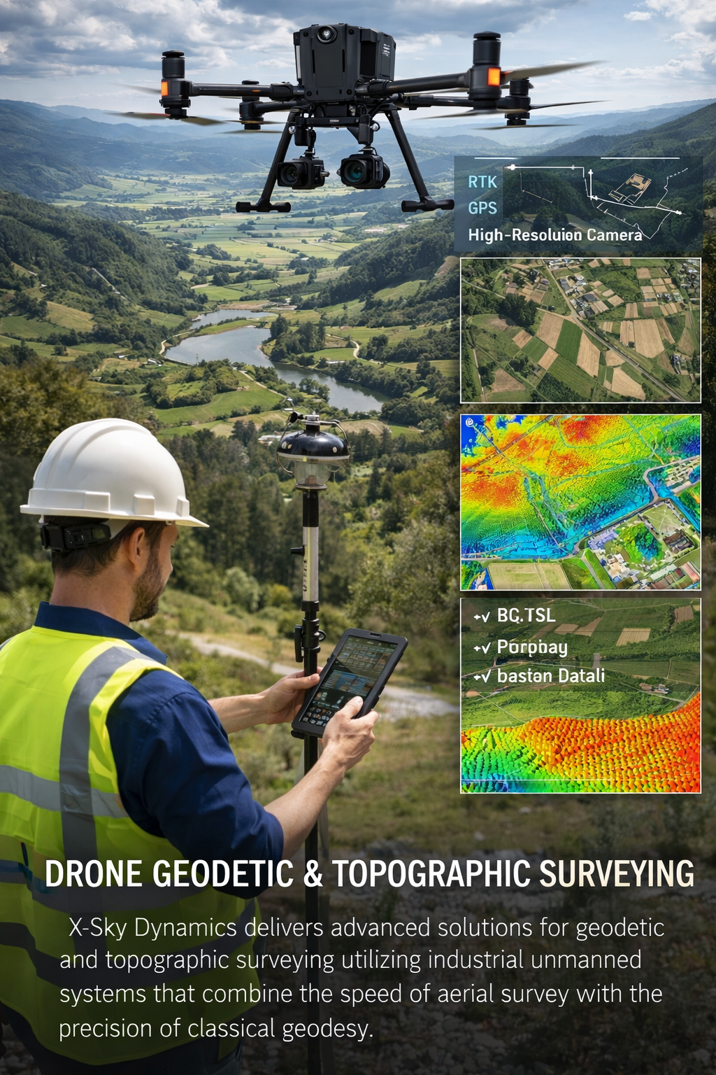
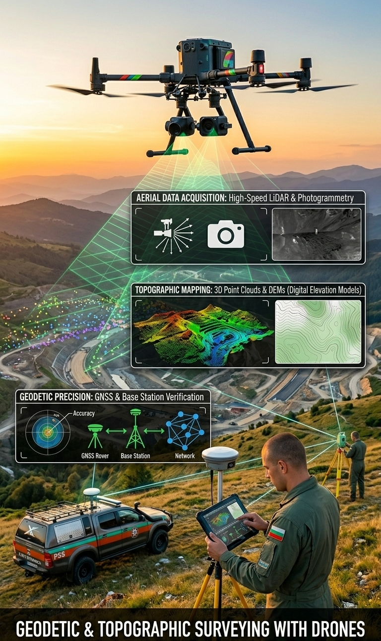
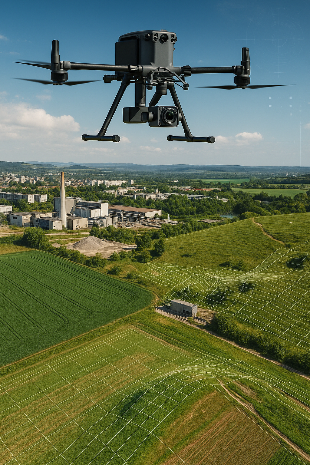
In modern engineering, construction, and infrastructure environments, accurate and up-to-date terrain information is a critical factor for making informed decisions. X-Sky Dynamics provides high-tech solutions for geodetic and topographic surveying using industrial unmanned aerial systems, combining the speed of aerial data acquisition with the precision of classical geodesy. By integrating photogrammetry, LiDAR technologies, RTK/PPK GNSS positioning, and intelligent analytical platforms, we deliver detailed and reliable geospatial data for terrain, structures, and infrastructure. The collected data serves as a foundation for design, analysis, monitoring, and process management across multiple industries. The process itself involves carefully planned aerial missions, during which UAV systems collect large volumes of data in the form of high-resolution imagery or laser measurements. Following processing in specialized software, a complete digital representation of the terrain is generated, enabling both visual analysis and highly accurate engineering calculations.
What Does the Service Include?
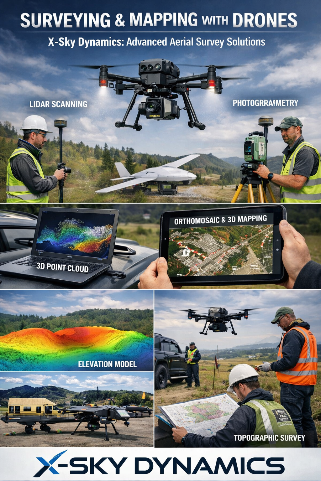
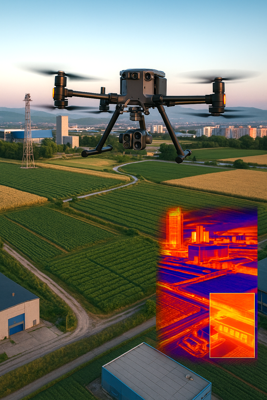
Geodetic and topographic surveying with UAV systems is a highly efficient method for collecting spatial data through precisely planned aerial missions. During these operations, drones capture thousands of high-resolution images or collect laser reflections using LiDAR systems, which are subsequently processed using specialized software. The result is a complete digital reconstruction of the real environment, including georeferenced orthophoto maps, digital surface and terrain models (DSM/DTM), 3D models, and high-density point clouds. This enables highly accurate measurements of distances, elevations, areas, and volumes, as well as monitoring changes over time through comparison with archived datasets from previous surveys.
Technological Solutions and Advantages
The technological foundation of this service includes:
- High-resolution photogrammetric UAV systems providing detailed imagery for mapping and analysis
- LiDAR systems capable of penetrating vegetation and capturing complex terrain with high accuracy
- RTK/PPK GNSS technologies ensuring centimeter-level geodetic precision for large-scale projects
- Multispectral and thermal sensors providing additional data on vegetation health, moisture, and material characteristics
- Intelligent software solutions with integration into CAD, GIS, and BIM platforms for seamless workflow compatibility
Data Outputs
The collected data is processed in specialized software and enables:
- creation of georeferenced orthophoto maps
- generation of digital surface and terrain models (DSM/DTM)
- development of 3D reconstructions and dense point clouds
- precise measurements of distances, elevations, areas, and volumes
- monitoring of dynamic changes over time and comparison with historical data
Applications and Industries
Construction and Infrastructure
- planning and design of road, railway, and engineering routes
- volumetric calculations for excavation, embankments, and materials
- progress monitoring through регуляр surveys
- documentation for investors and regulatory authorities
Urban Planning, Cadastre, and Architecture
- creation and updating of cadastral maps and property boundaries
- analysis of building density and access to green areas
- precise land parcel delineation
- façade and roof surveying for restoration and architectural projects
Environmental Monitoring and Forestry
- monitoring of erosion, landslides, and natural processes
- analysis of water resources (rivers, lakes, reservoirs)
- vegetation and biodiversity monitoring
- damage assessment after natural disasters (fires, floods, storms)
Agriculture
- topographic mapping of agricultural land and terrain analysis
- slope, drainage, and soil condition assessment
- irrigation planning and resource optimization
- integration of multispectral data for productivity analysis
Industry and Mining
- measurement of areas and volumes in quarries, mines, and stockpiles
- high-precision excavation and embankment calculations
- monitoring of industrial facilities and infrastructure
- safe access to hazardous or restricted areas without human presence
Client Benefits
- Speed and efficiency – large areas surveyed within hours, with near real-time data availability
- High precision – centimeter-level accuracy suitable for engineering, design, and legal applications
- Cost efficiency – reduced costs compared to traditional surveying methods
- Safety – eliminates the need for physical presence in hazardous or hard-to-reach areas
- Visualization and analysis – results delivered as orthophotos, 3D models, point clouds, and interactive datasets
- Sustainability – minimal environmental impact and ability to monitor changes over time
Conclusion
Geodetic and topographic surveying with UAV systems is a modern solution for measurement, analysis, and planning, combining the precision of classical geodesy with the advantages of advanced technologies. It enables engineers, architects, municipalities, investors, and agricultural professionals to access accurate and reliable data, essential for informed decision-making, resource optimization, and successful project execution.
Get in Touch
[ CONTACT US ]