[ SERVICES / SPECIALIZED BIOMETRIC UAS DRONE SYSTEMS FOR SAR ]
/ SERVICE #02
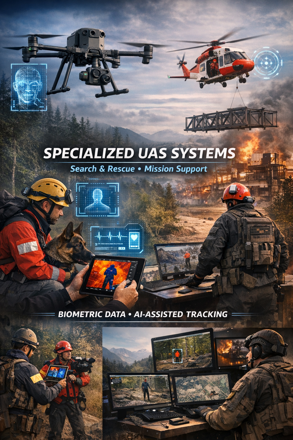
Specialized UAS Systems for Search, Rescue & Mission Support
Drone UAS biometric data collection Specialized UAS Systems for Search Rescue Mission Support search and rescue, locating missing persons, monitoring hard-to-reach areas, crisis response, and operational support for ground teams
/ 01
Our approach combines aerial platforms, payload systems, ground control stations, communication architecture, and analytical software into a unified solution designed for real-world operations, not just demonstration flights. Systems are designed and configured according to the client’s operational profile and can be adapted for civil, governmental, emergency response, and specialized institutional applications, in full compliance with applicable laws, aviation regulations, data protection requirements, and national operational frameworks.
What We Provide
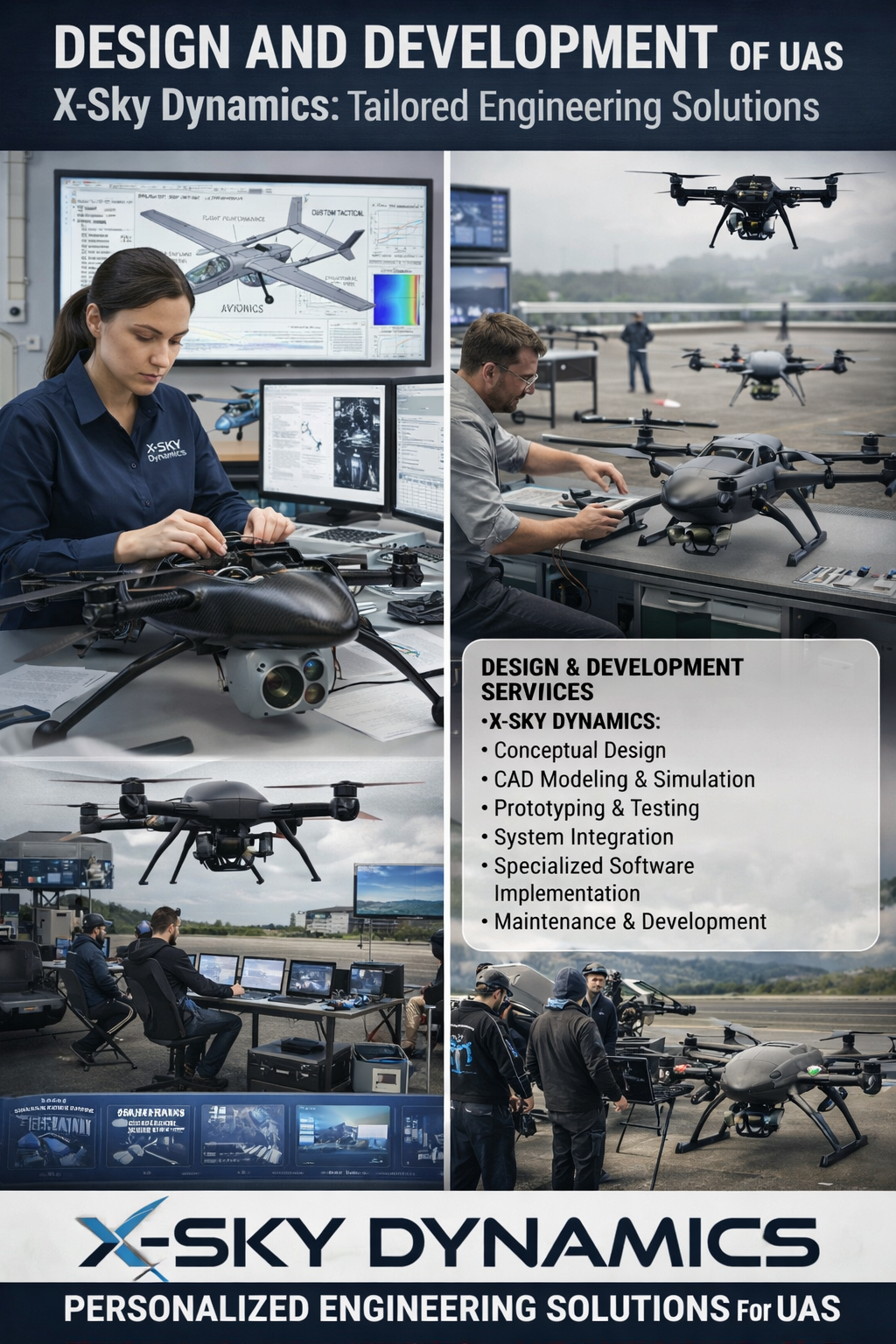
1. Design of Specialized UAS Solutions
We develop mission-specific systems, including:
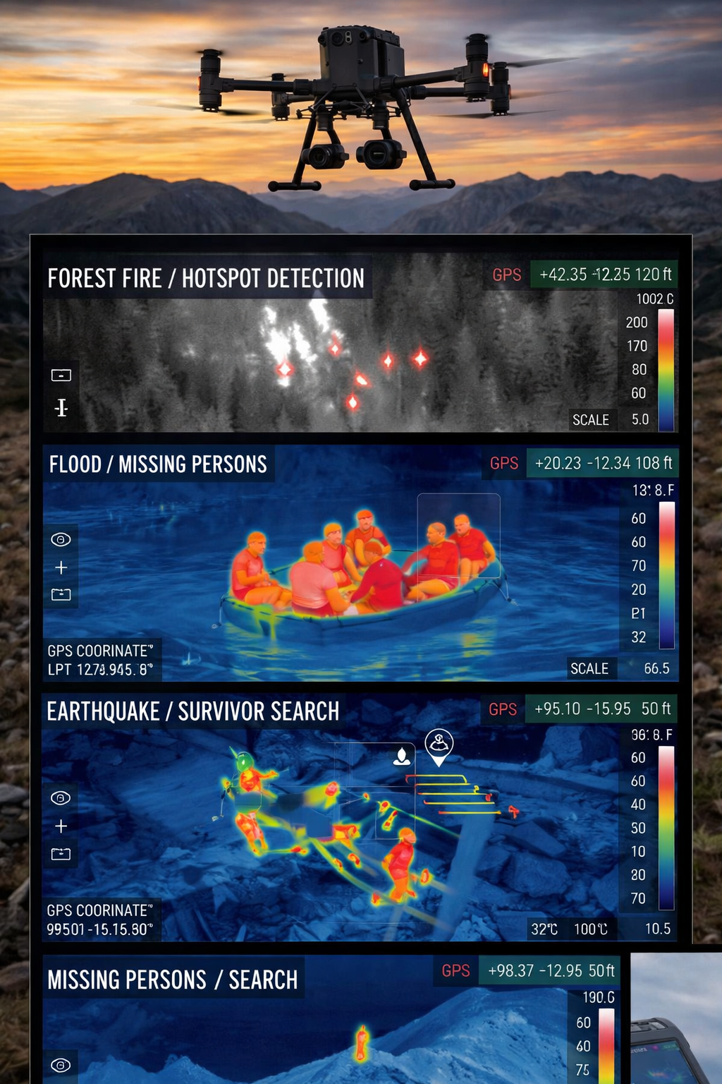
- configuration of platforms for SAR and disaster response
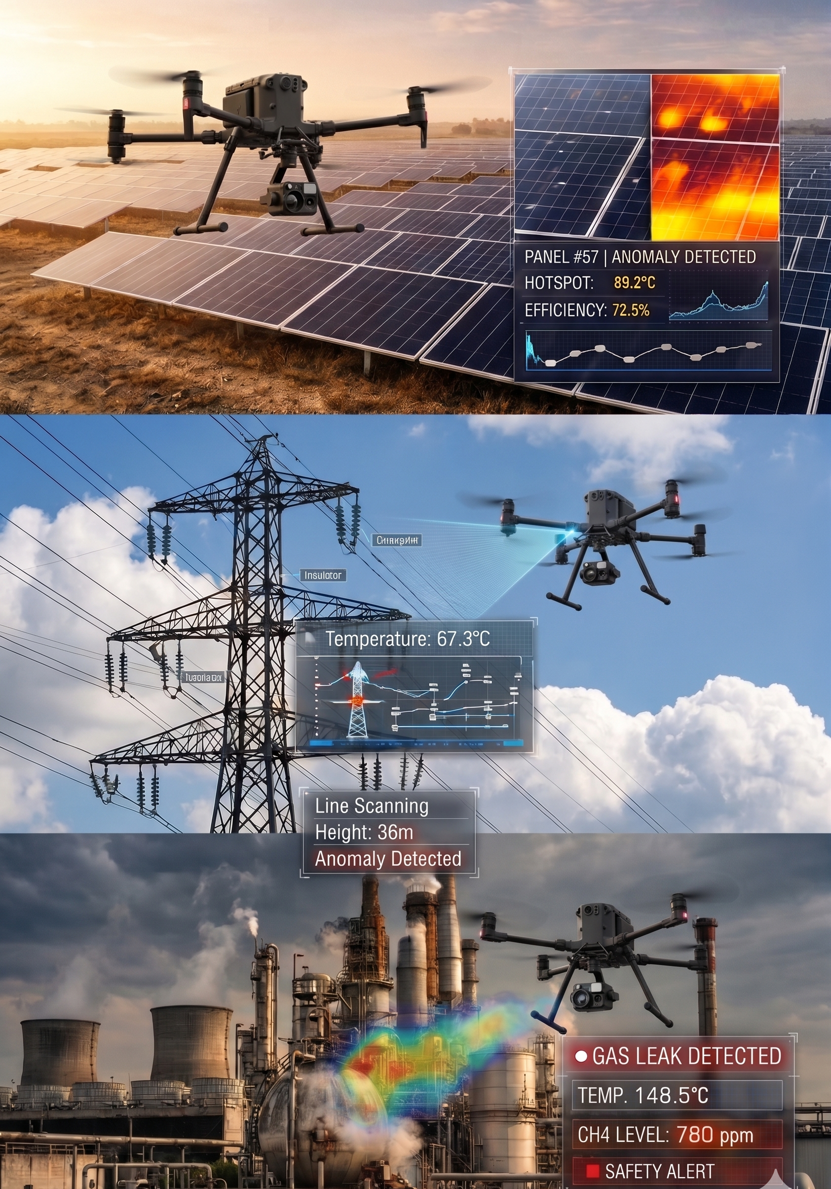
- selection and integration of thermal, optical, and zoom sensors
- implementation of RTK/PPK positioning and precise telemetry
- integration of spotlights, loudspeakers, marking, and communication modules
- deployment of mobile or fixed ground control stations
- secure real-time transmission of video and geospatial data
2. Operational Deployment
/ 02
X-Sky Dynamics goes beyond equipment delivery. We provide:
- operational setup and scenario-based testing
- flight procedures and operational checklists
- training of pilots and technical teams
- development of Concept of Operations (CONOPS)
- coordination methodologies between aerial and ground units
- validation in daytime, nighttime, and complex environmental conditions
3. Mission Support & System Expansion
After deployment, we offer:
- system upgrades with additional payloads
- sensor calibration and optimization
- integration with external command-and-control environments
- expansion of live monitoring and remote supervision capabilities
- periodic technical evaluations and system upgrades
Operational Applications
/ 03
These systems are suitable for:
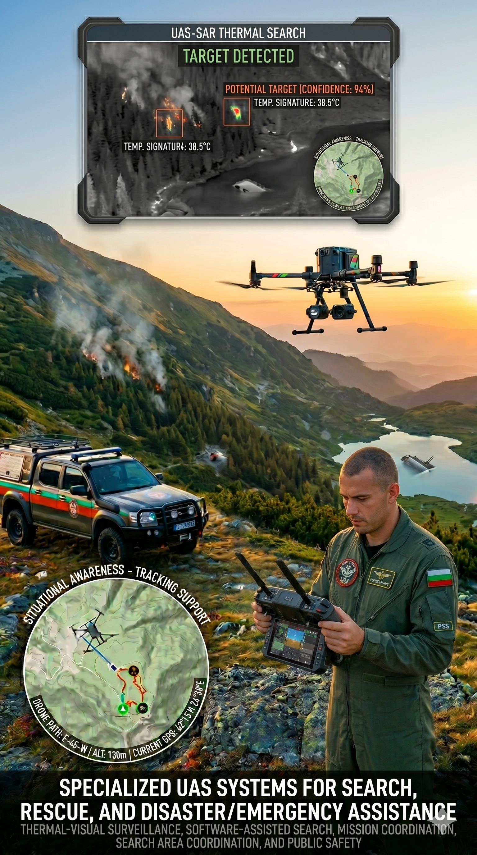
- search and rescue of missing persons in forest, mountainous, and remote areas
- support of emergency response operations during disasters, fires, floods, and incidents
- monitoring of critical infrastructure during incidents or risk situations
- locating animals in large or difficult terrains
- situational awareness missions and real-time operational picture building
- coordination of ground teams via live video, GPS marking, and shared georeferenced data
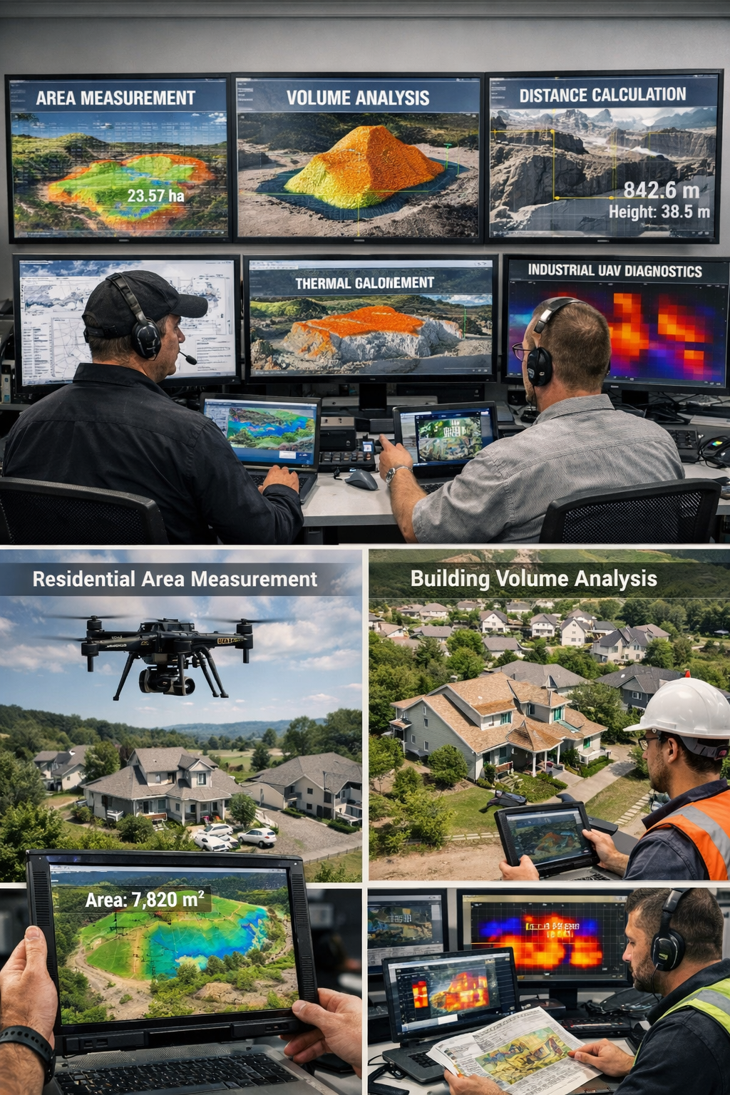
Sensors & System Capabilities
Depending on the mission, platforms can be equipped with:
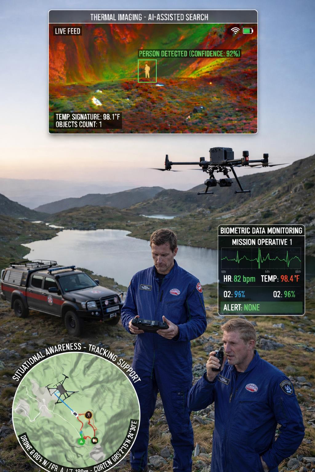
- thermal imaging cameras for detecting heat signatures in low visibility or nighttime conditions
- RGB and zoom cameras for visual confirmation and detailed inspection
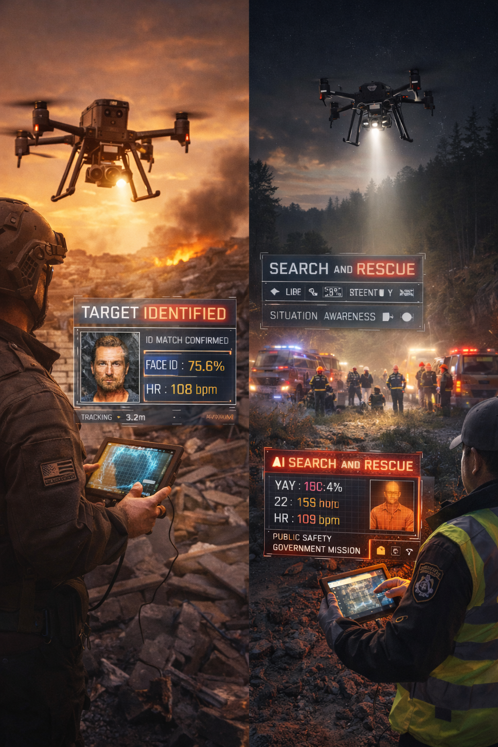
- AI-assisted analytics to support operators in detecting movement, anomalies, or objects of interest
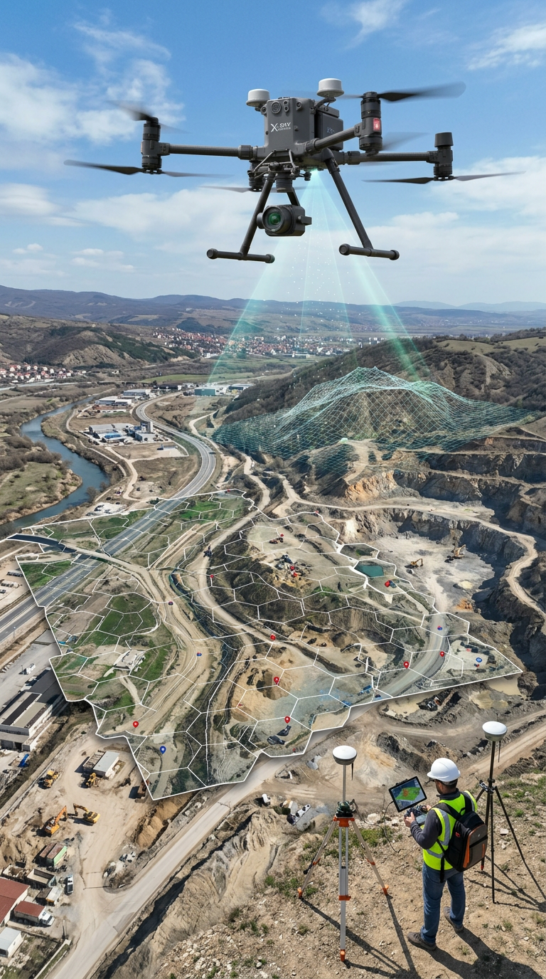
- geospatial tools for mapping, marking, and rapid coordinate sharing
- real-time video streaming to command centers or authorized remote users
- multi-operator workflows, where pilot and analyst operate simultaneously during missions
Real-Time Coordination & Data Flow
Our systems provide:
This enables faster response, improved coordination, and significantly reduced time for locating targets during emergency and operational missions.
- live thermal and visual video feeds
- real-time telemetry and platform positioning
- rapid marking of objects and areas of interest
- instant transmission of GPS coordinates to ground units
- secure web-based access for authorized stakeholders
- synchronization between aerial platforms, command units, and field teams
/ 04
Why These Systems Matter
Compared to traditional ground-based approaches, specialized UAS systems:
- cover large areas in significantly shorter timeframes
- access hazardous or difficult terrain without exposing personnel to risk
- operate effectively both day and night
- accelerate situational awareness and decision-making
- reduce response time and increase mission efficiency
- optimize operational costs compared to conventional search and monitoring methods
Target Clients
For government clients, systems can be adapted for enhanced situational awareness, perimeter monitoring, coordination of response units, and crisis management, in full compliance with applicable legal and regulatory frameworks.
- government and municipal authorities
- disaster response and civil protection agencies
- search and rescue teams
- forestry, environmental, and park services
- maritime and inland water authorities
- specialized institutional clients with regulated operational mandates
Why X-Sky Dynamics
- We develop mission-specific solutions, not generic products
- We integrate aviation, sensors, communications, and operational logic
- We provide full operational deployment, testing, and training
- Our systems are designed for real-world conditions and complex environments
- Strong focus on legal compliance, data security, and operational reliability
- Capability to support both civil and specialized government structures
[ Get in Touch ]
X-Sky Dynamics
- ✉xskydynamics@gmail.com
- ✉xsky@xskydynamics.com
- ☎+359 87 6975862
 WhatsApp: +359 87 6975862
 Viber: +359 87 6975862
- 📍Sofia, bul. "Yanko Sakazov"

[ SERVICES ]
Specialized biometric UAS drone Systems for SAR
Search and Rescue via Drones
UAS Design, Engineering & Capabilities
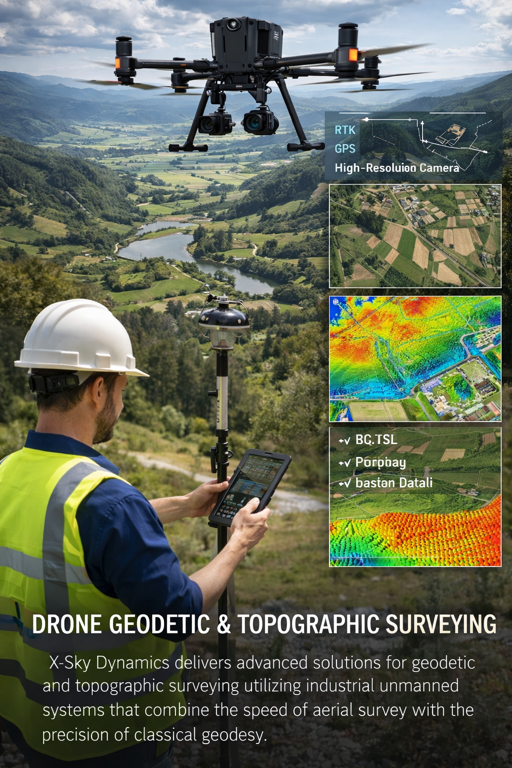
Geodetic and Topographic Surveying with UAV Systems
Measurement of Areas, Volumes, Distances with Drones
Mapping, Orthophoto, Geodetic UAV Systems
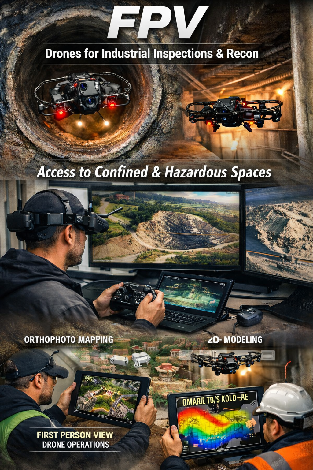
FPV Drone Inspections, Surveys
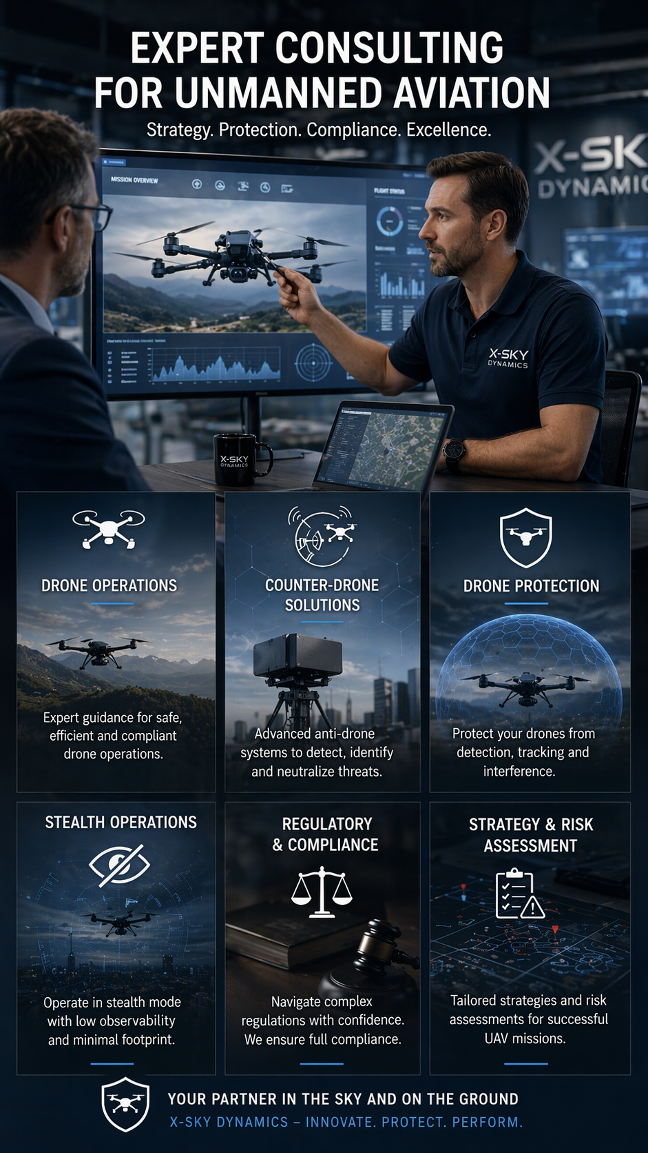
CONSULTING IN UNMANNED AVIATION (DRONES), ANTI-DRONE SYSTEMS
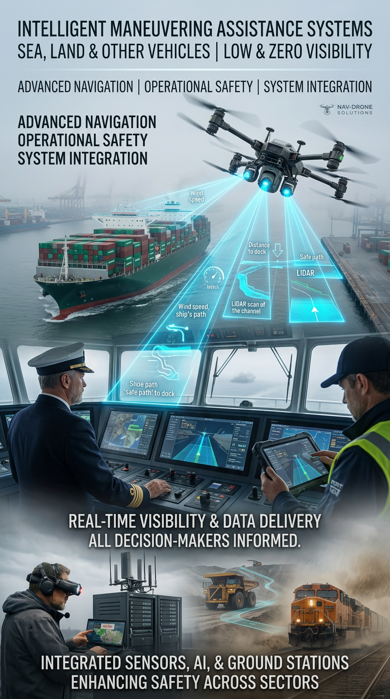
Systems for Assisting the Maneuvering in Low or Zero Visibility
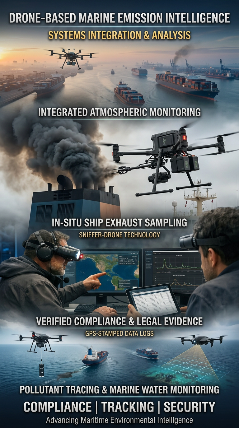
Drone Systems for Exhaust Gas Analysis
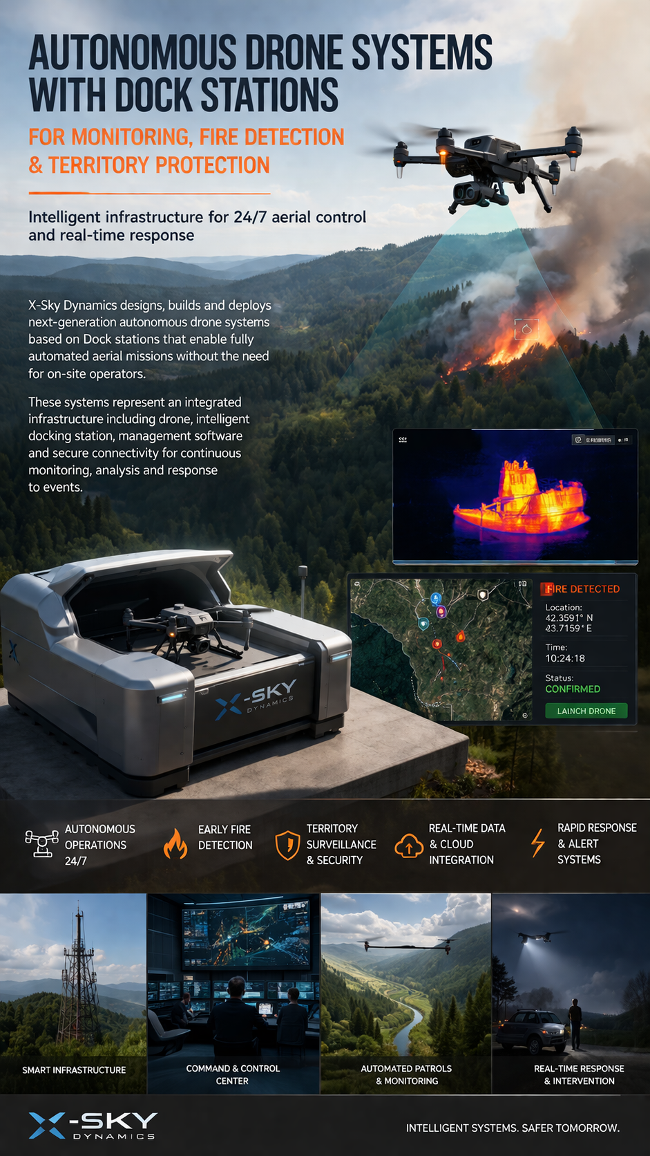
Dock Stations for Monitoring, Early Fire Detection
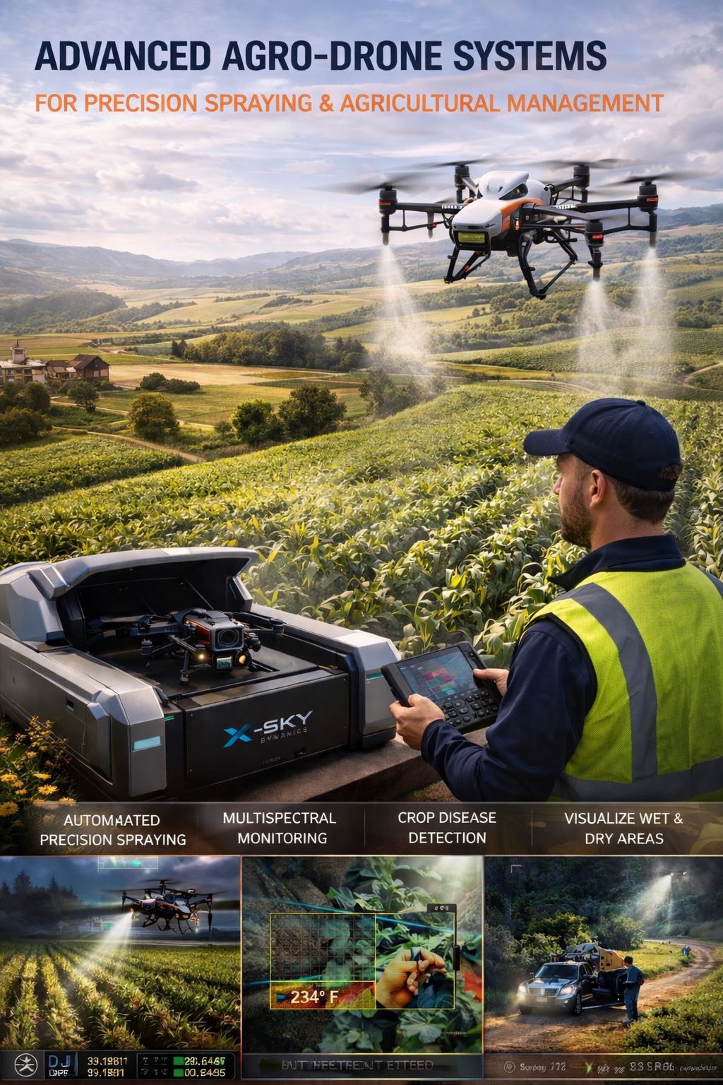
Agricultural Drone Systems for Precision Spraying, Spectral Monitoring
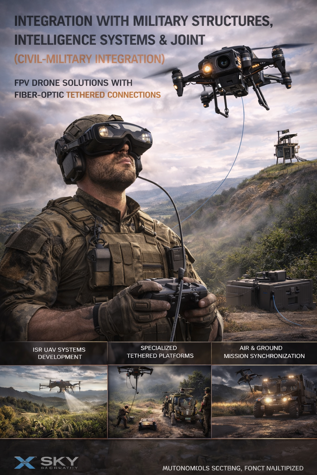
UAV – Drone Integration with Military
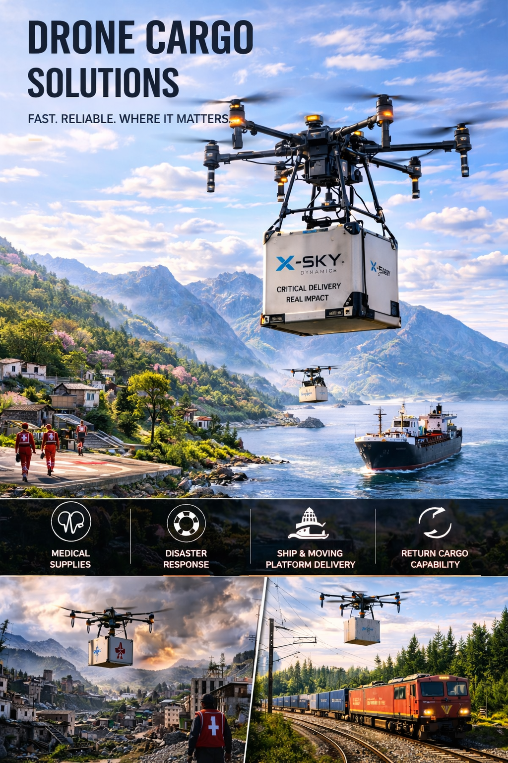
Cargo Transportation with Drones
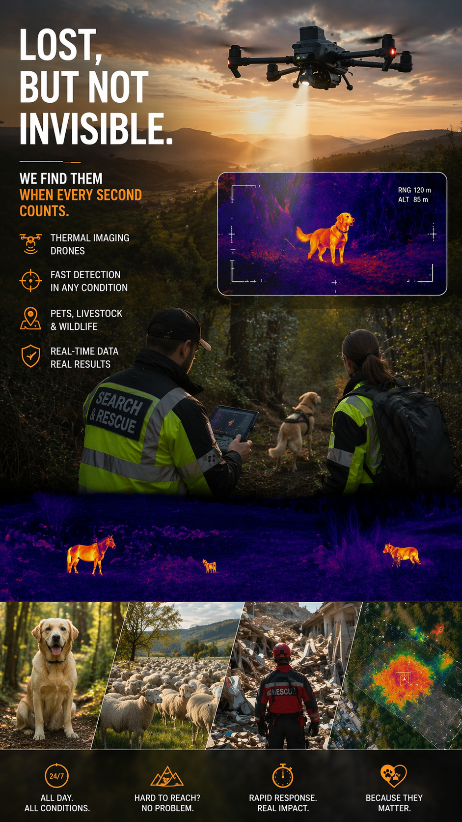
Search and Rescue of Pets and animals Using Drones
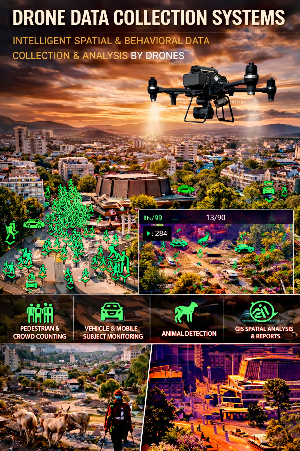
Drone Systems for Collecting Statistical Data
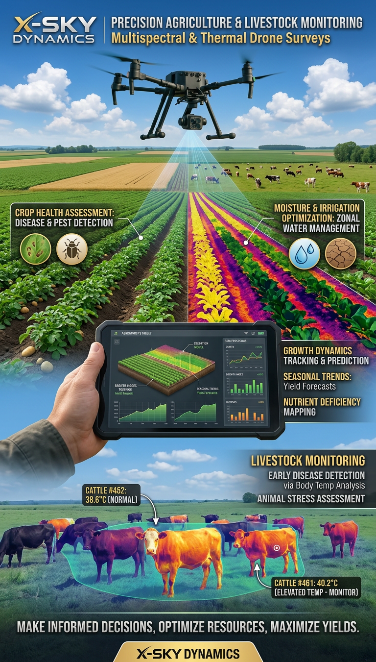
Multispectral and Thermal Drone Surveys for Agriculture
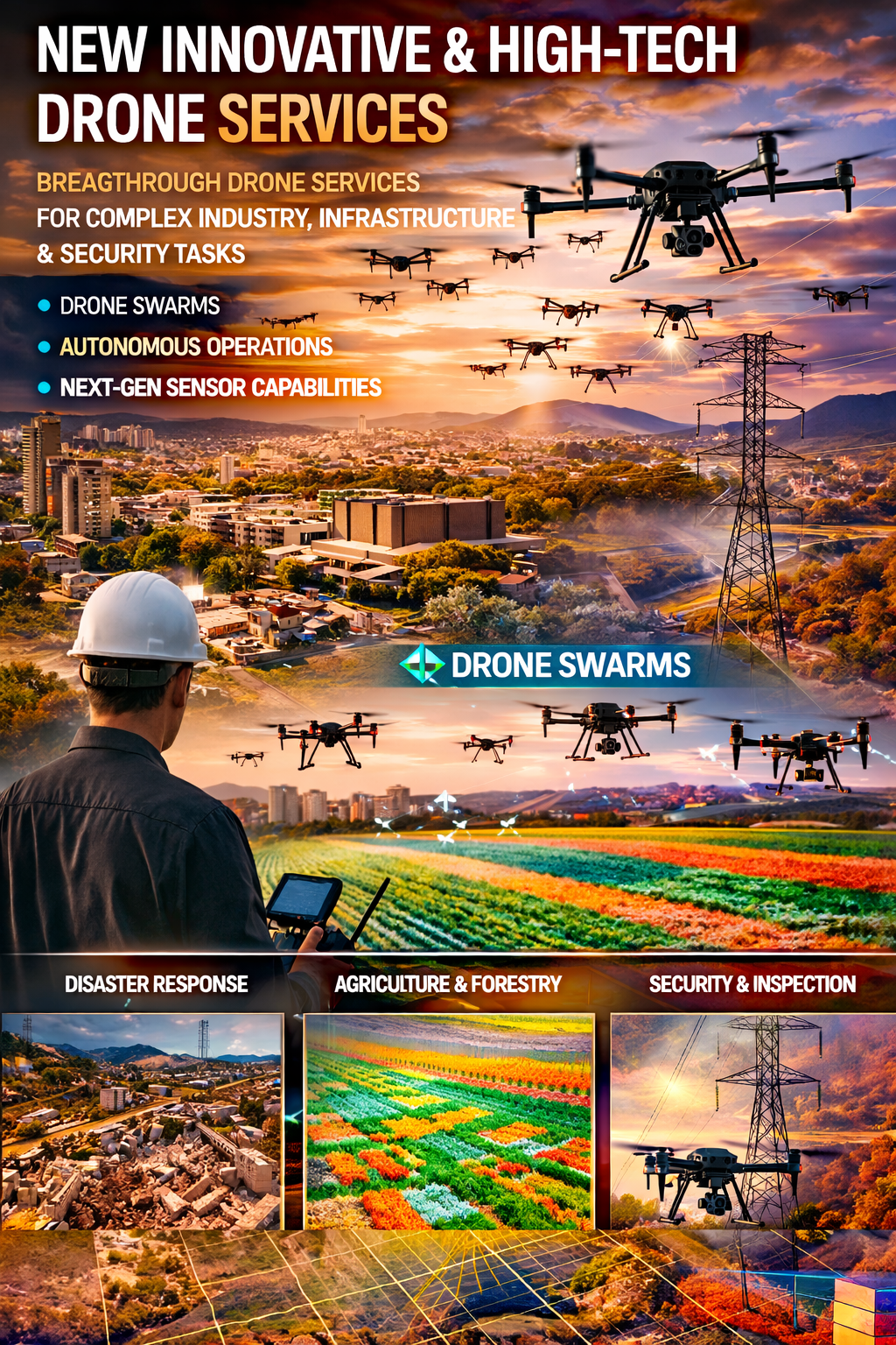
Innovative and High-Tech Drone Services
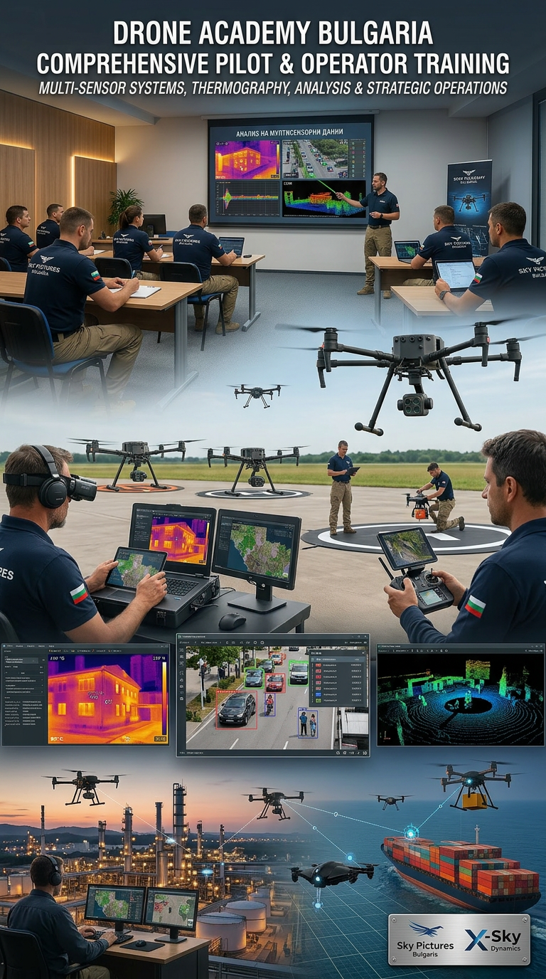
DRONE PILOTS AND OPERATORS TRAINING AND COURSES
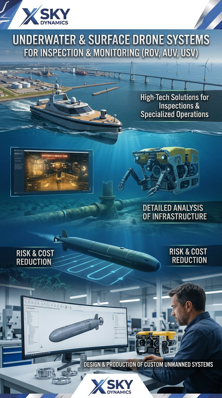
Underwater and Surface Drone Systems ROV, AUV, USV
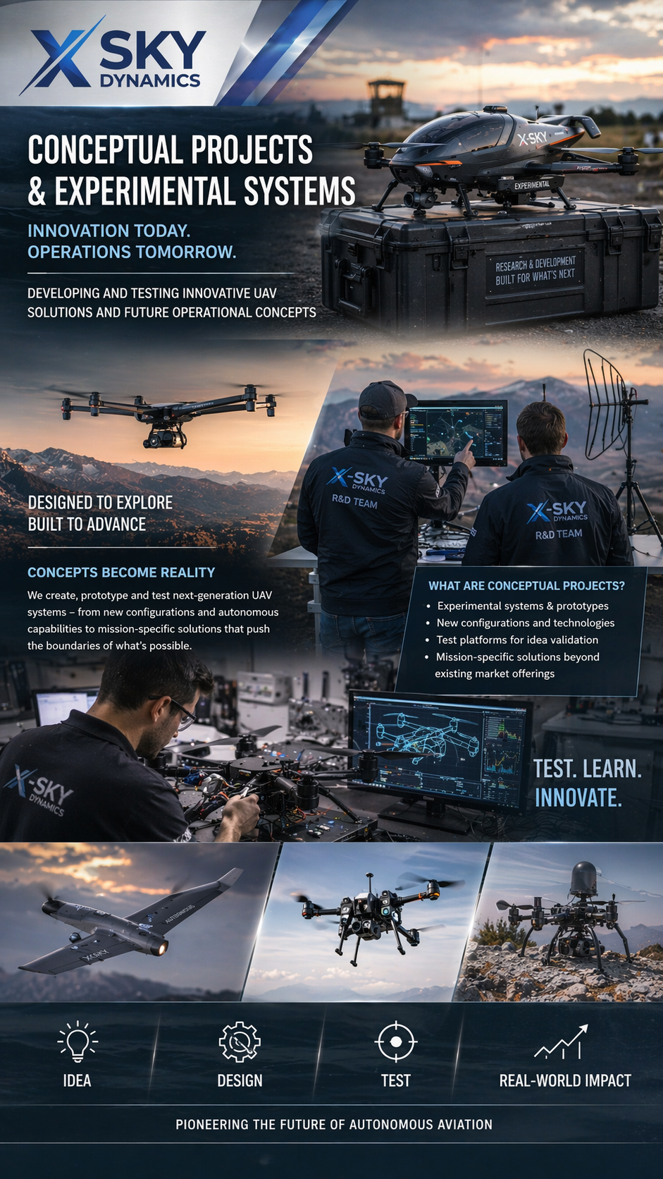
Concept Projects & Experimental UAV
Autonomous Drone Systems with Dock Stations
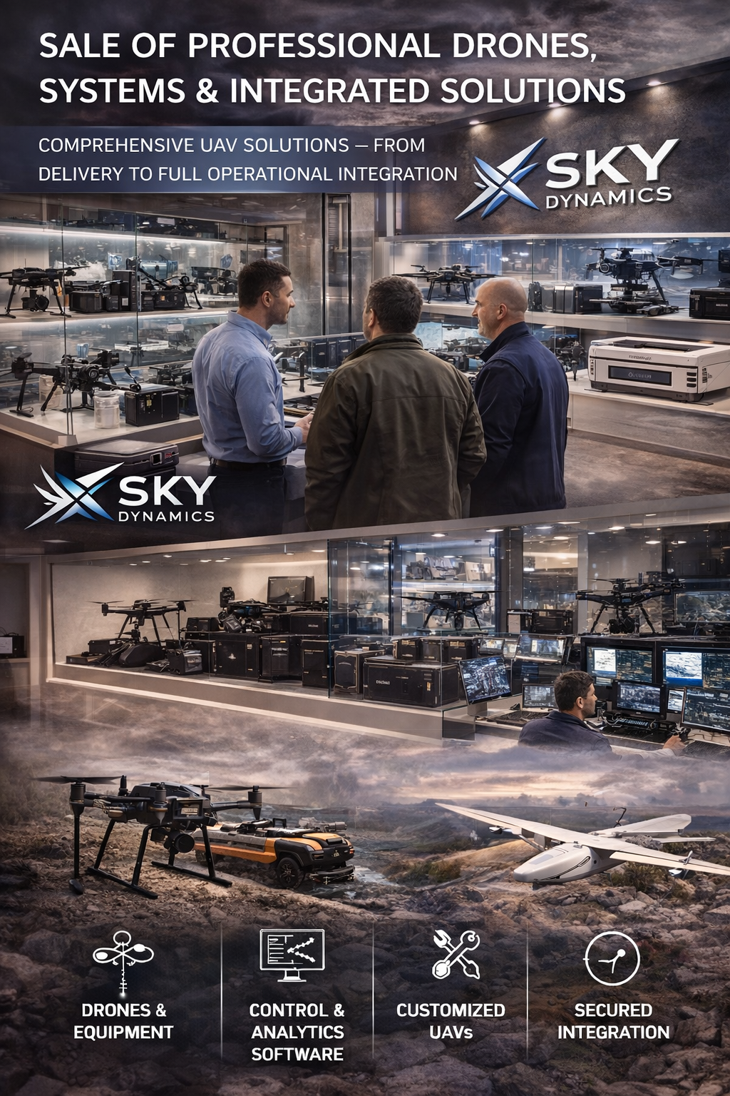
Sales of Professional Drones
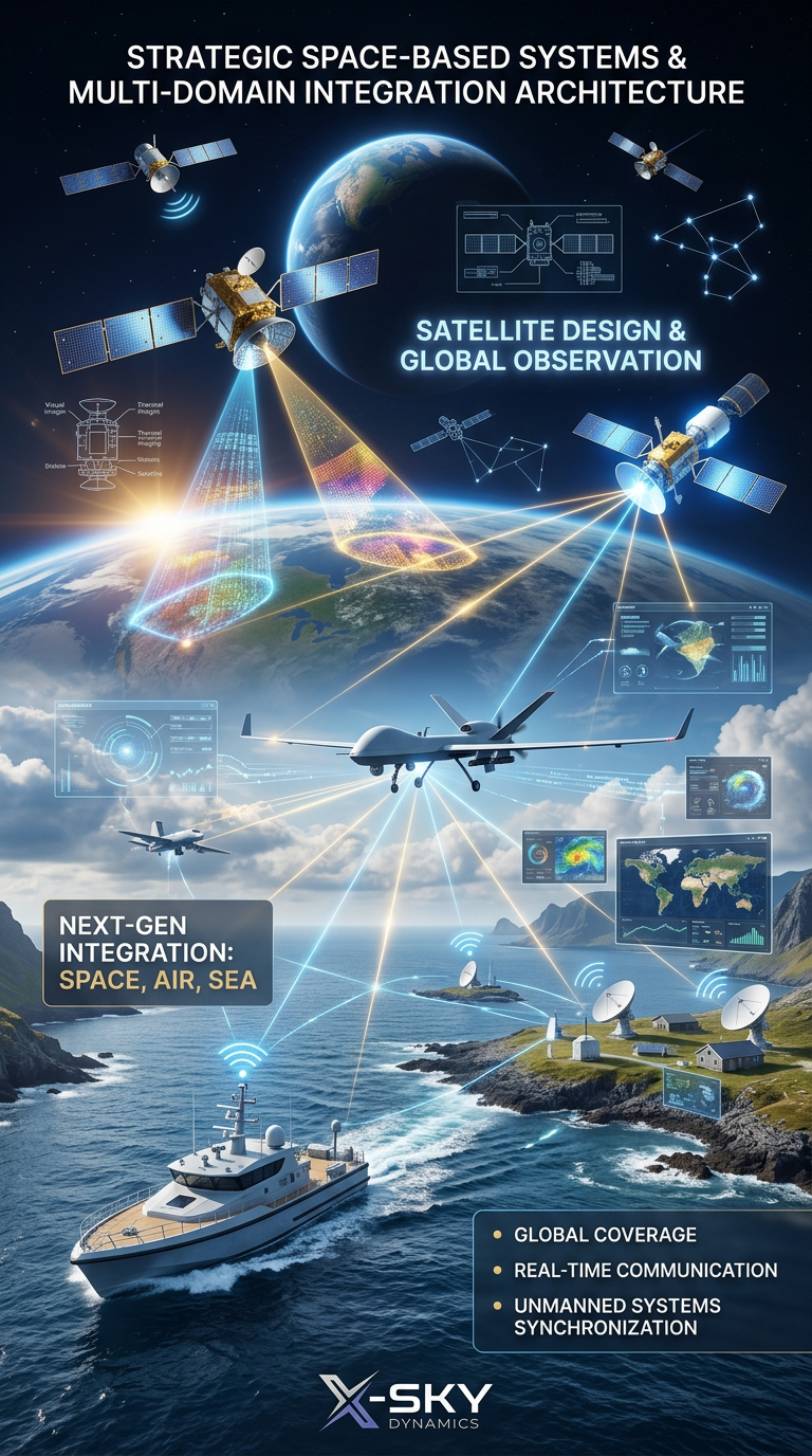
Satellite Imaging, Satellite Design and Integrated
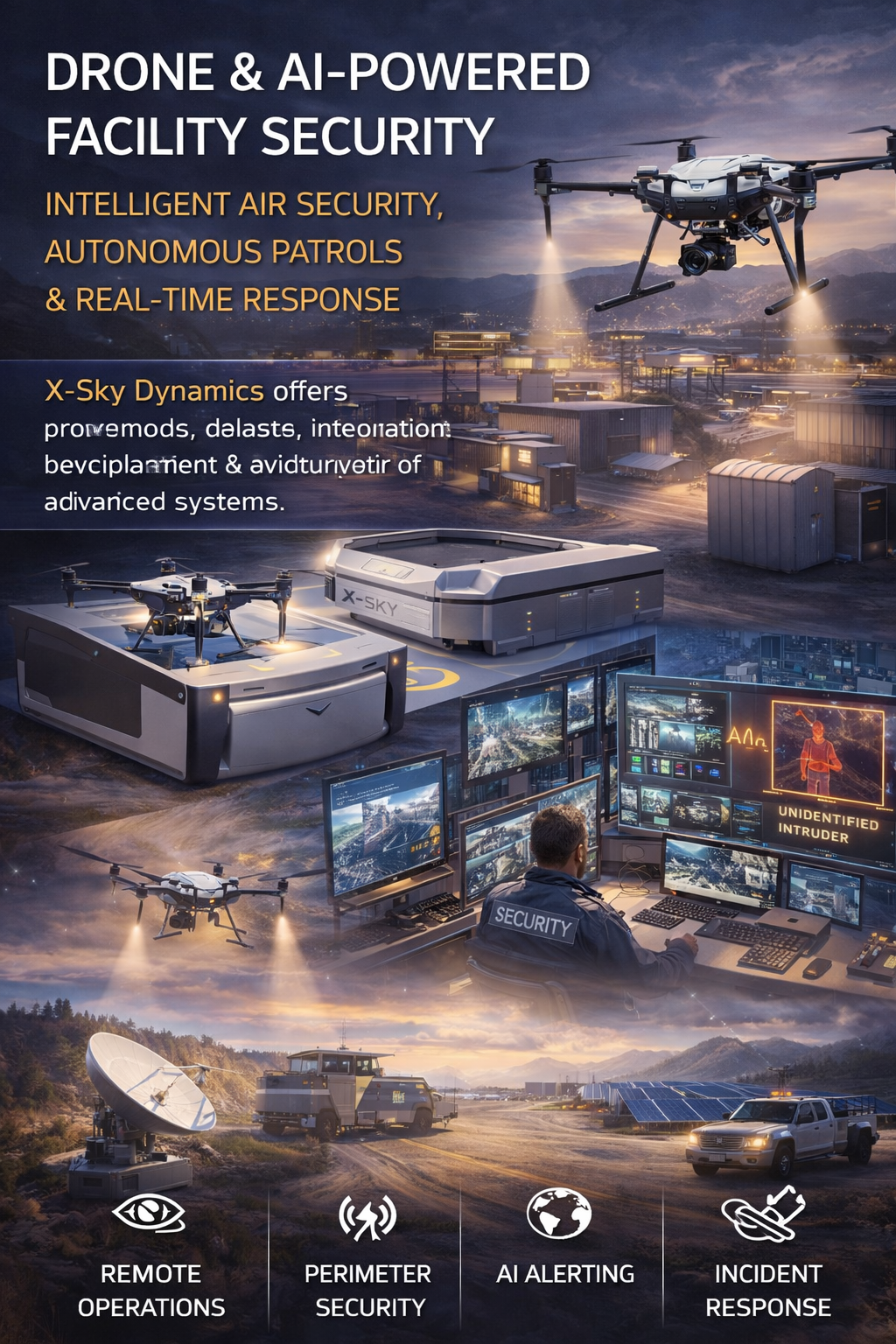
Security of Sites Through Drones AI Systems
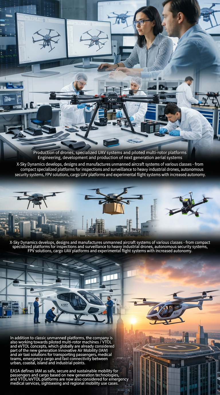
Drone Manufacturing and Manned Multirotor Platforms
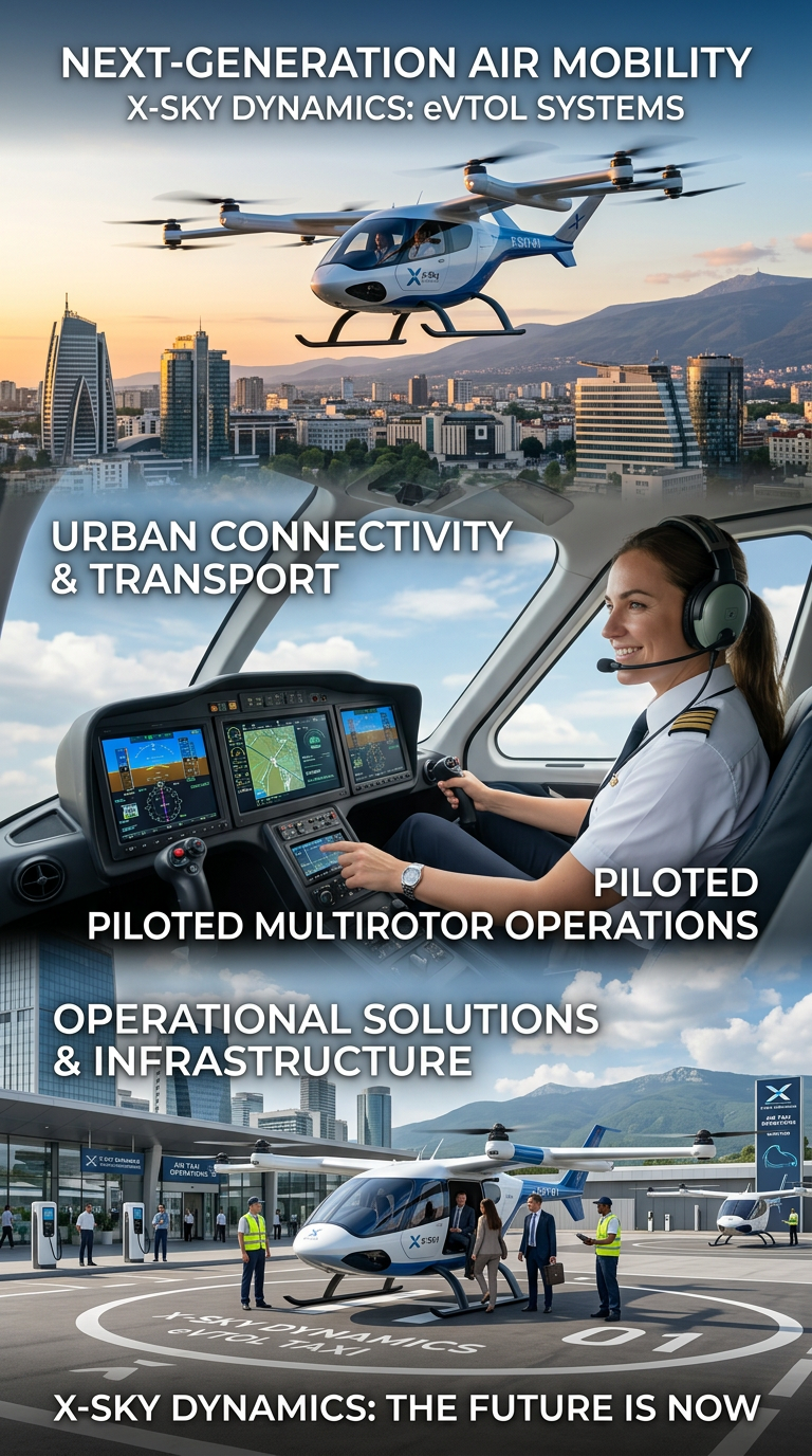
Air Taxis and eVTOL Systems
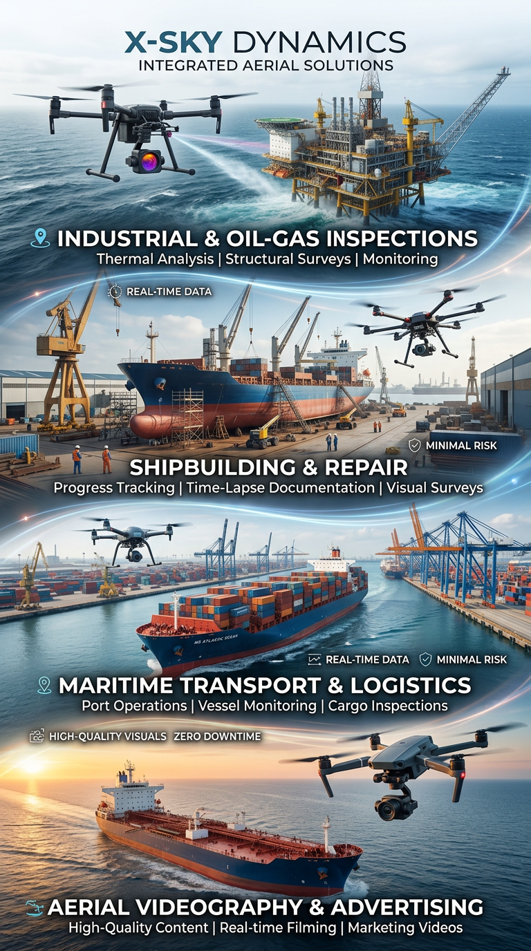
Drone and Video Services in Maritime Transport
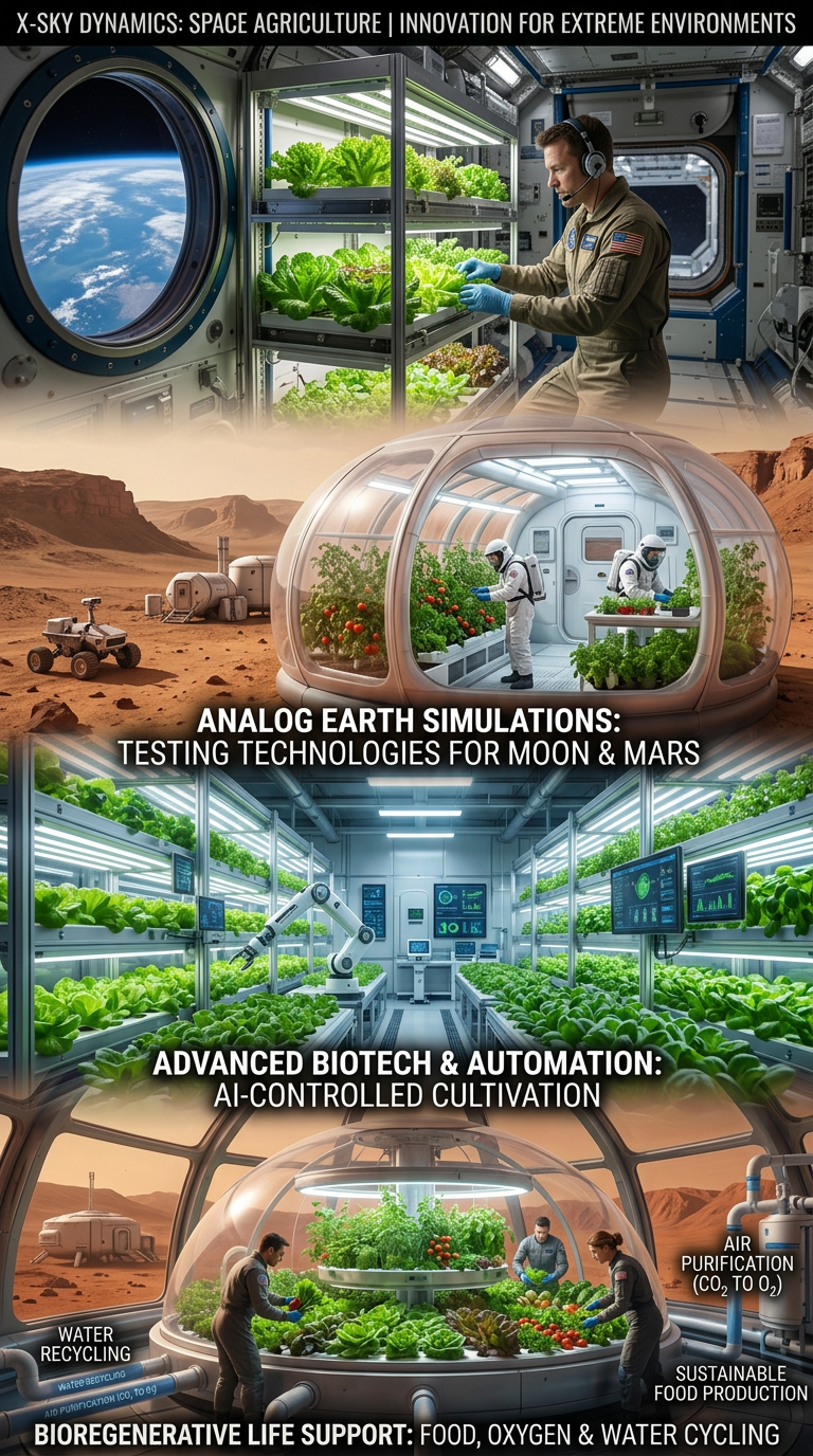
Space Agriculture, Agri-Systems for Extreme Environments

Cybersecurity, Cyber Defence and Protection of Critical Infrastructure
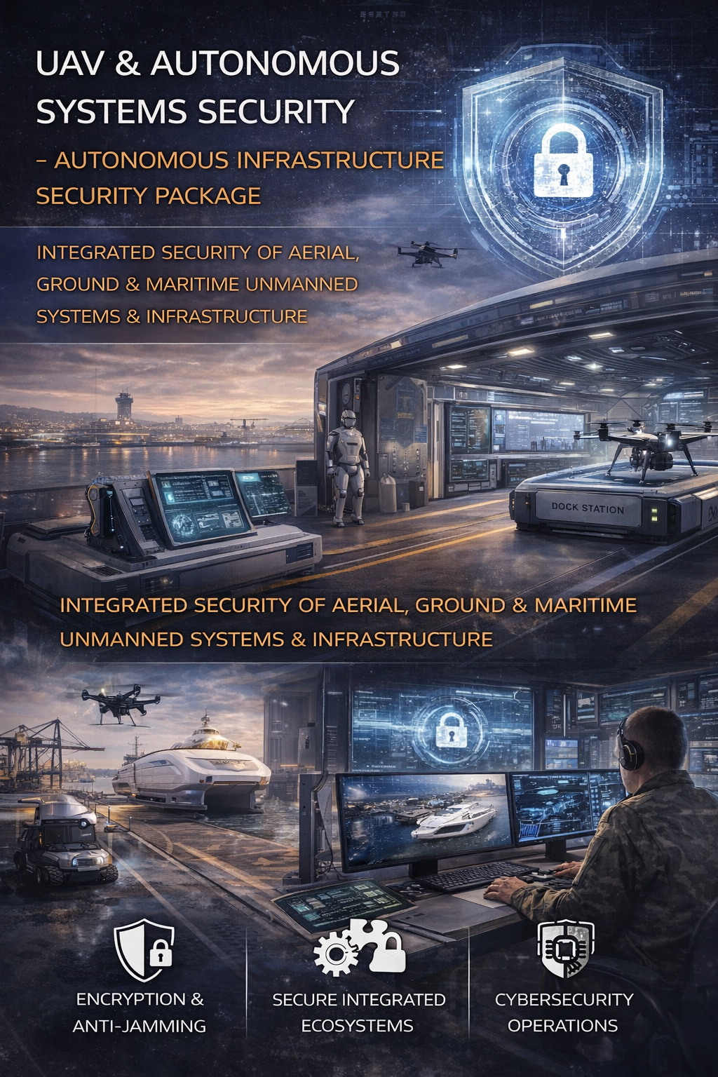
Cybersecurity and Protection of UAV and Autonomous Systems
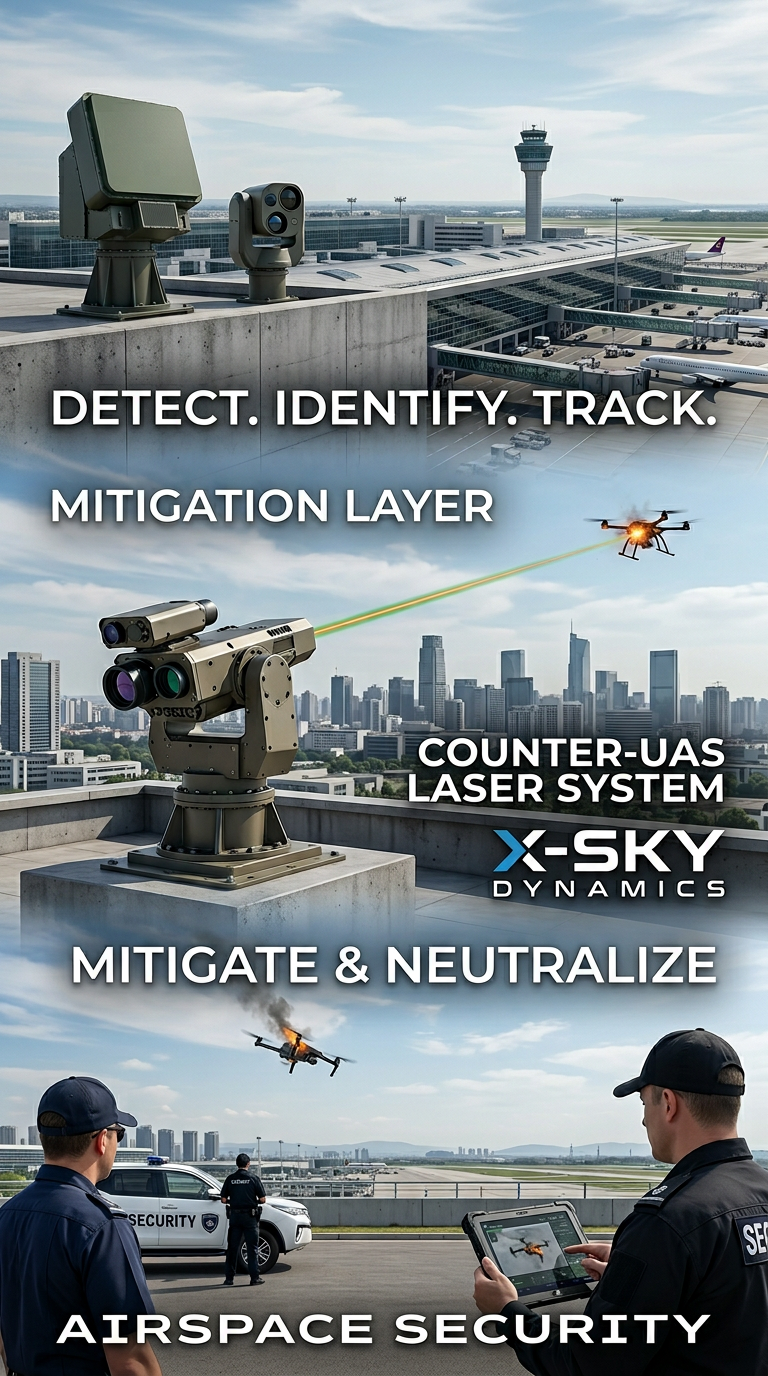
Counter-UAS, Laser and Kinetic Systems
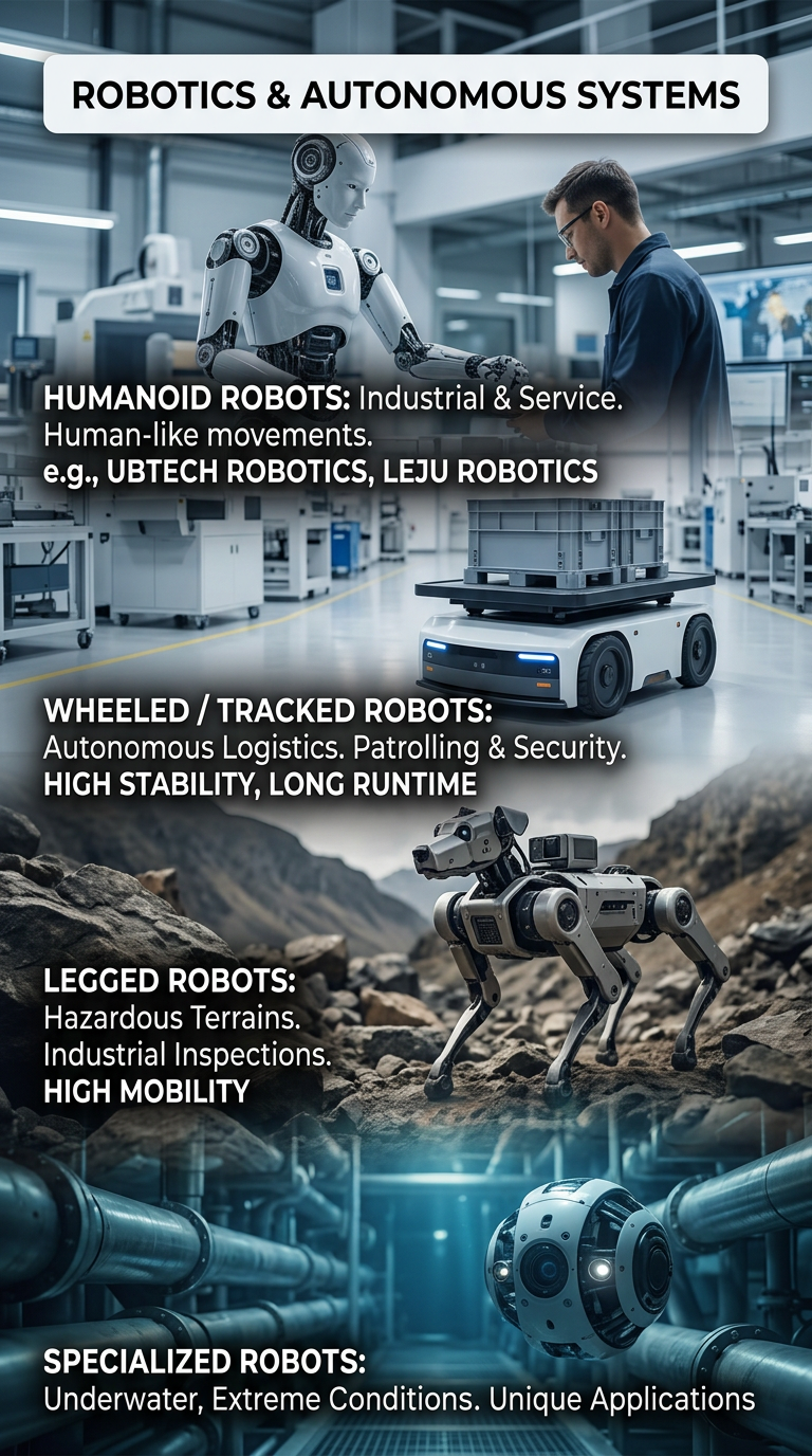
Robots and Autonomous Systems
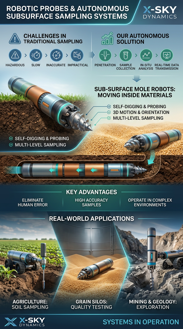
Robotic Probing Systems and Subsurface Technologies
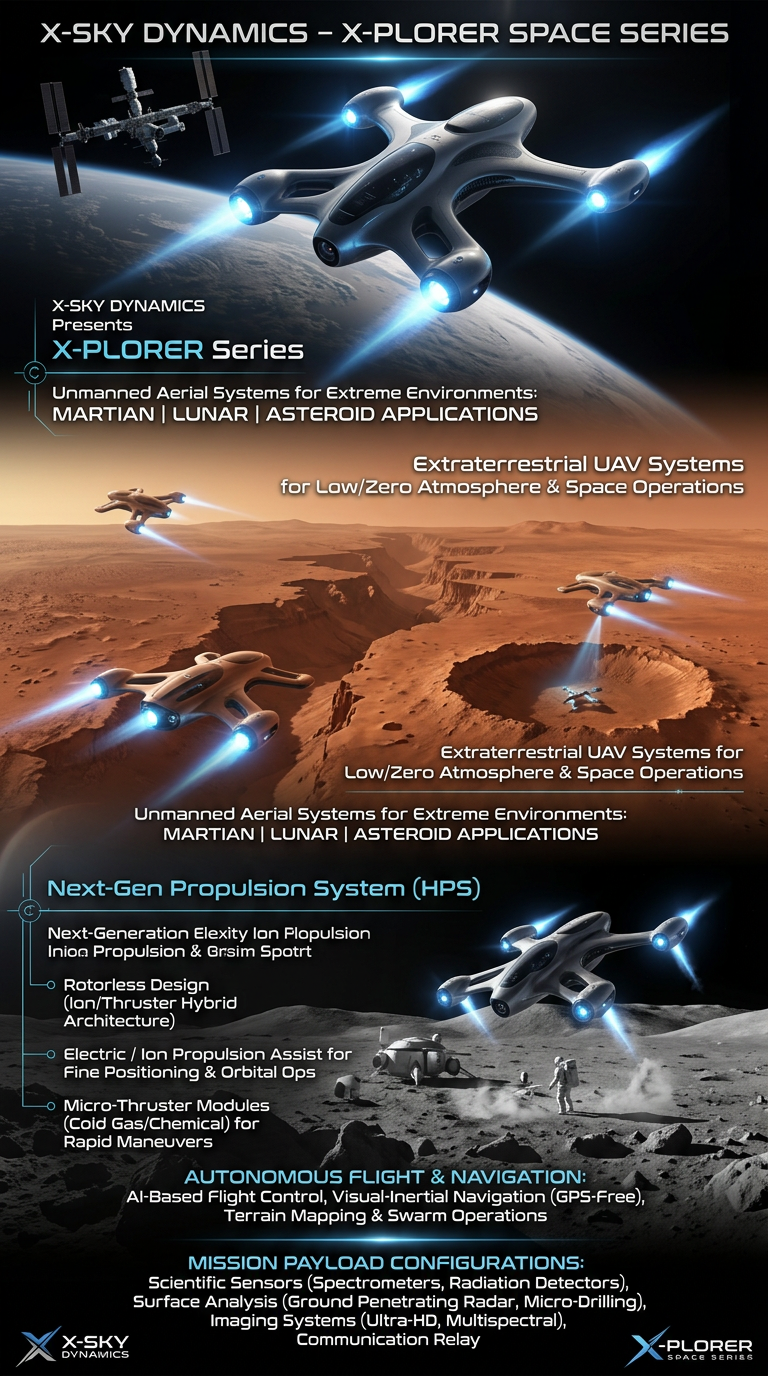
Space Drone systems SPACE X-PLORER SERIES

RAIGNV Partnership
Investors & Partners