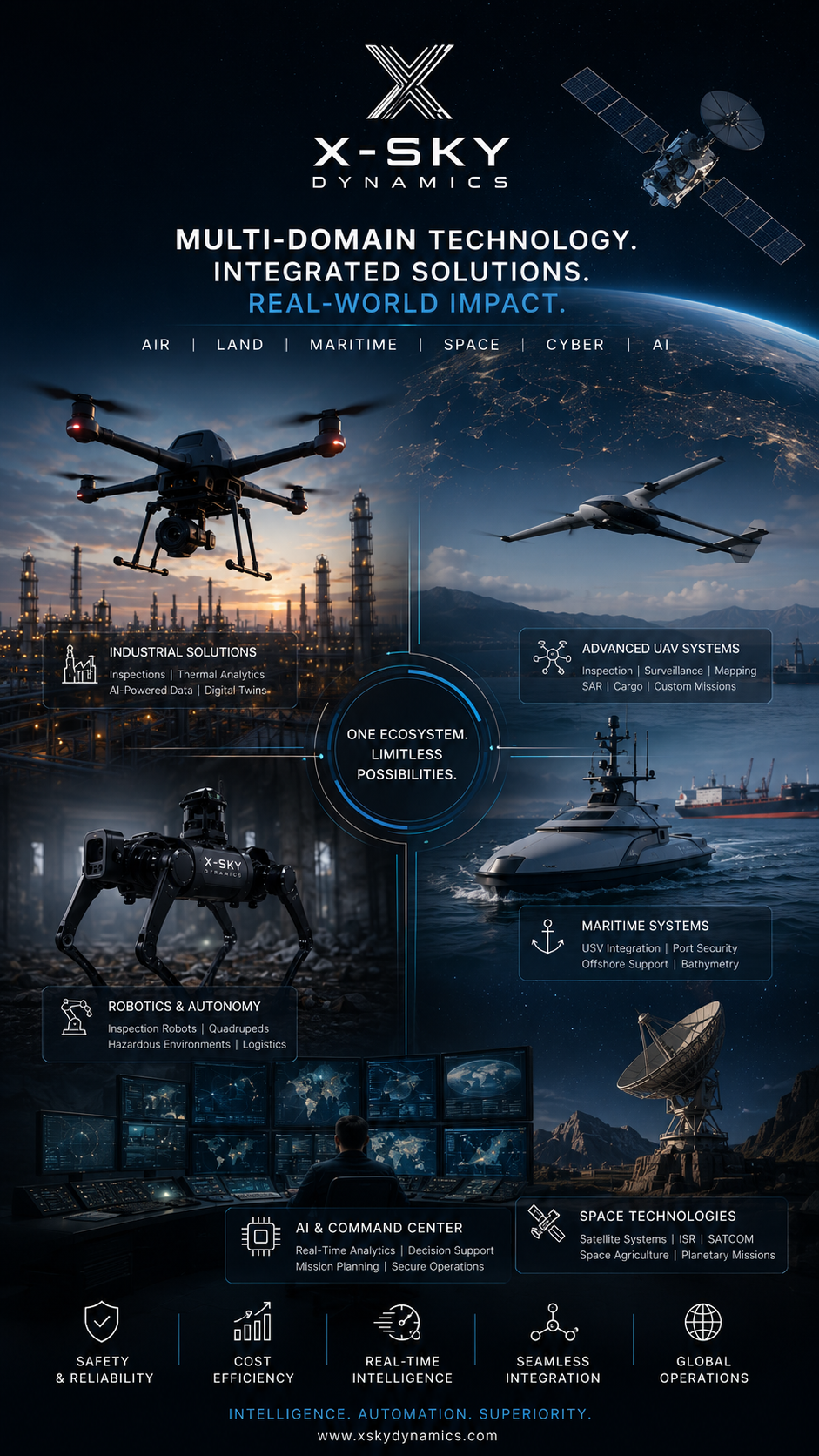
[ SERVICES / DRONE THERMAL INSPECTIONS SURVEY ]
/ SERVICE #01
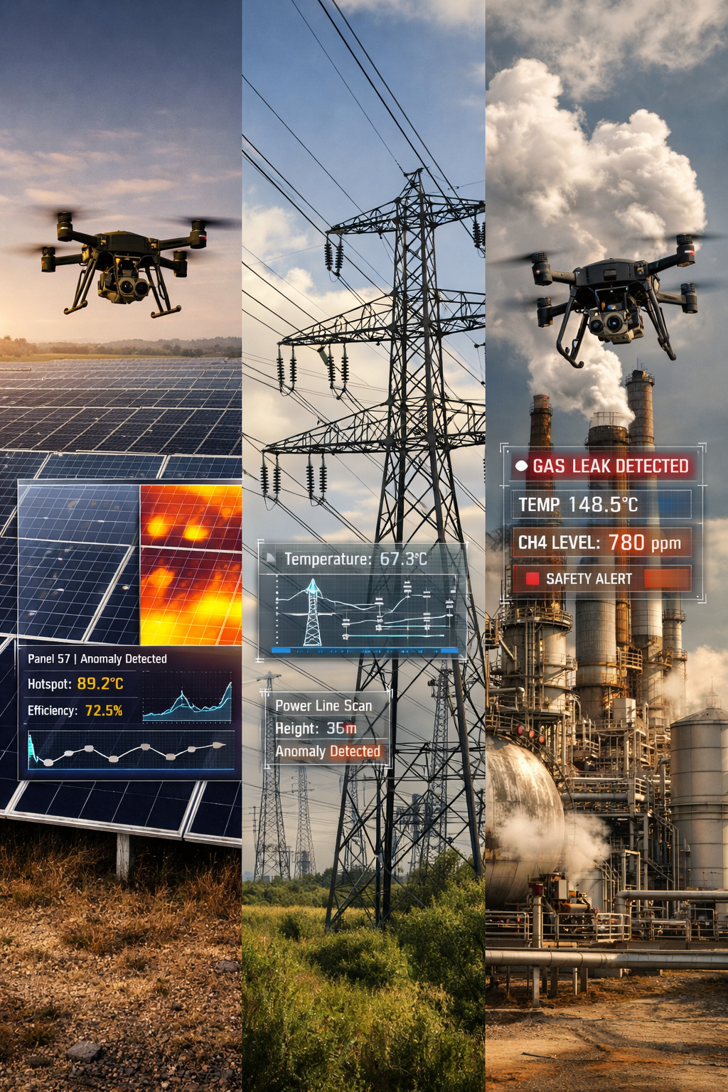
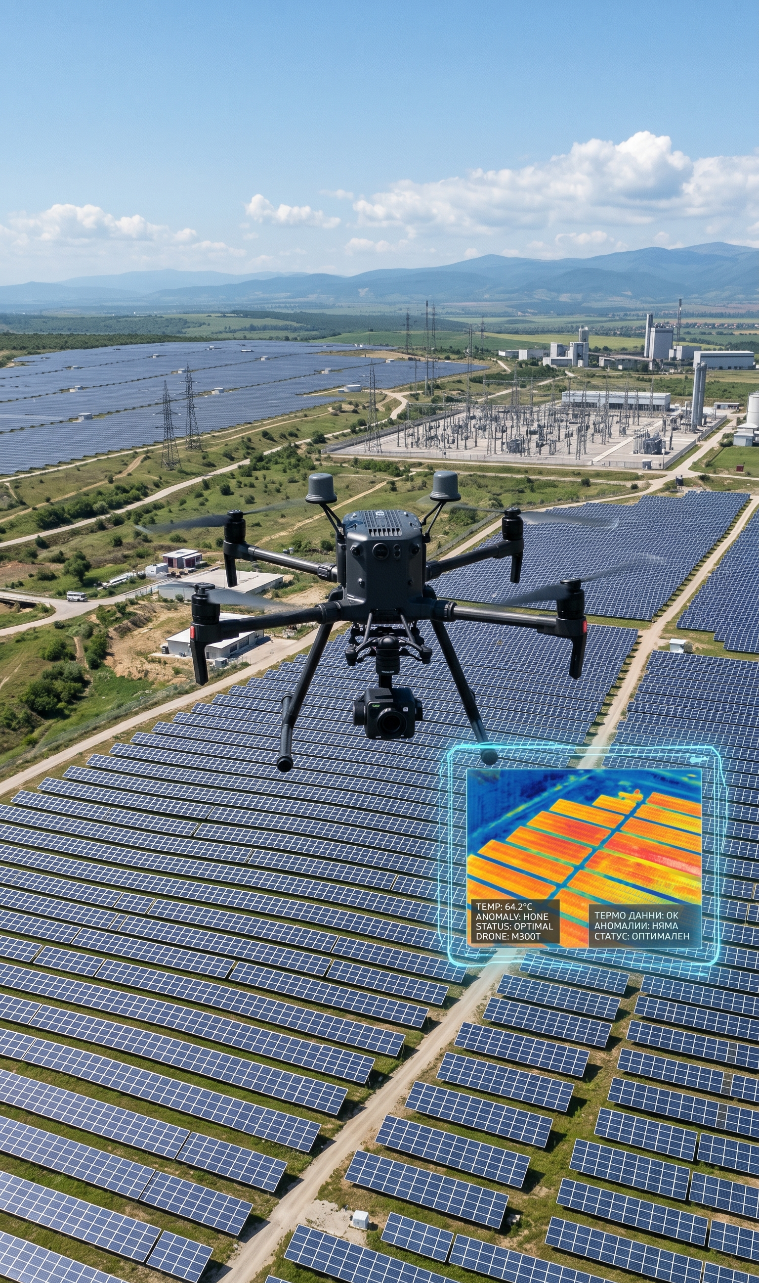
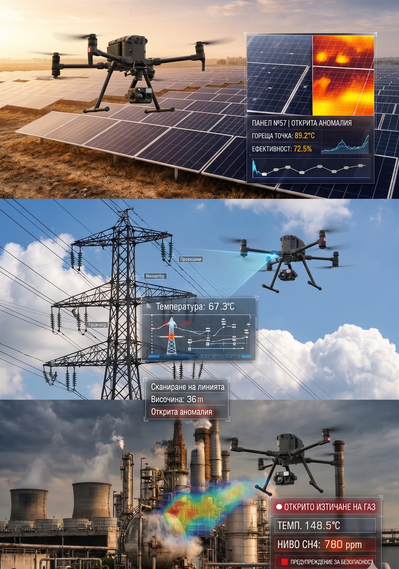
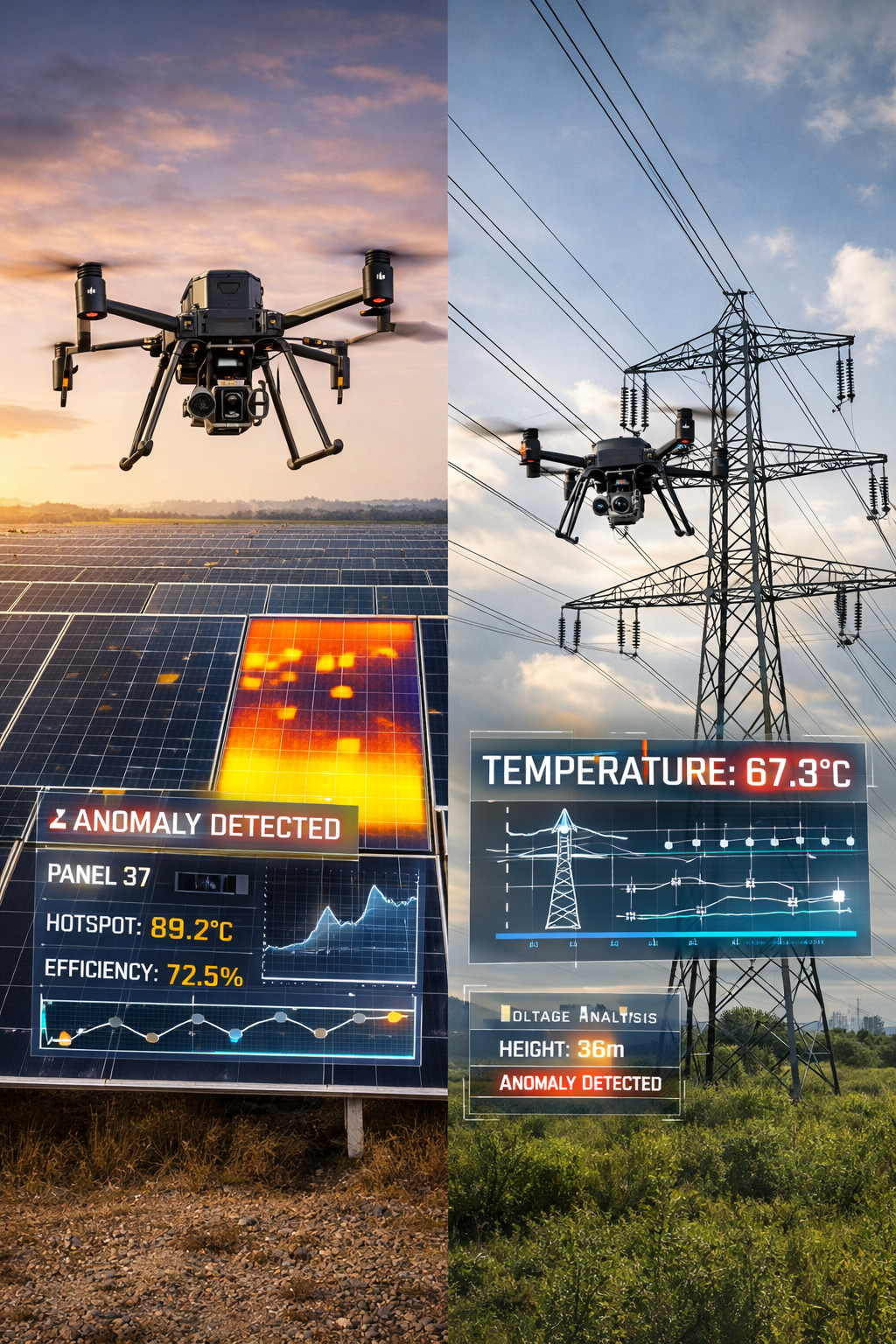
Drone Thermal, Optical and Visual Inspections of Photovoltaic Plants, Industrial Sites, Energy and Critical Infrastructure
Drone Thermal ispections survey Optical and Visual Inspections of Photovoltaic Plants solar panels , Industrial Sites Energy and Critical Infrastructure diagnostics, monitoring, and analysis of industrial, energy, and strategic assets, utilizing integrated Unmanned Aerial Systems UAS drones
/ 01
We combine thermal, optical, and geospatial data into a unified operational picture, enabling early defect detection, risk assessment, and real-time decision-making.
UAV-Based Inspection Services
Our core activities include:
Preventive & Emergency UAV Inspections of:
- Utility-scale photovoltaic parks and rooftop solar systems
- Wind turbines and renewable energy assets
- Industrial and manufacturing facilities
- Buildings (roofs, façades, insulation systems)
- Energy, gas, and oil infrastructure
- Maritime facilities and vessels
- Metal structures and other critical assets
Advanced Defect Detection
/ 02
Through multi-sensor analysis, we identify defects not visible through conventional methods:
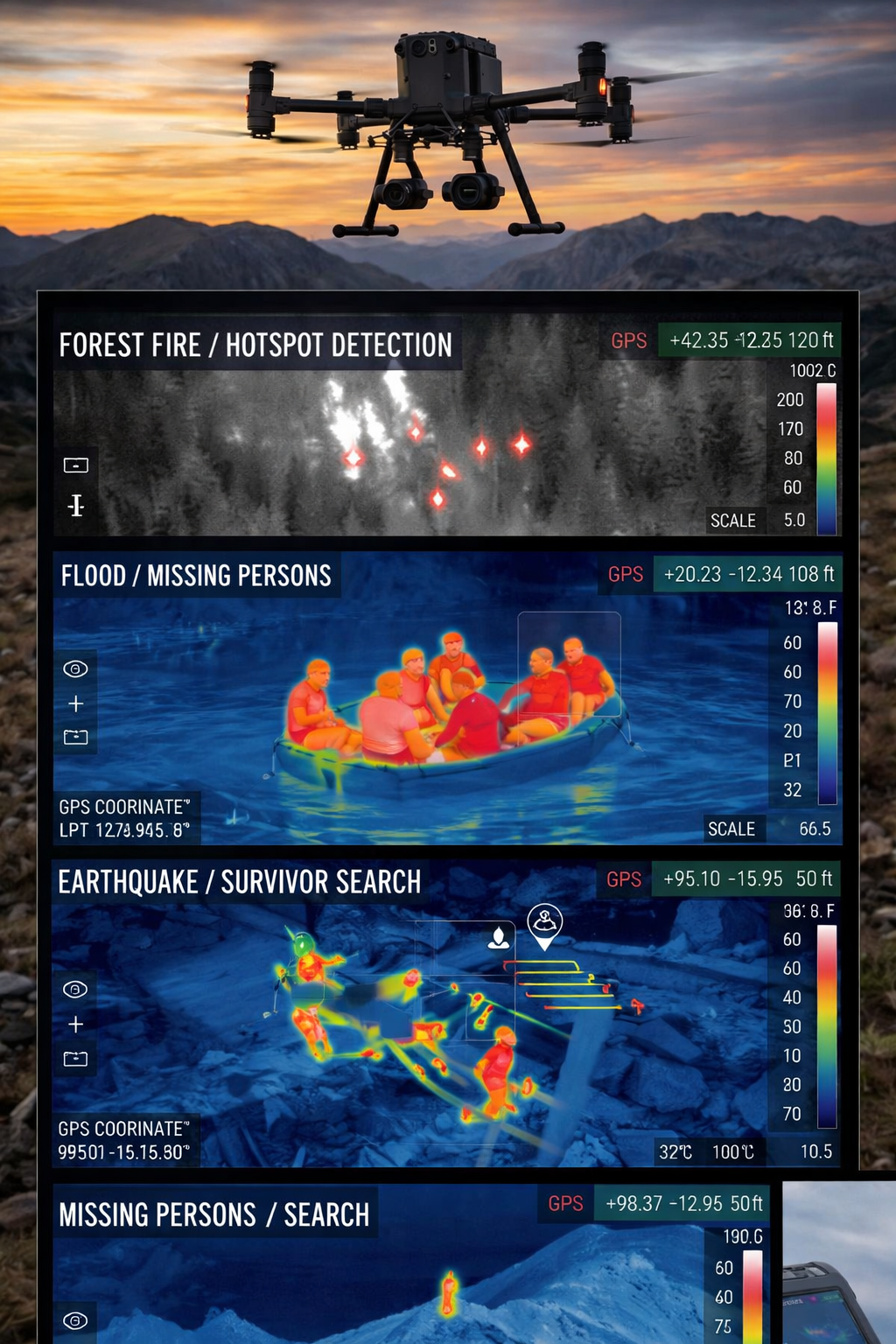
- Thermal anomalies and hotspots
- Solar panel degradation and inefficiency
- Water ingress and structural moisture
- Corrosion and structural weaknesses
- Failures in cabling systems and electrical connections
Additional Capabilities
- Thermographic building inspections
- Environmental and water resource monitoring
- Thermal dispersion analysis (including industrial pollution)
- Energy efficiency analysis of buildings and facilities
Technology Advantages
UAS Platforms
/ 03
We operate high-end industrial UAV systems (Enterprise class), equipped with:
- Thermal cameras (FLIR, MWIR, LWIR) – precise temperature anomaly detection
- High-resolution RGB cameras – detailed visual inspection and comparison
- AI-powered analytics – automated detection of defects, objects, and anomalies
- RTK positioning systems – centimeter-level accuracy
- LiDAR (optional) – 3D modeling and volumetric analysis
Operational Performance
Our systems enable:
- Flights in harsh weather conditions
- Operations in hard-to-reach and hazardous environments
- Day and night missions
- Significant reduction of human risk during inspections
Real-Time Monitoring & Immediate Diagnostics
/ 04
Our software platform provides:
Thermal and visual data are transmitted in real time to a ground control station, where a secondary operator monitors the mission using advanced thermal analysis software on a larger display. The second operator can be positioned remotely, anywhere in the world, enabling distributed mission control based on modern communication technologies. Under appropriate technical conditions, authorized stakeholders and institutions can access the live operation via a secure web interface, receiving: All data is transmitted in real time with near-zero latency (milliseconds). This enables rapid coordination between involved parties and supports fast, informed decision-making during ongoing operations. With a single action (tap/click), the system can transmit GPS coordinates with visual markers (geo-tagged images) to other units or teams involved in the operation.
- Real-time streaming of thermal and visual data to a command center
- Comparative analysis with previous inspections for trend tracking
- Generation of detailed reports including defect localization, temperature values, defect classification, and recommendations
- Live video streams
- Telemetry data
- AI-processed analytical outputs
Real-Time Intelligence & Remote Operations
X-Sky Dynamics implements a distributed operational architecture, enabling:
- Live thermal and visual video streaming to command centers
- Remote monitoring from multiple geographic locations
- Real-time data sharing with institutions and partners
- Integration with web-based mission access interfaces
Key Capabilities:
This architecture enables real-time critical decision-making, including emergency, industrial, and specialized operations.
- One-click geo-referenced marking (tap-to-mark GPS)
- Instant sharing of coordinates and visual data
- Synchronization between aerial and ground teams
- Support for multi-agency operations
/ 05
Why Choose UAV Inspections
Preventive UAV inspections:
- Reduce the risk of failures and costly downtime
- Enable early detection of issues before escalation
- Provide a faster, safer, and more cost-effective alternative to traditional methods (lifts, rope access, manual inspection)
Applications & Sectors
- Solar Energy – hotspots, damaged cells, contamination, electrical faults
- Wind Energy – blades, rotor hubs, mechanical components
- Oil & Gas – leaks, corrosion, infrastructure integrity
- Maritime Industry – hull inspections, cargo areas, structural deformation, in-motion assessments
- Industrial Facilities – structural integrity and operational monitoring
- Buildings & Infrastructure – energy efficiency, moisture detection, façade defects, volumetric analysis
Why X-Sky Dynamics
- Proven experience in industrial and high-risk environments across Bulgaria and internationally
- End-to-end technological solutions – from hardware to data analysis
- Certified UAV pilots and technical experts
- Capability to support defense and strategic projects
- Real-time workflow – from data acquisition to actionable insights
- High level of data security and operational control
- Full inspection video documentation with professional post-processing (optional)
- Specialized thermographic inspections for early risk detection
- Compliance with industry-specific, energy, and defense standards when required
[ Get in Touch ]
X-Sky Dynamics
- ✉xskydynamics@gmail.com
- ✉xsky@xskydynamics.com
- ☎+359 87 6975862
 WhatsApp: +359 87 6975862
 Viber: +359 87 6975862
- 📍Sofia, bul. "Yanko Sakazov"

[ SERVICES ]
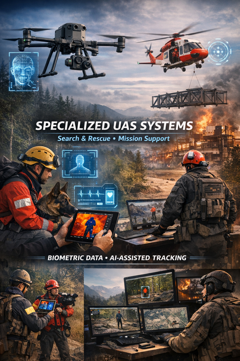
Specialized biometric UAS drone Systems for SAR
Search and Rescue via Drones
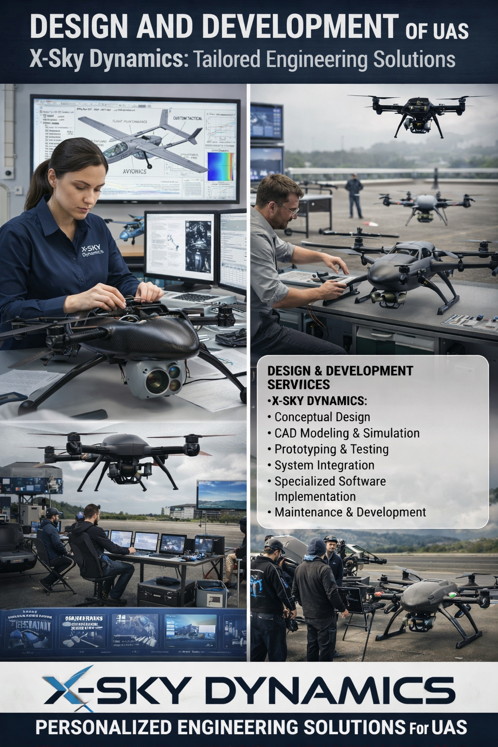
UAS Design, Engineering & Capabilities
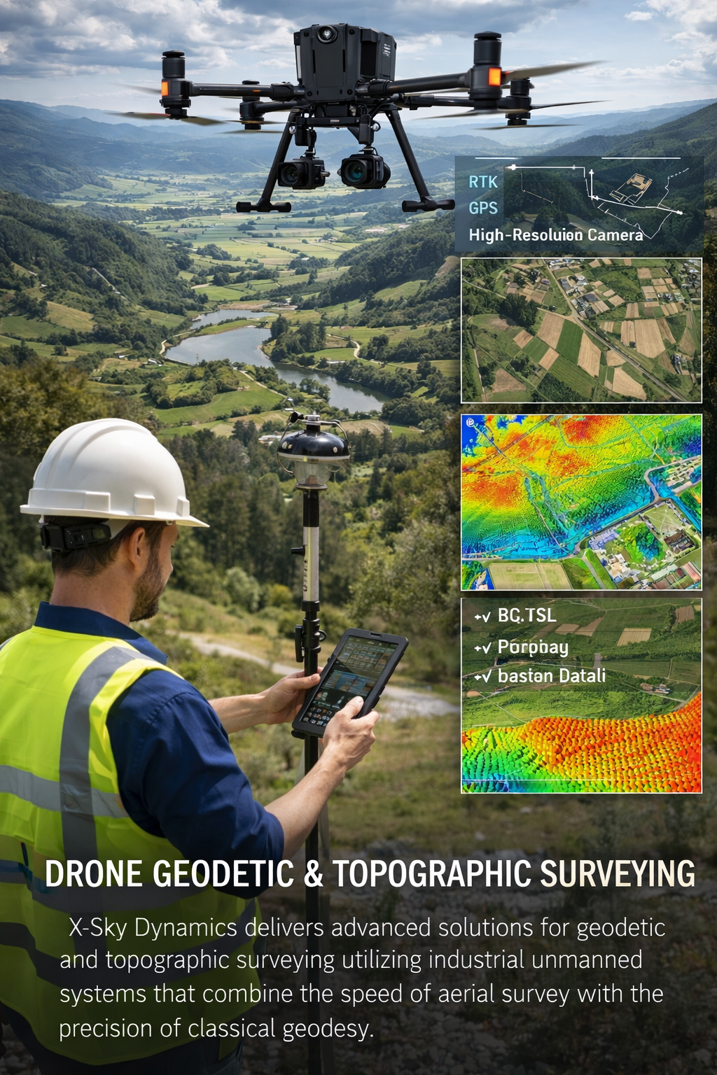
Geodetic and Topographic Surveying with UAV Systems
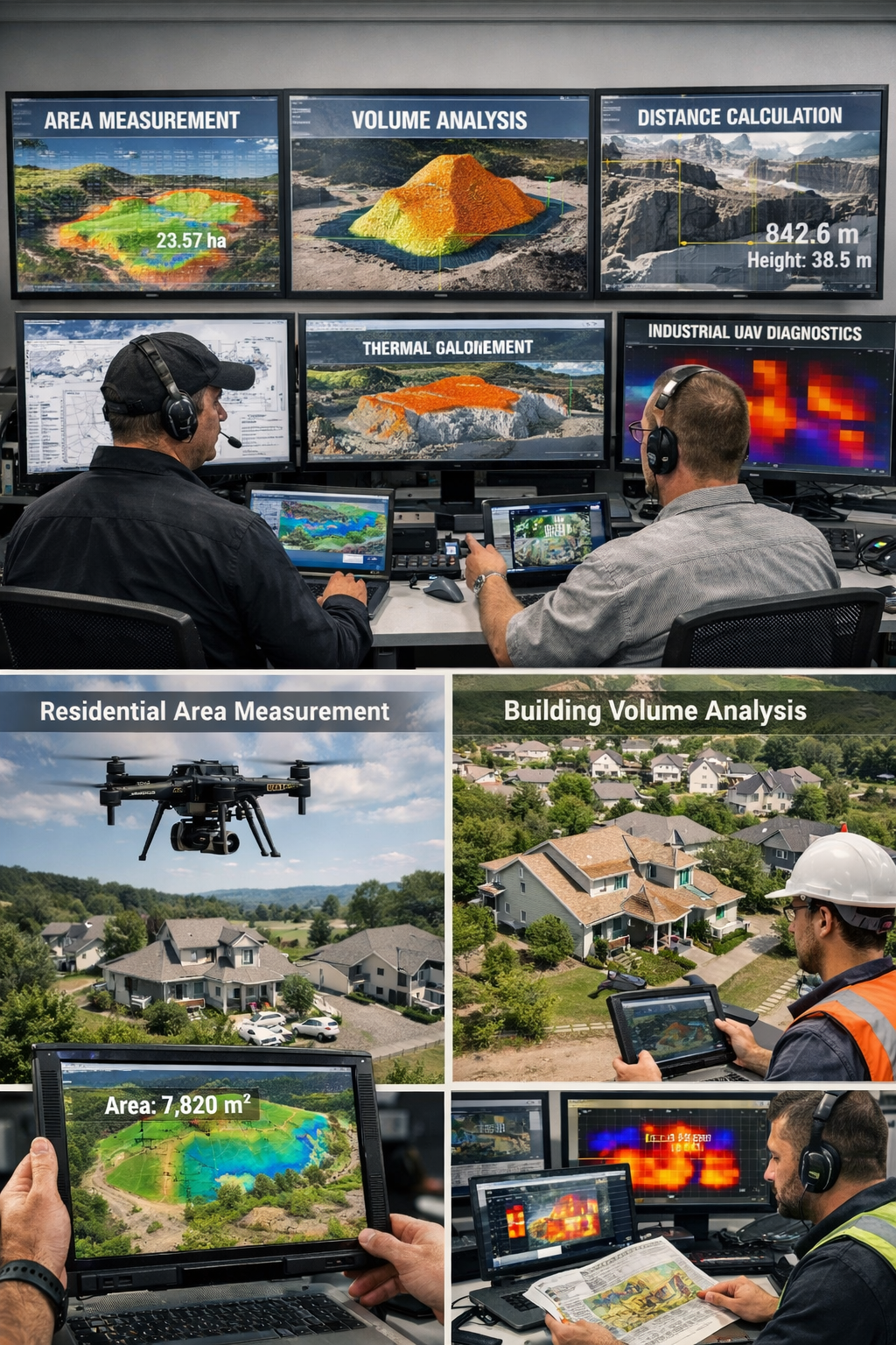
Measurement of Areas, Volumes, Distances with Drones
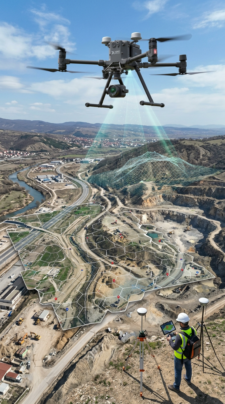
Mapping, Orthophoto, Geodetic UAV Systems
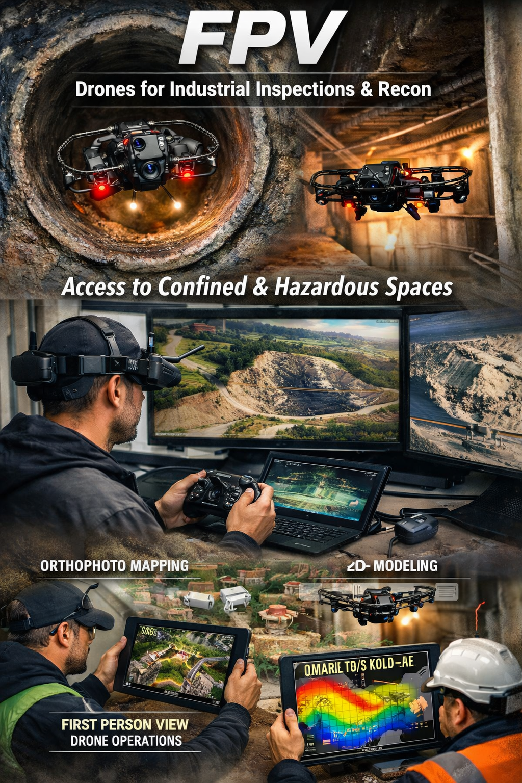
FPV Drone Inspections, Surveys
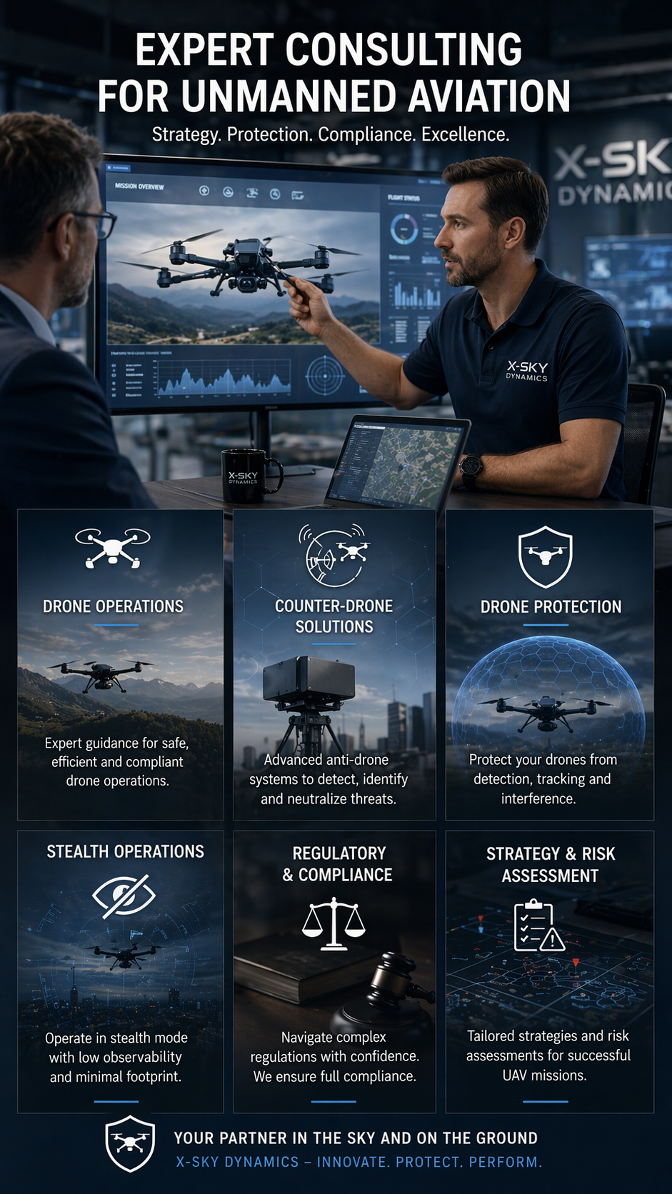
CONSULTING IN UNMANNED AVIATION (DRONES), ANTI-DRONE SYSTEMS
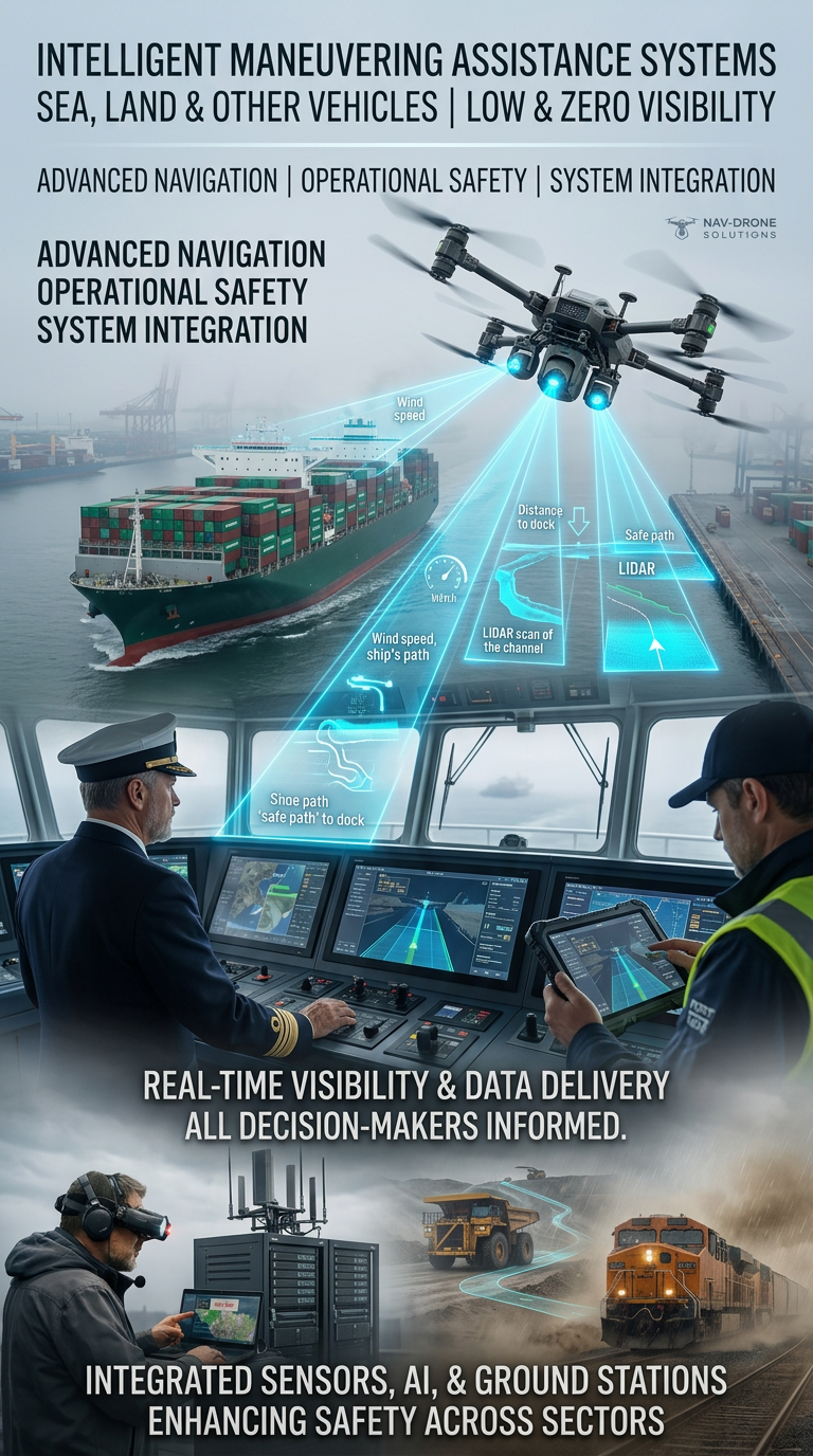
Systems for Assisting the Maneuvering in Low or Zero Visibility
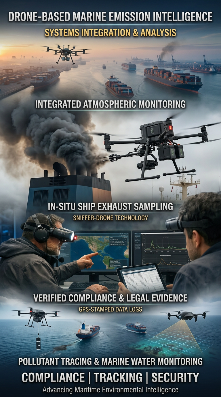
Drone Systems for Exhaust Gas Analysis
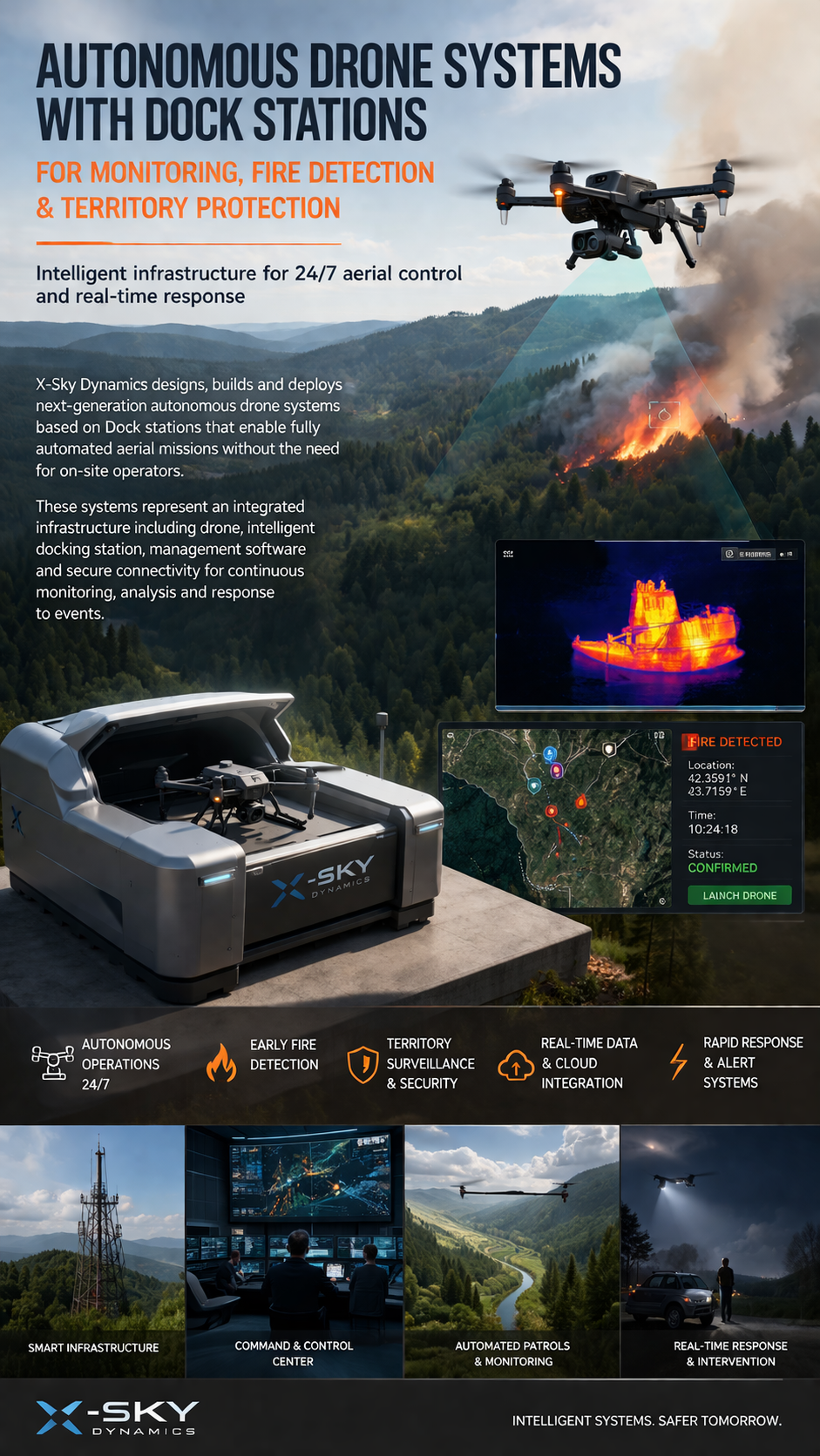
Dock Stations for Monitoring, Early Fire Detection
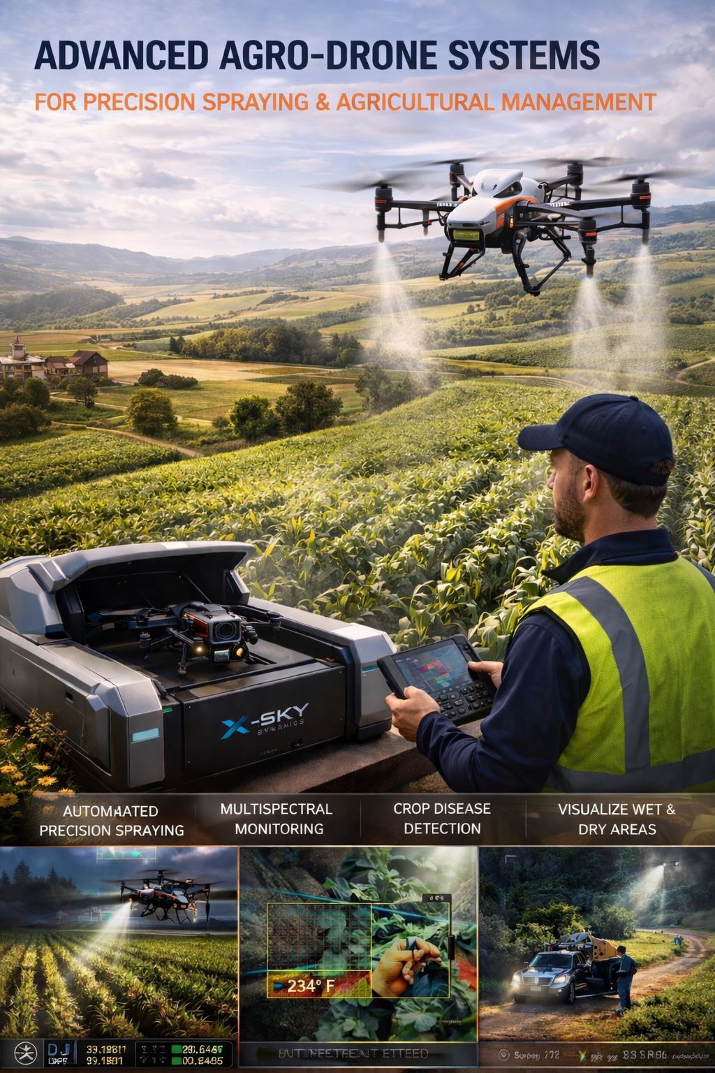
Agricultural Drone Systems for Precision Spraying, Spectral Monitoring
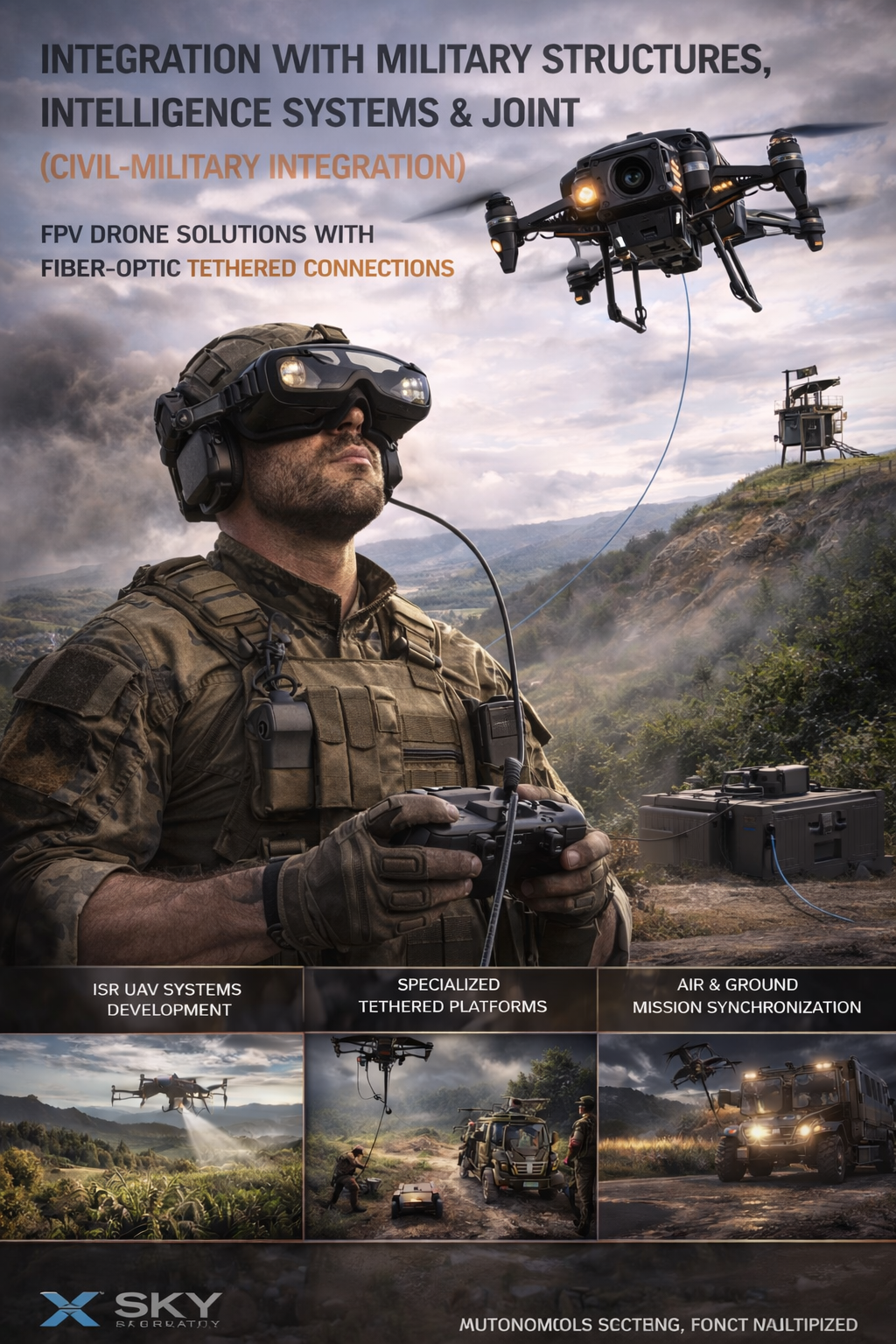
UAV – Drone Integration with Military
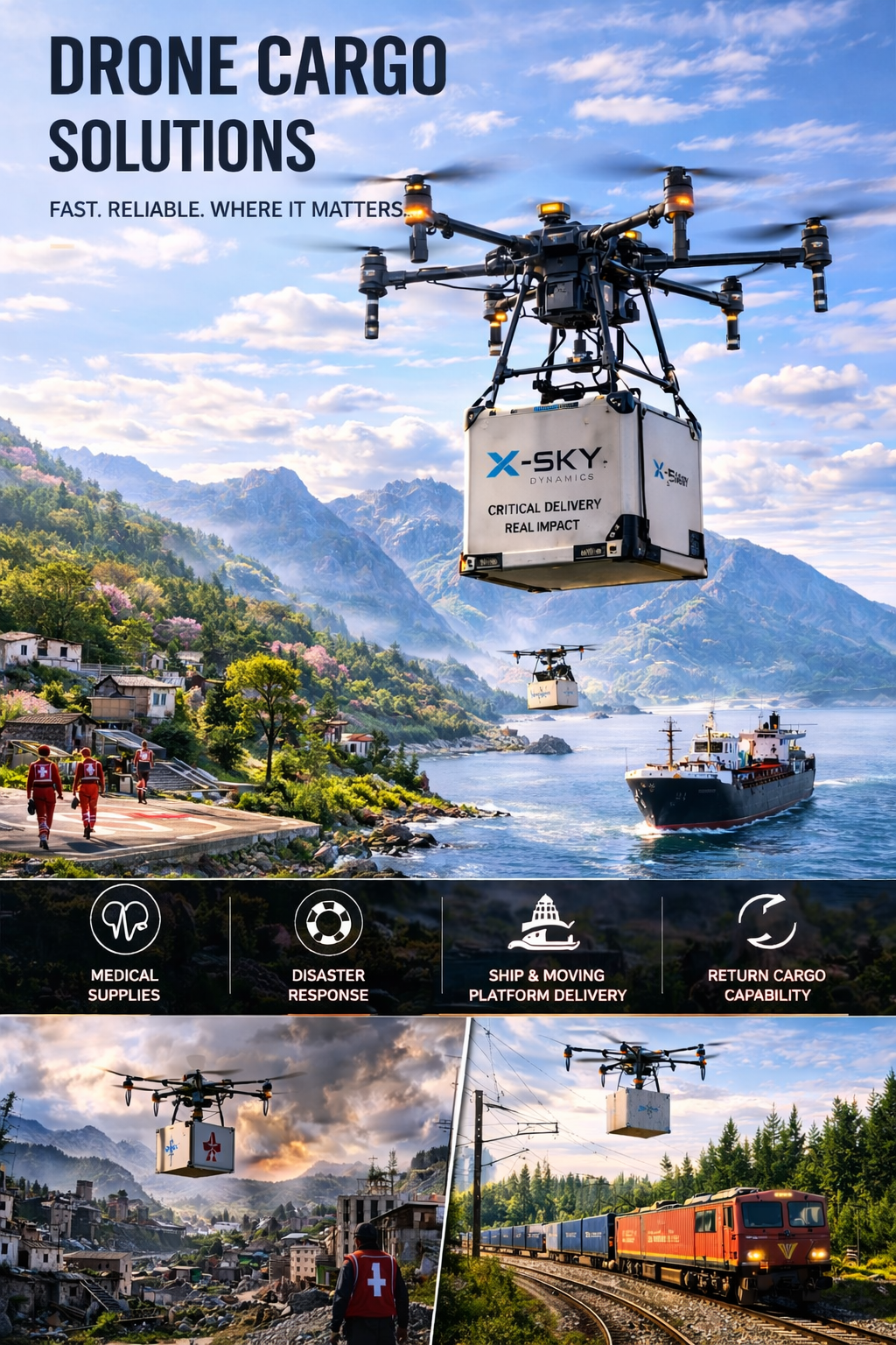
Cargo Transportation with Drones
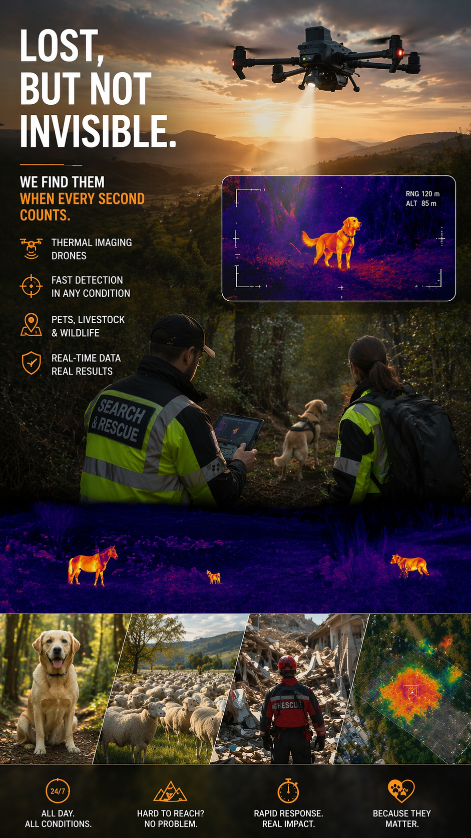
Search and Rescue of Pets and animals Using Drones
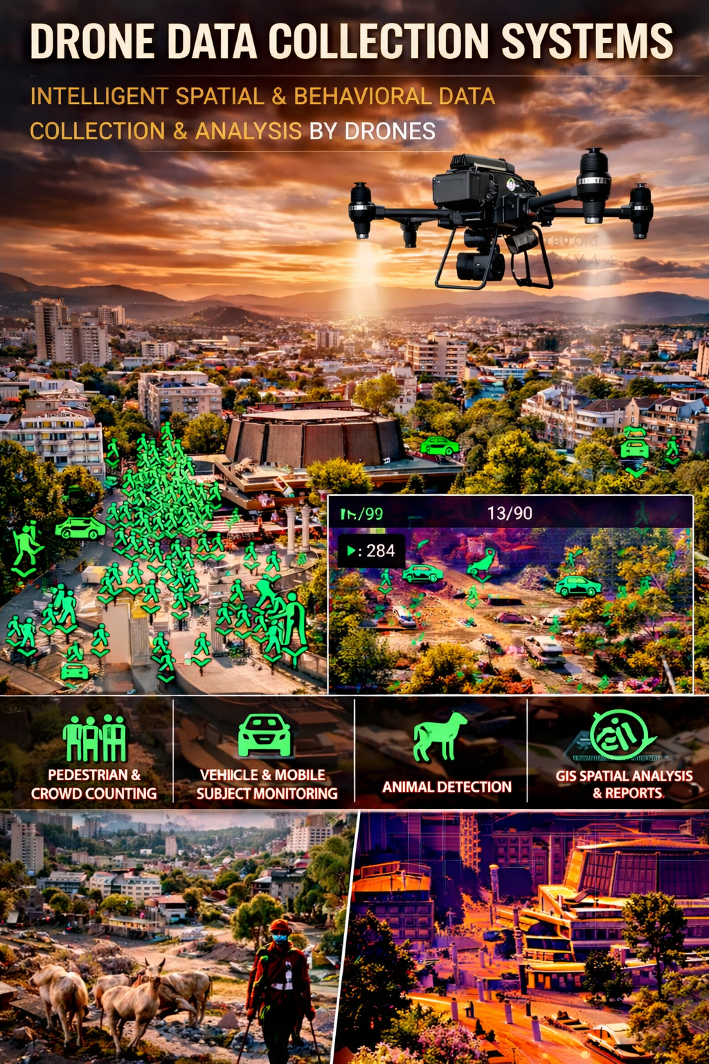
Drone Systems for Collecting Statistical Data
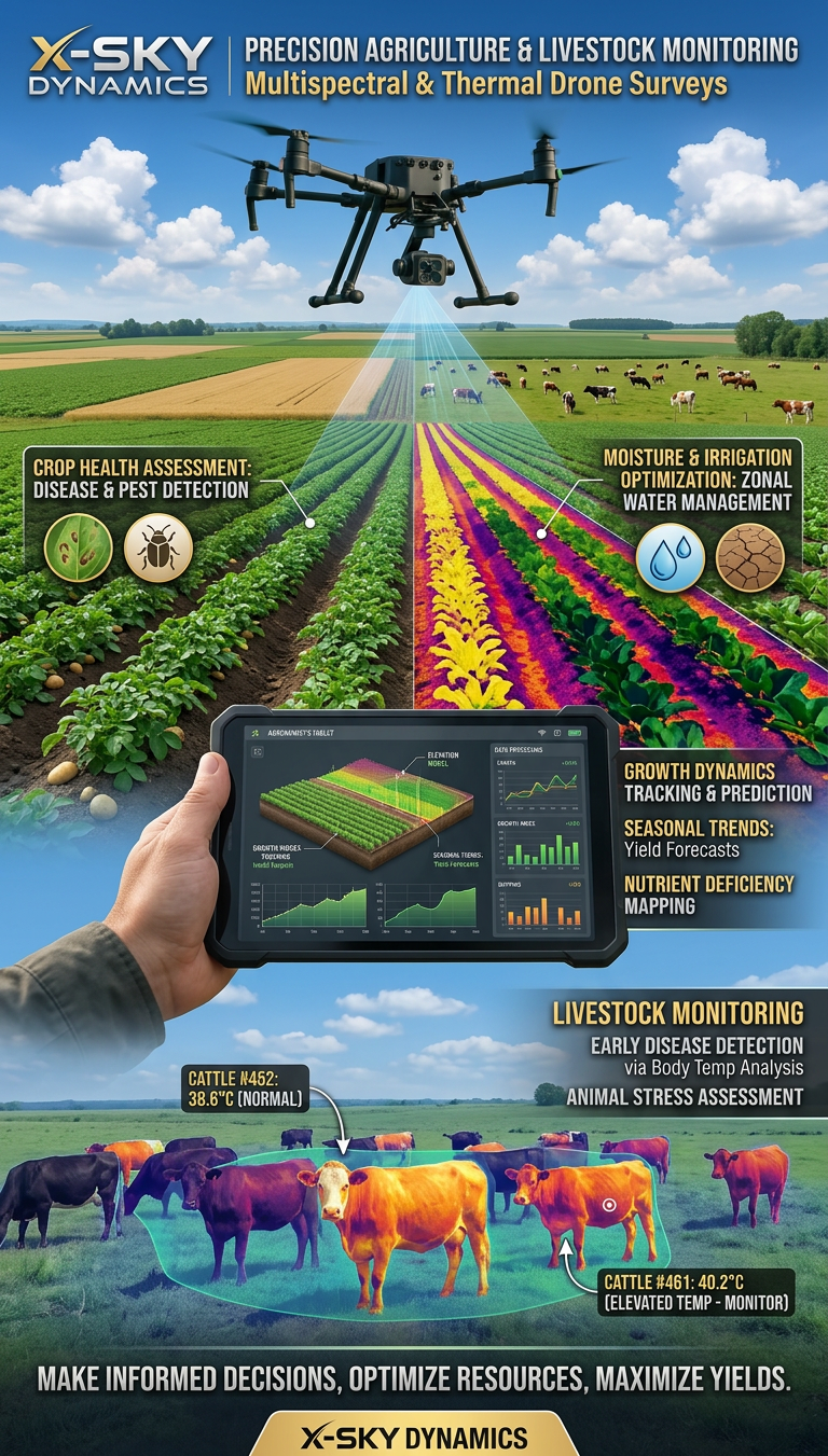
Multispectral and Thermal Drone Surveys for Agriculture
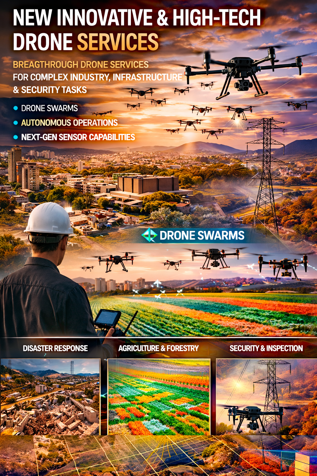
Innovative and High-Tech Drone Services
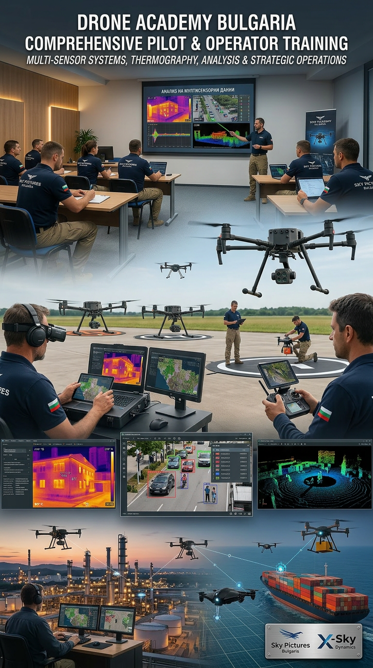
DRONE PILOTS AND OPERATORS TRAINING AND COURSES
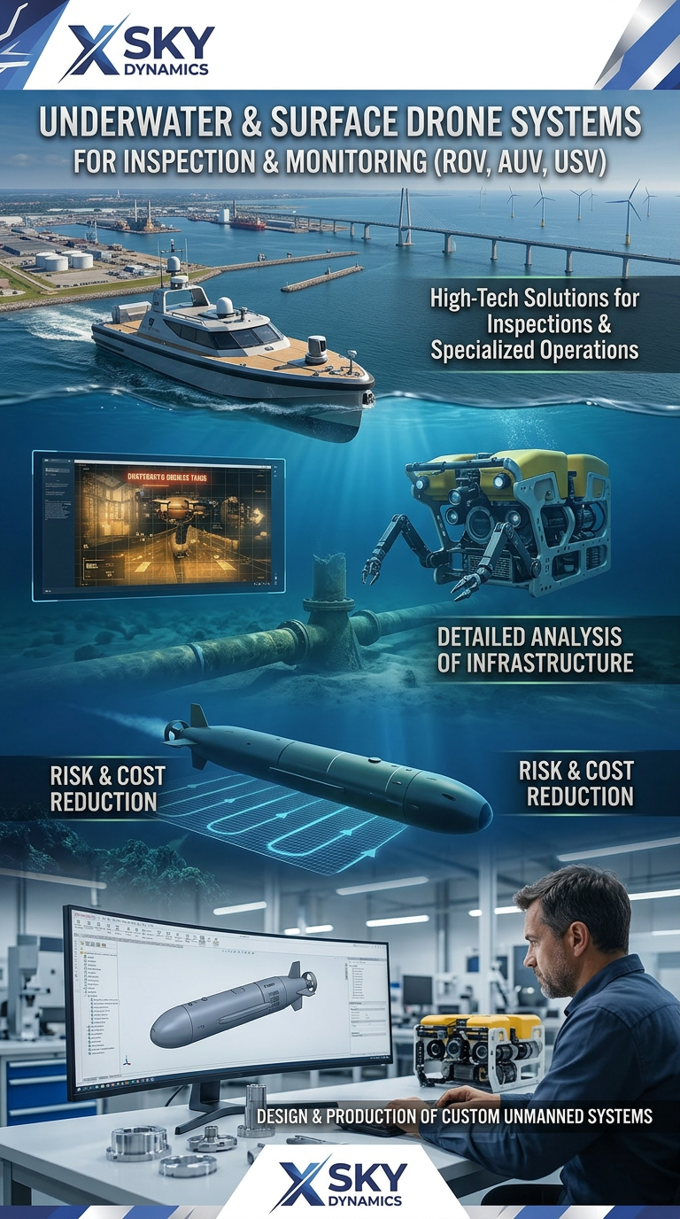
Underwater and Surface Drone Systems ROV, AUV, USV
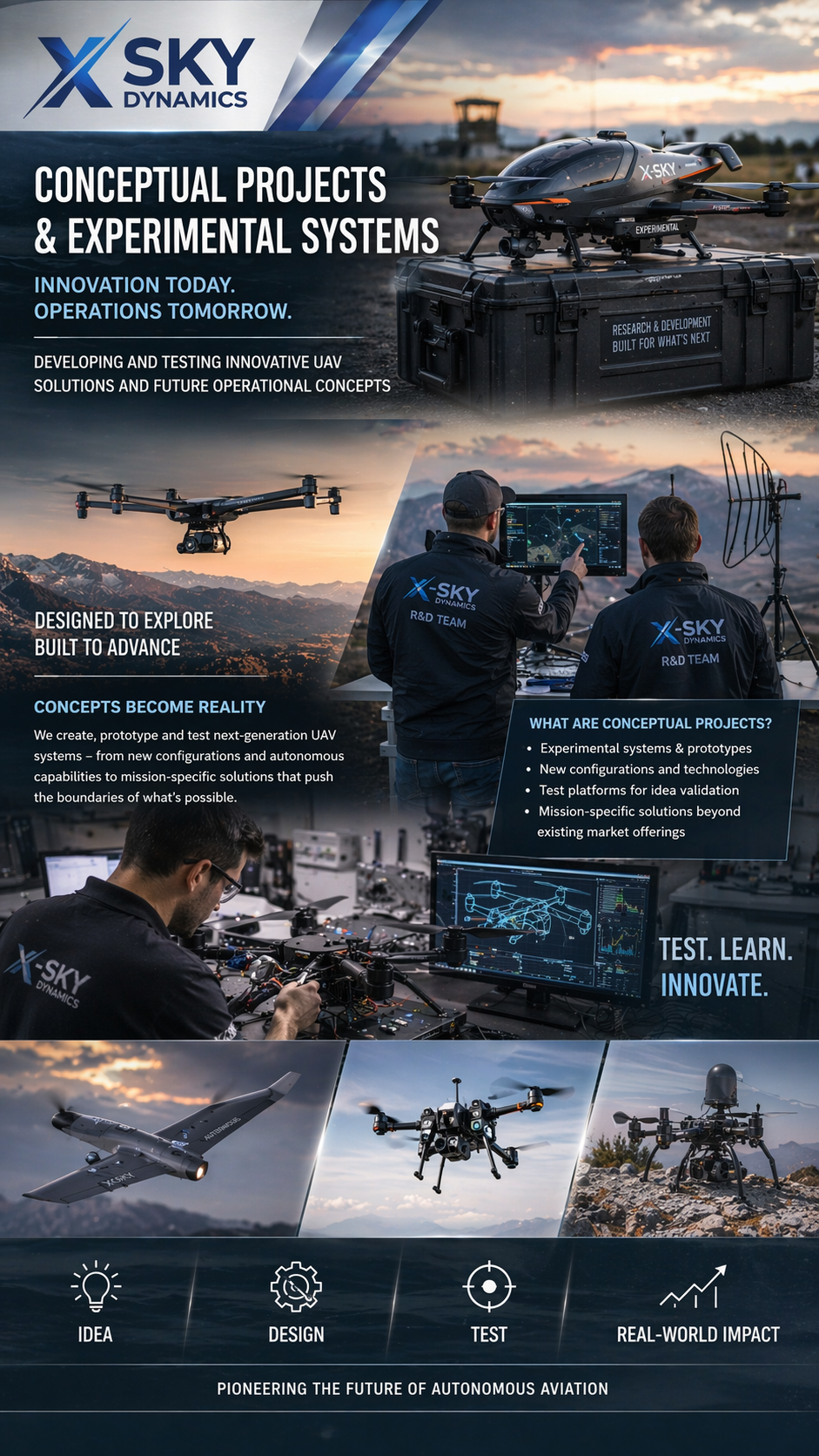
Concept Projects & Experimental UAV
Autonomous Drone Systems with Dock Stations
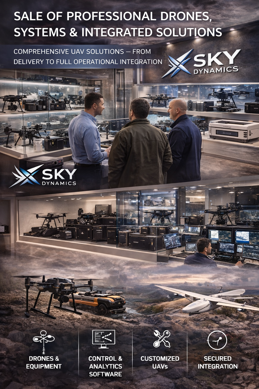
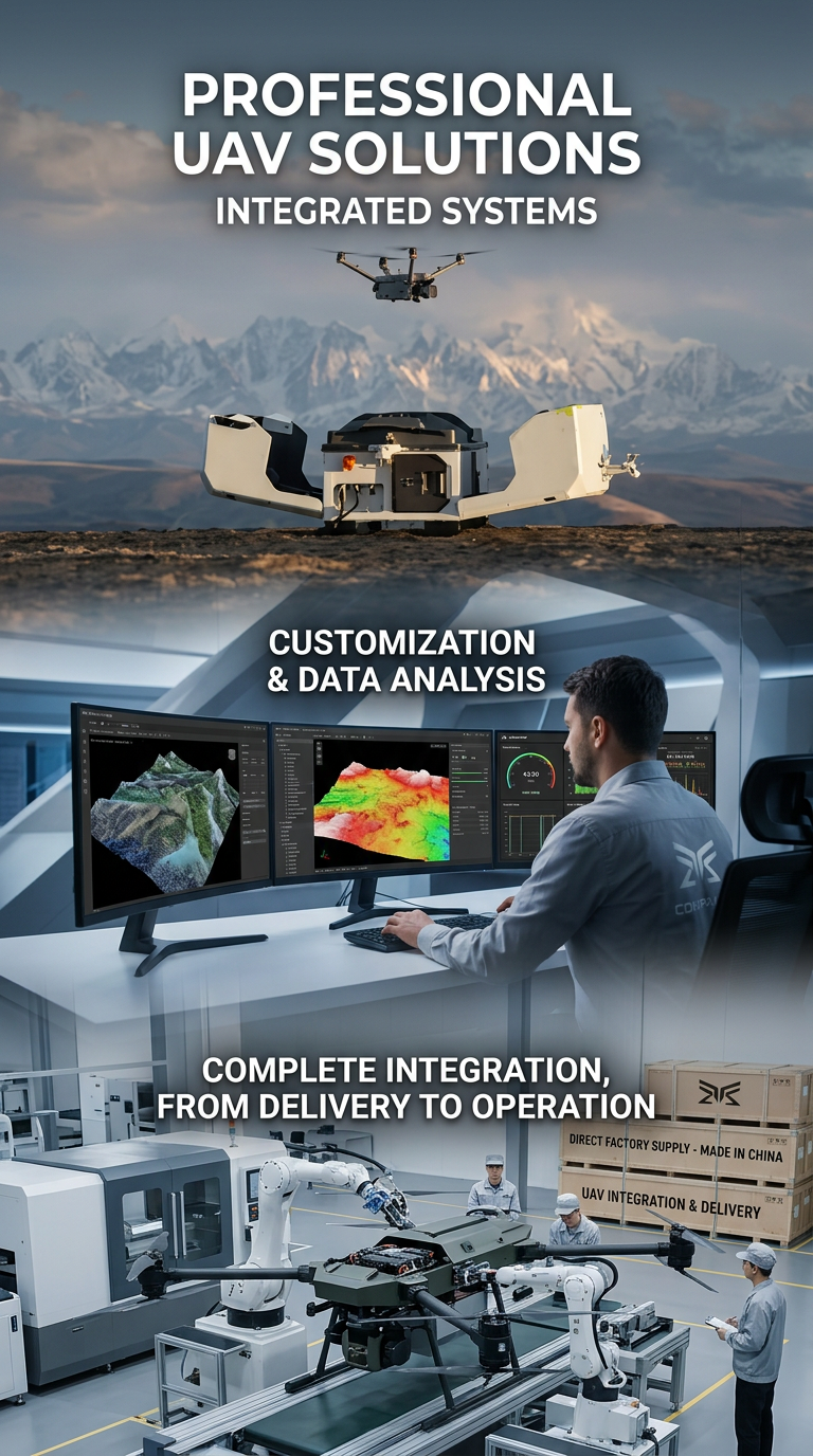
Sales of Professional Drones

Satellite Imaging, Satellite Design and Integrated
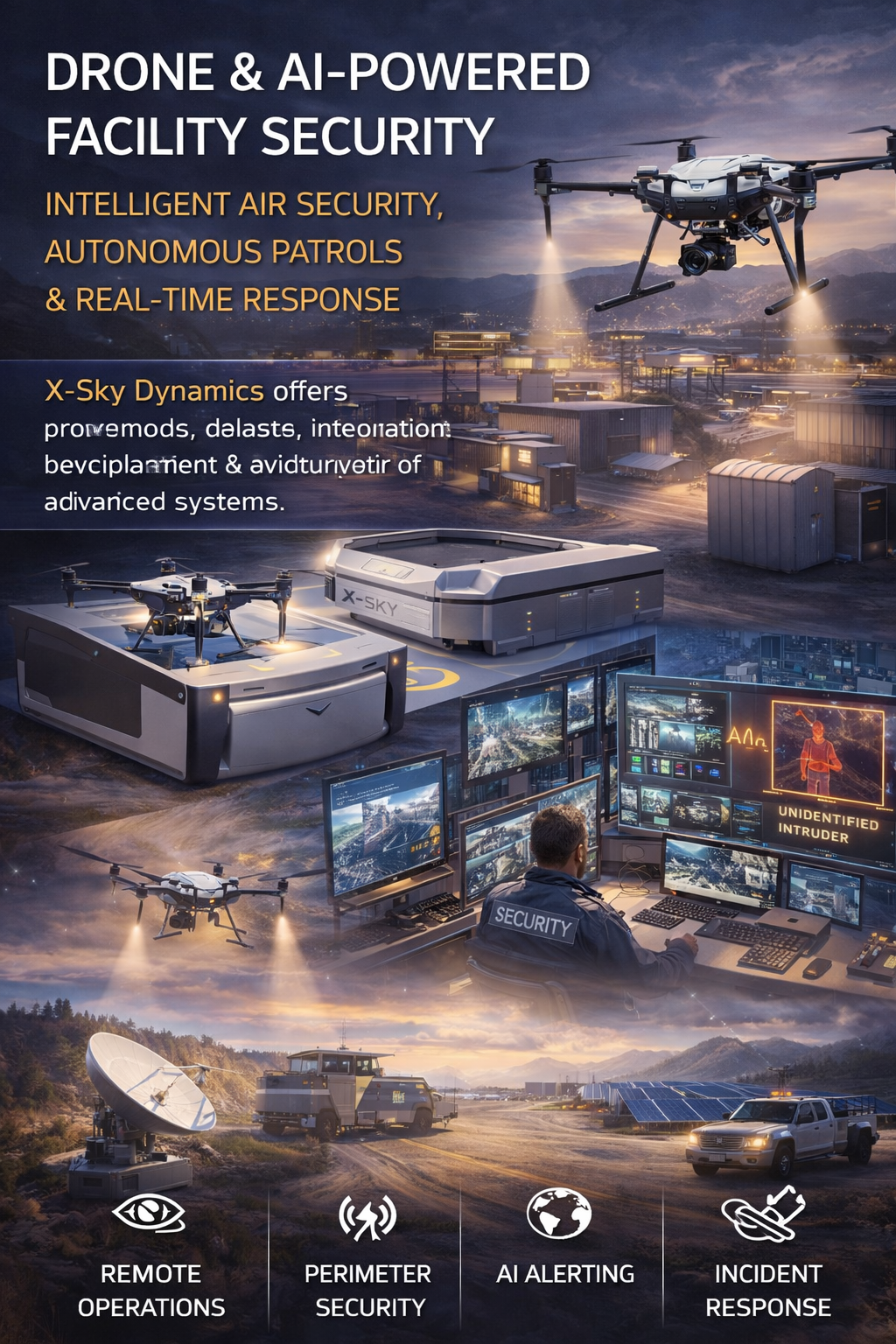
Security of Sites Through Drones AI Systems
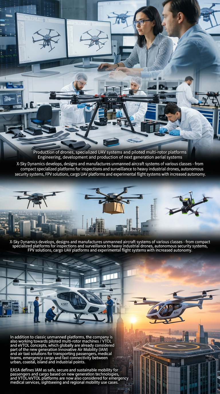
Drone Manufacturing and Manned Multirotor Platforms
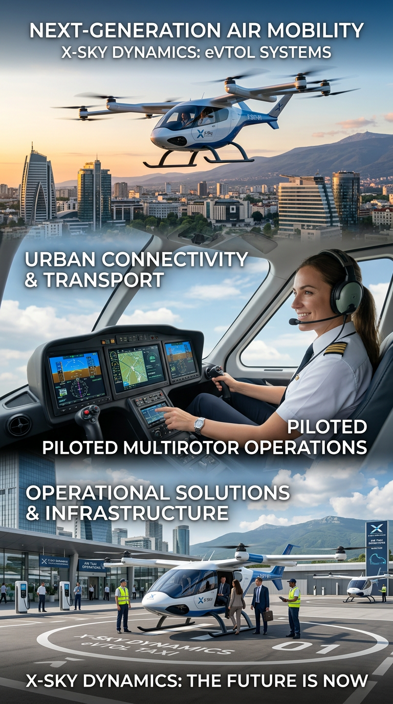
Air Taxis and eVTOL Systems
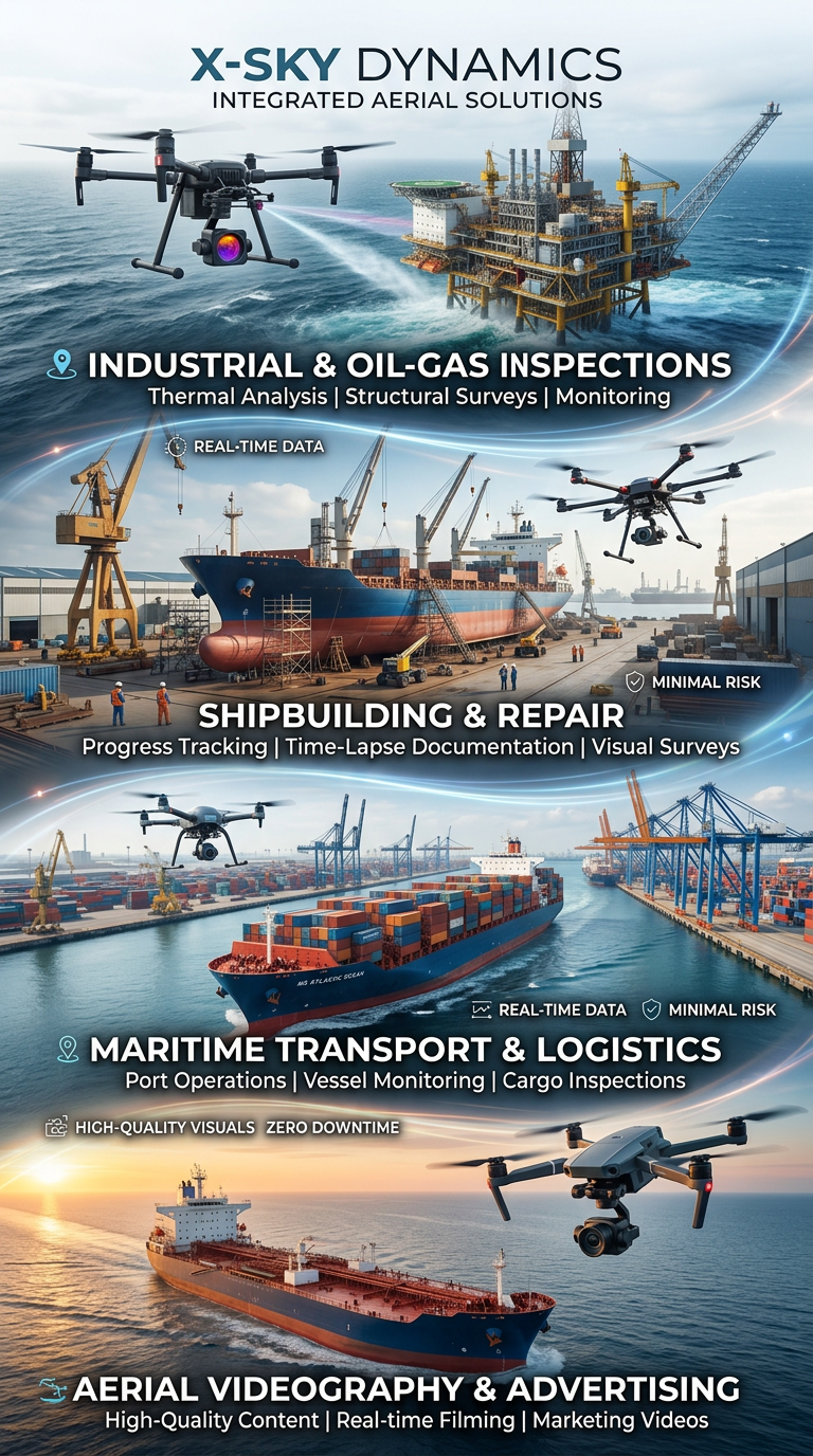
Drone and Video Services in Maritime Transport

Space Agriculture, Agri-Systems for Extreme Environments

Cybersecurity, Cyber Defence and Protection of Critical Infrastructure
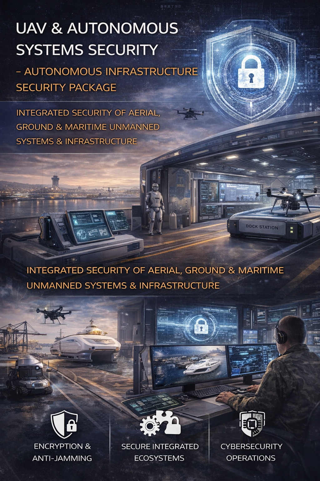
Cybersecurity and Protection of UAV and Autonomous Systems
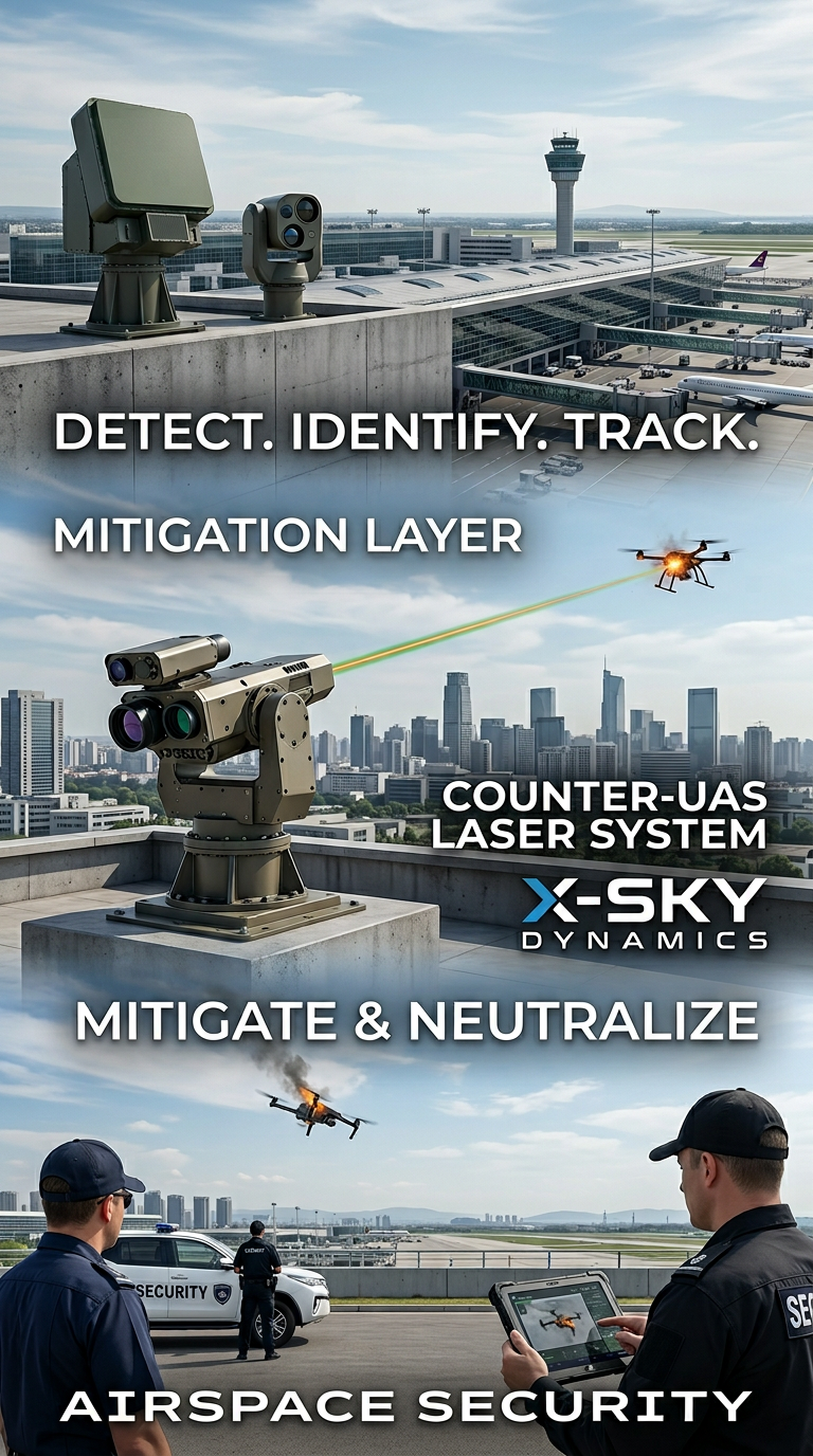
Counter-UAS, Laser and Kinetic Systems
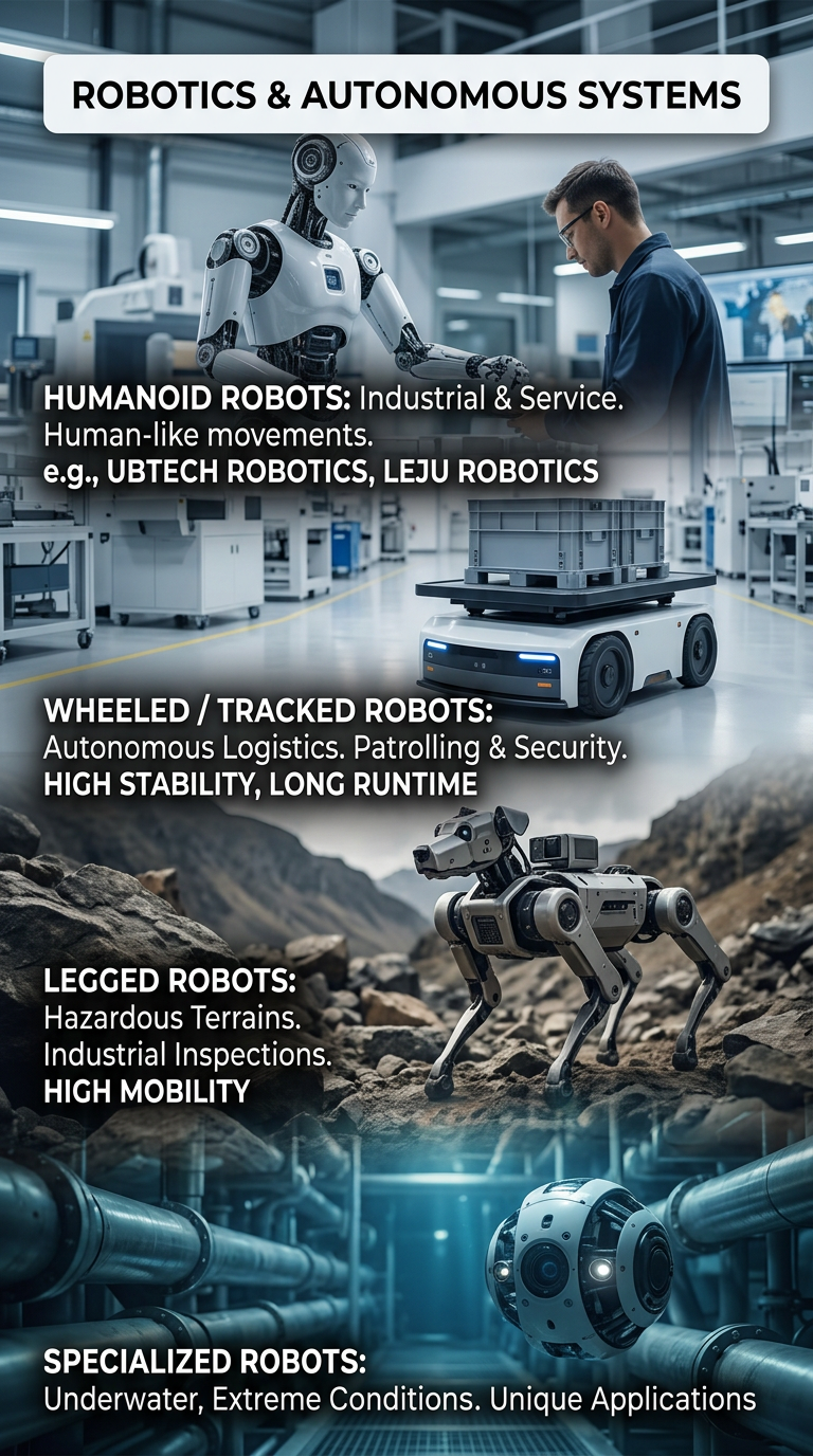
Robots and Autonomous Systems
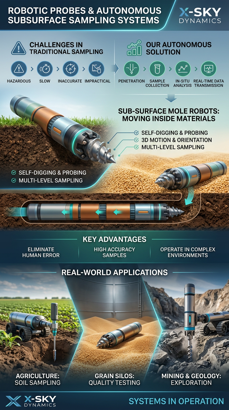
Robotic Probing Systems and Subsurface Technologies
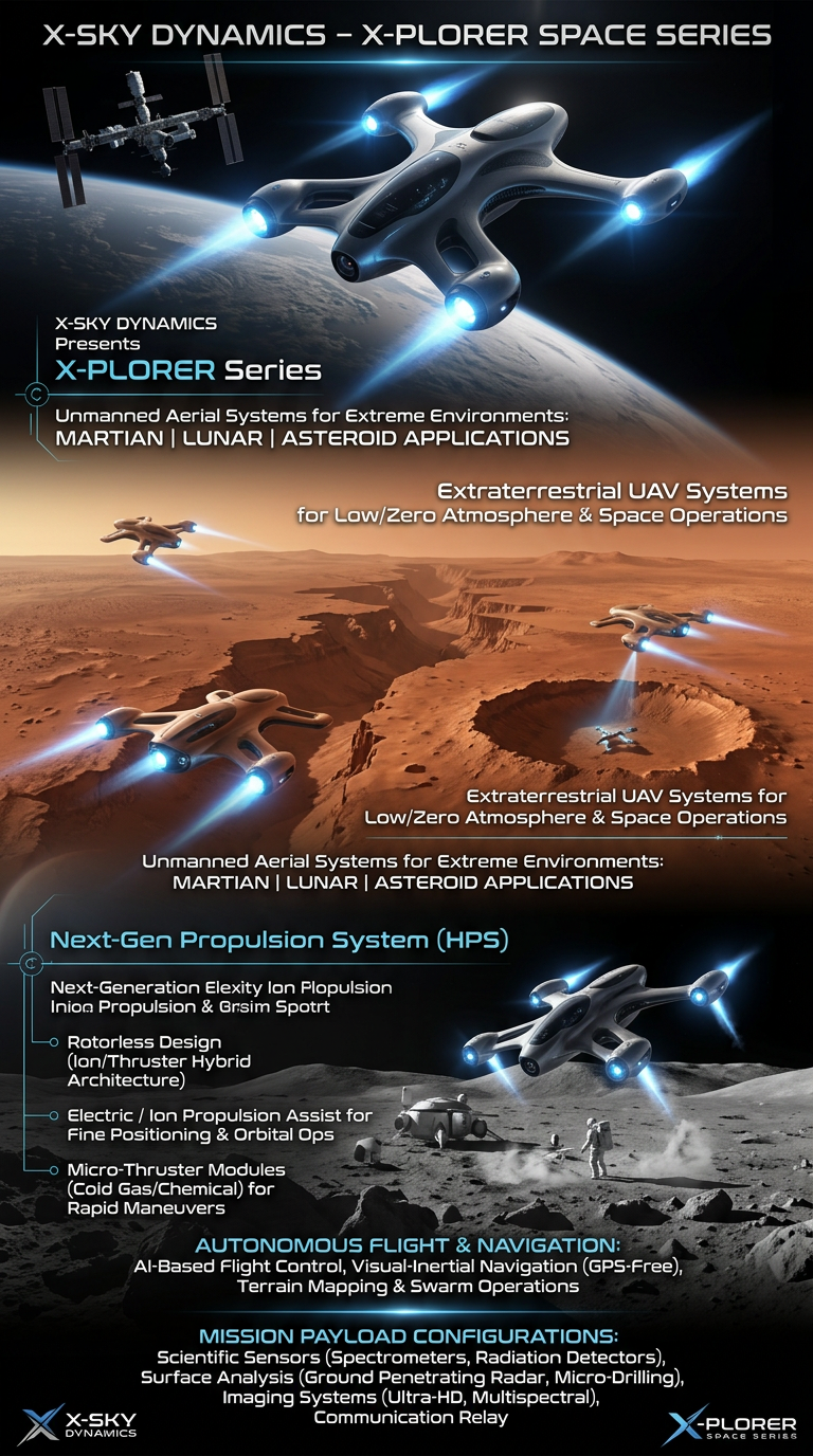
Space Drone systems SPACE X-PLORER SERIES

RAIGNV Partnership
Investors & Partners