[ SERVICES / INNOVATIVE AND HIGH-TECH DRONE SERVICES ]
/ SERVICE #19
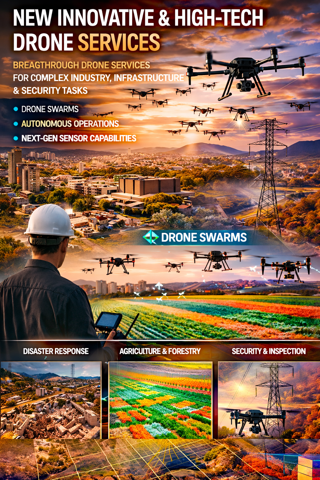
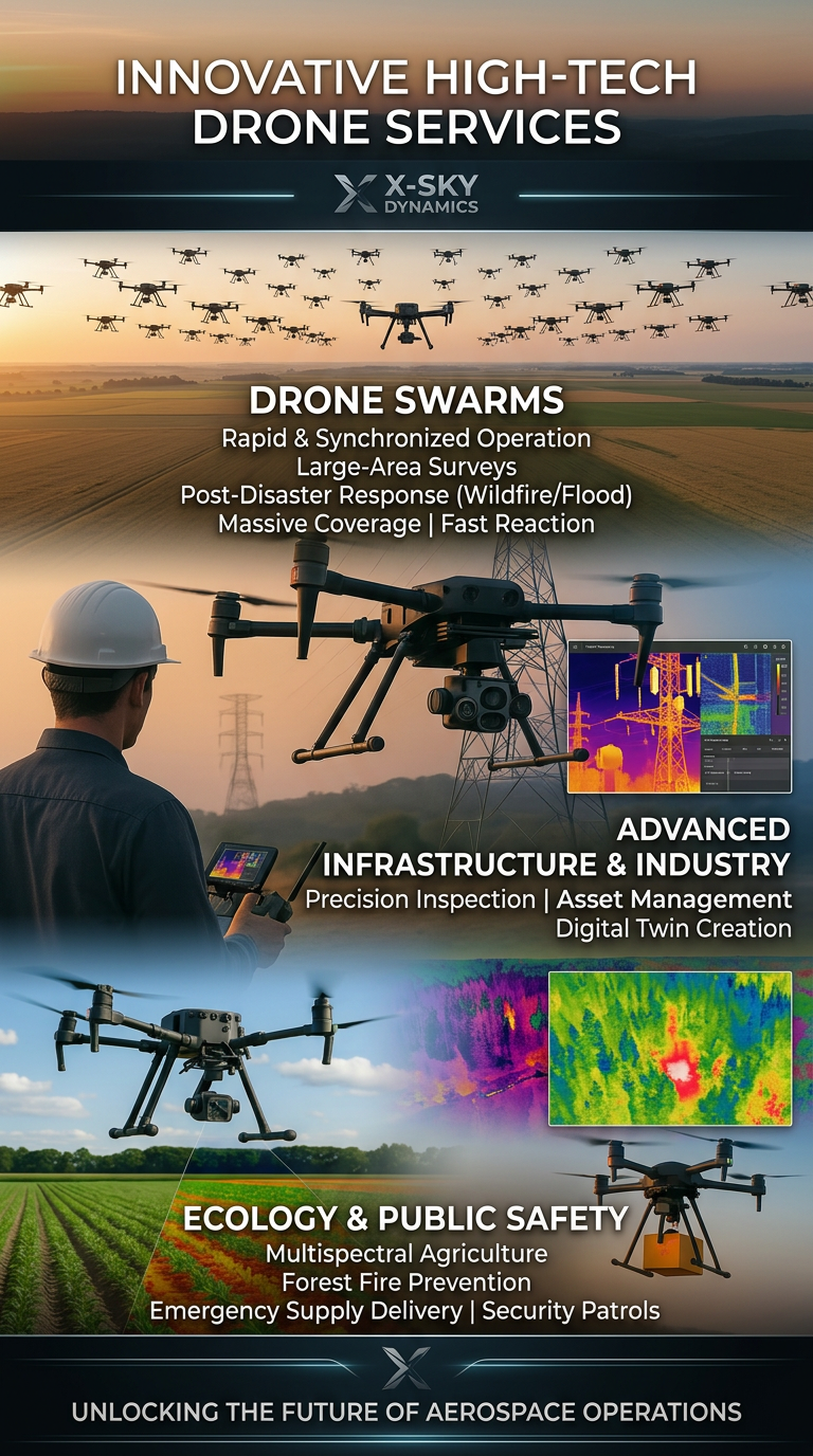
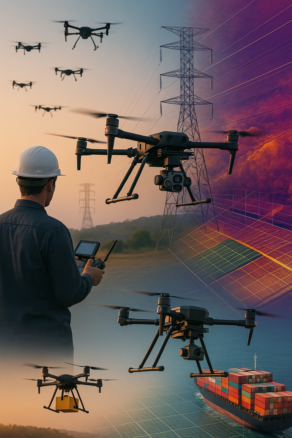
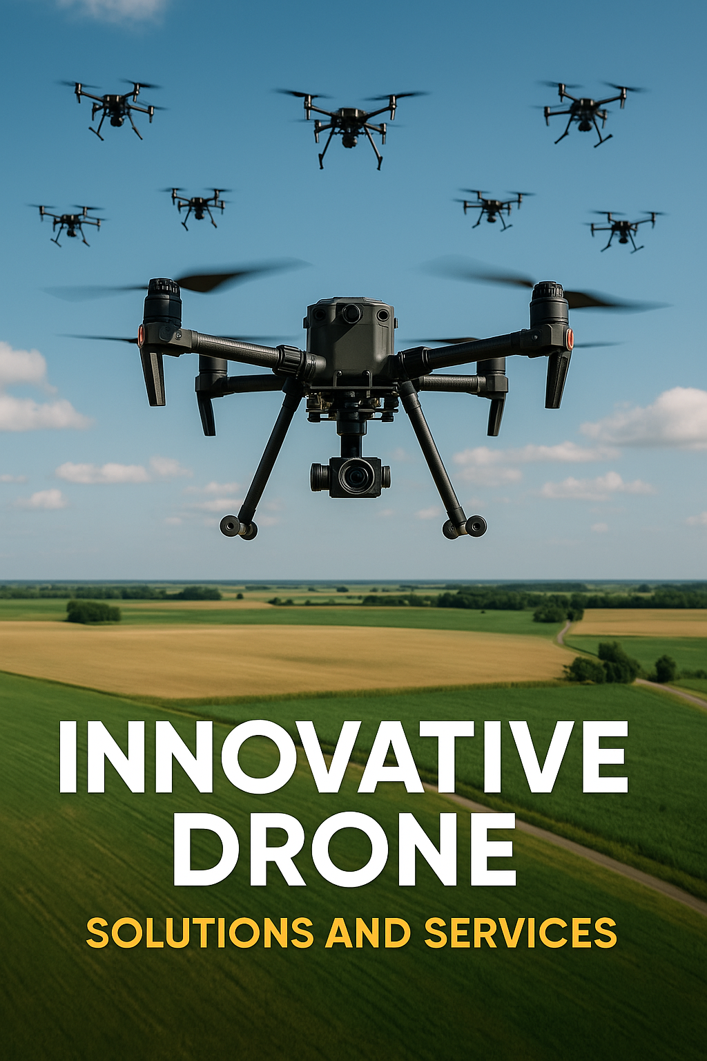
Innovative and High-Tech Drone Services
Innovative and High-Tech Drone Services Drone Swarms for Large-Scale Coverage and Rapid Response Drone Simulations and Training for Crisis Response Preparing fire brigades, rescue teams, and medical units for real-life missions
/ 01
X-Sky Dynamics are expanding their portfolio by adding innovative and future-oriented drone services, designed to solve complex challenges in industry, infrastructure, ecology, and security. These services go beyond standard aerial inspections and mapping, offering faster, more precise, and highly automated solutions that until recently seemed impossible.
Drone Swarms for Large-Scale Coverage and Rapid Response
What is it? Multiple drones working in full synchronization as a single "swarm," capable of covering vast territories in an extremely short time.
Applications:
Client benefits: speed, exponentially greater coverage, minimal risk during emergencies.
- Mass surveys after disasters – earthquakes, floods, forest fires
- Monitoring large agricultural or forest areas for diseases, fires, or erosion
- Security of critical facilities and high-profile events through full aerial coverage.
Drone Simulations and Training for Crisis Response
What is it? Conducting training missions simulating disasters – fires, floods, accidents – using drones and specialized software.
/ 02
Applications:
Benefits: safe training environment, improved preparedness, accumulation of real-world data for analysis.
- Preparing fire brigades, rescue teams, and medical units for real-life missions
- Assessing reaction time and coordination effectiveness among different agencies
- Using real thermal and visual data during training sessions.
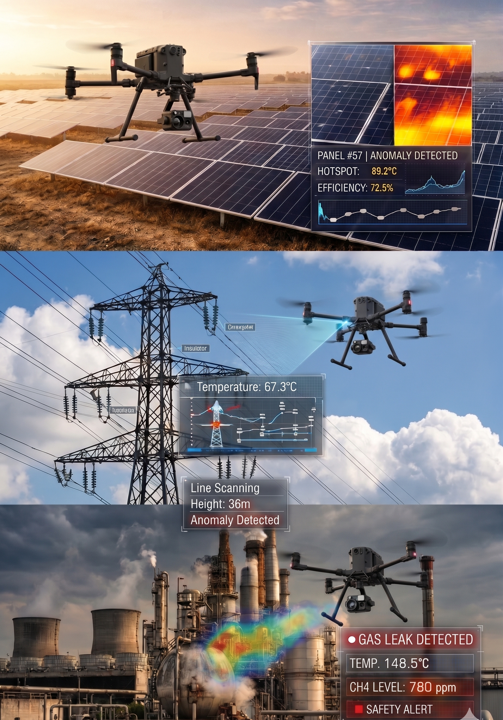
Air Corridor and Drone Route Monitoring
What is it? Drone inspections of aerial corridors intended for future cargo drone deliveries, as well as monitoring power lines, telecommunication routes, and other aerial infrastructure.
Applications:
Benefits: safer airspace, reduced incidents, and better strategic planning.
- Detecting obstacles along routes (trees, structures, buildings)
- Preventive diagnostics of power lines and communication networks
- Preparing infrastructure for future drone-based transport services.
/ 03
Drone-in-a-Box Stations for Continuous Monitoring
What is it? Installation of fixed automated drone stations capable of self-launch, autonomous landing, and automated recharging, ensuring continuous monitoring of designated areas.
Applications:
Benefits: 24/7 observation without human presence, rapid response to alerts and incidents.
- Security of industrial complexes, airports, ports, and strategic facilities
- Continuous monitoring of rivers, dams, and flood-risk zones
- Oversight of large construction sites or transport corridors.
LiDAR, Multispectral Data, and BI Visualization Integration
What is it? Combining LiDAR, RGB, and multispectral imagery to create photorealistic 3D and 4D models integrated into BI (Business Intelligence) platforms.
/ 04
Applications:
Benefits: deeper understanding of dynamic processes, predictive analysis capability, visually clear results for clients and institutions.
- Time-based change analysis – erosion, construction processes, land use dynamics
- Generating dynamic maps for agricultural, forestry, and urban management
- Infrastructure planning and visualization of future projects.
Drone Cargo Transport in Specific Conditions
What is it? Using drones to deliver goods to hard-to-reach or unconventional locations – rooftops, vessels, and mobile objects.
Applications:
Benefits: speed, elimination of transport limitations, reduced human resource involvement.
- Delivering medicines, spare parts, or supplies to ships and trains in motion
- Equipment delivery for concerts, events, and festivals
- Emergency deliveries in remote or inaccessible terrain.
[ Get in Touch ]
X-Sky Dynamics
- ✉xskydynamics@gmail.com
- ✉xsky@xskydynamics.com
- ☎+359 87 6975862
 WhatsApp: +359 87 6975862
 Viber: +359 87 6975862
- 📍Sofia, bul. "Yanko Sakazov"

[ SERVICES ]
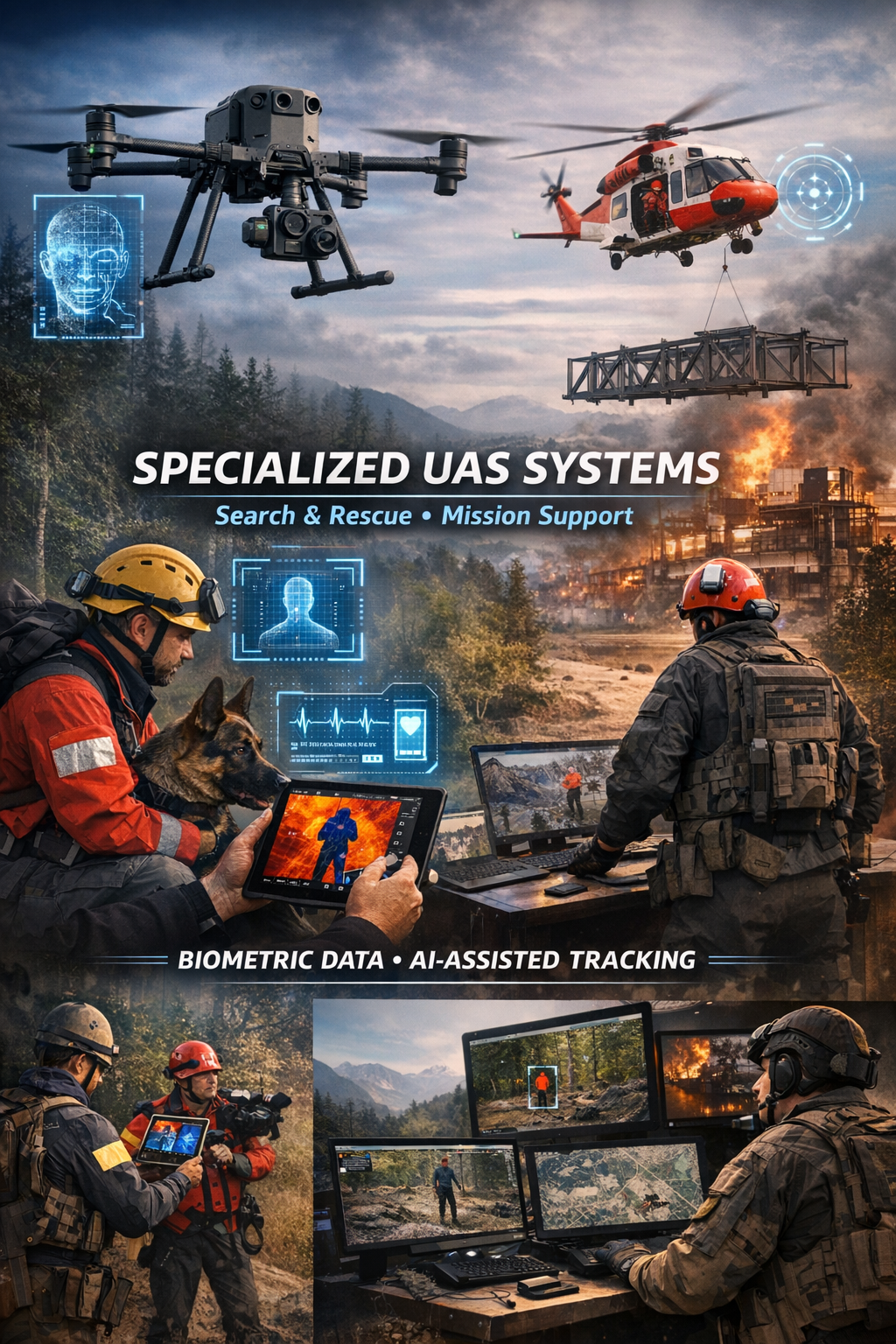
Specialized biometric UAS drone Systems for SAR
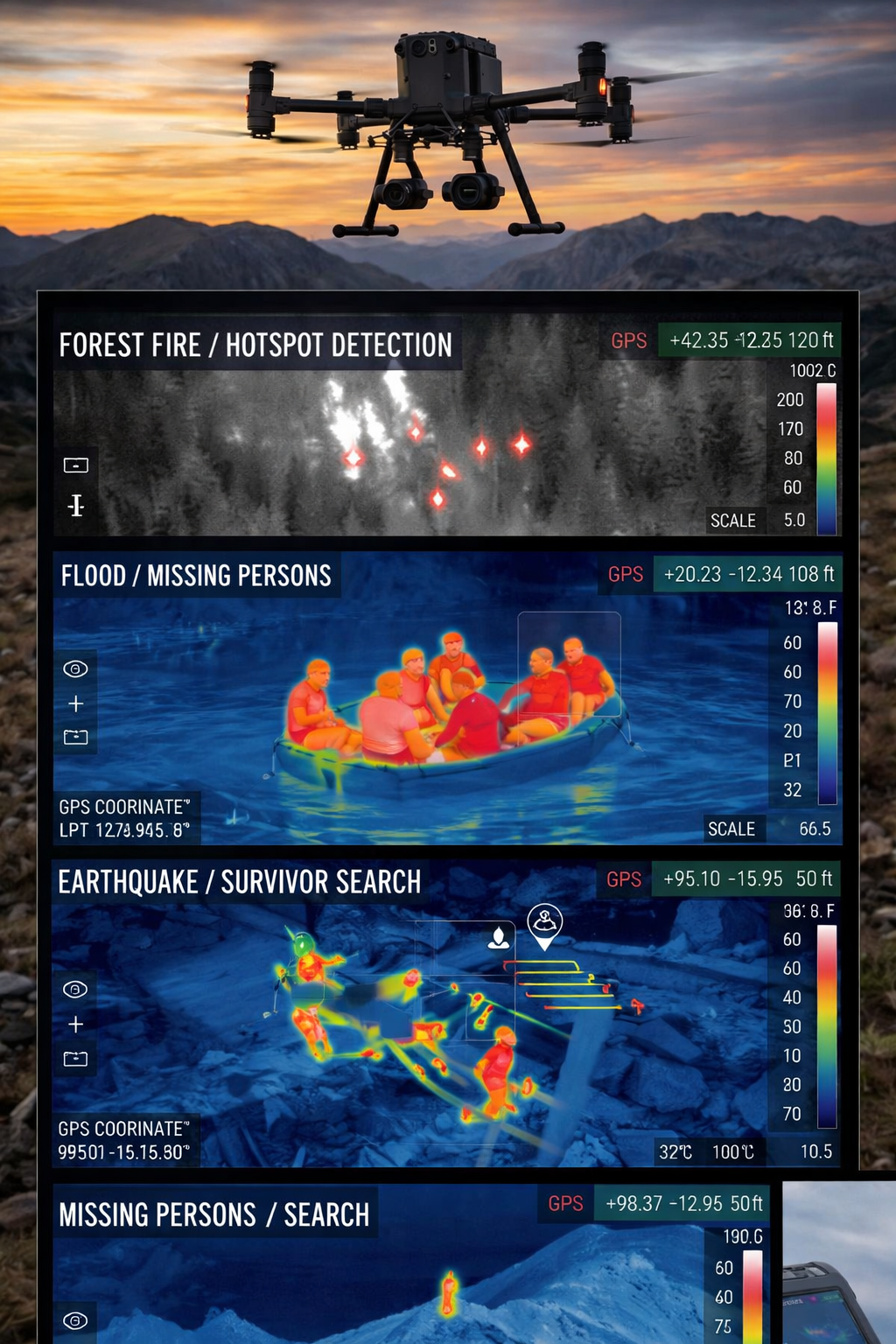
Search and Rescue via Drones
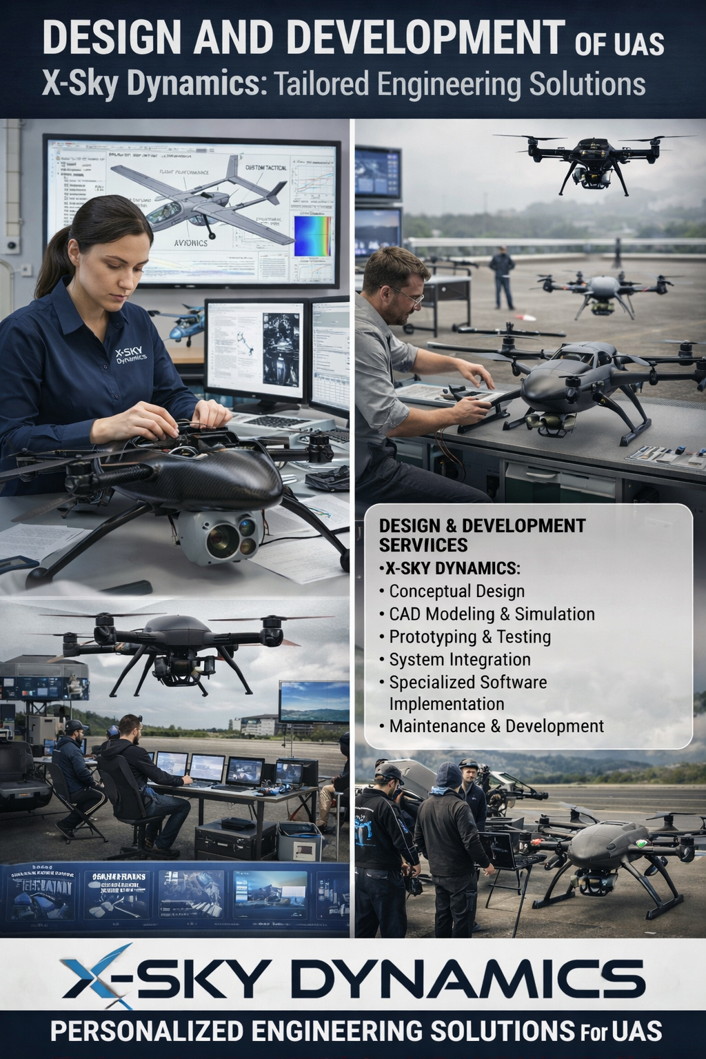
UAS Design, Engineering & Capabilities
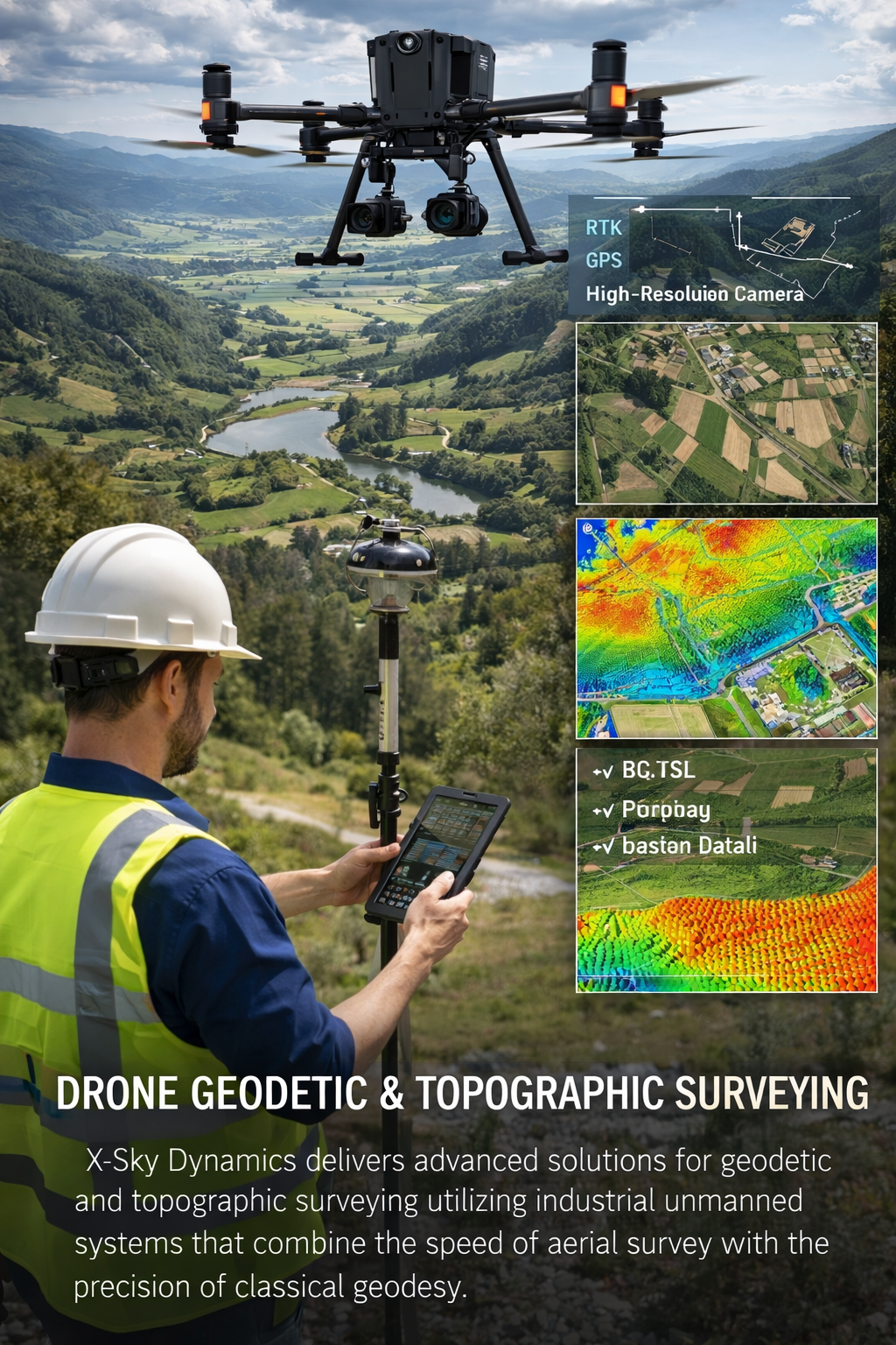
Geodetic and Topographic Surveying with UAV Systems
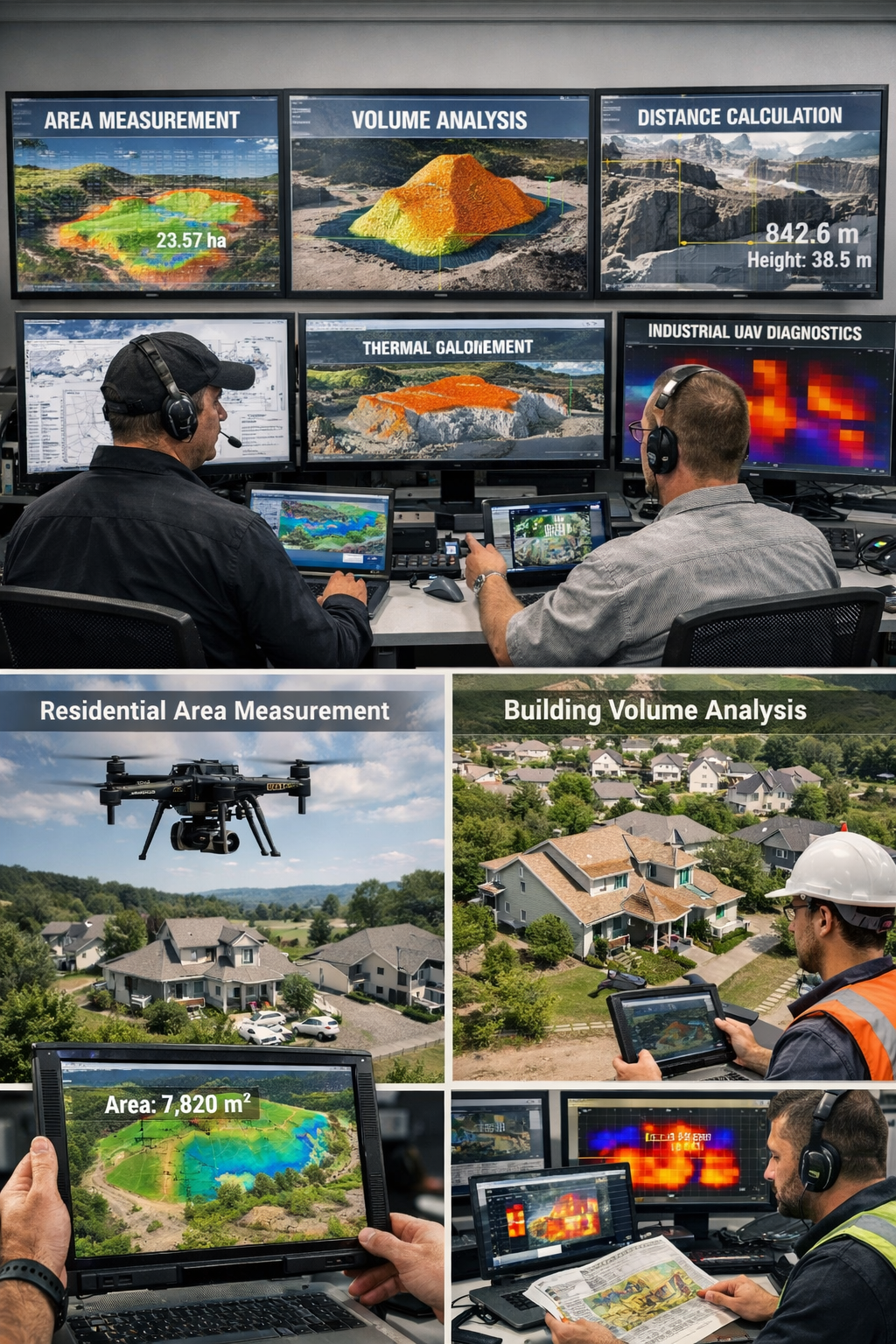
Measurement of Areas, Volumes, Distances with Drones
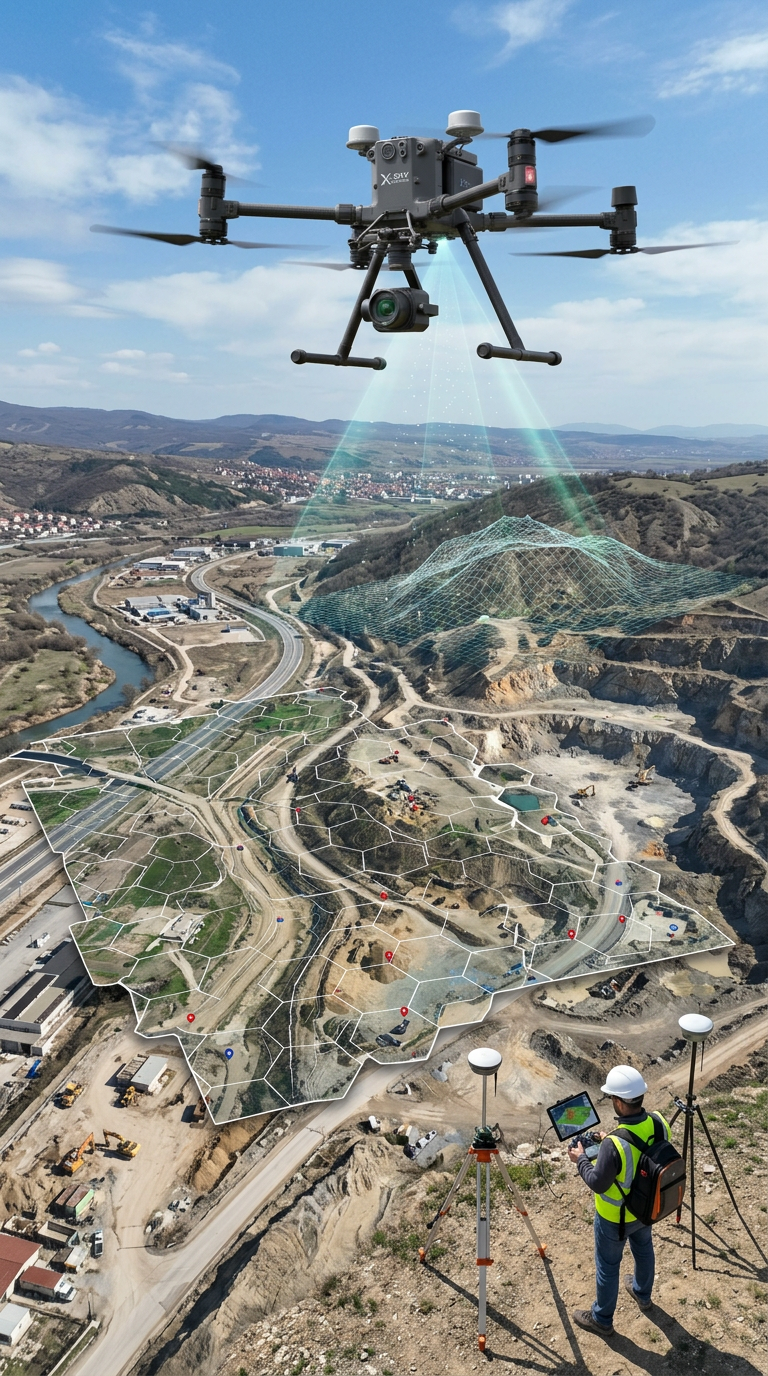
Mapping, Orthophoto, Geodetic UAV Systems
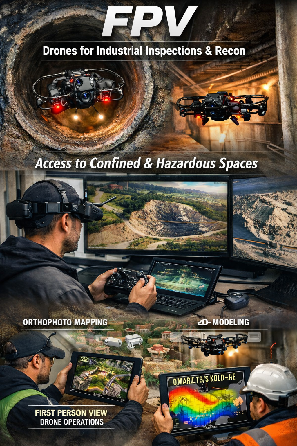
FPV Drone Inspections, Surveys
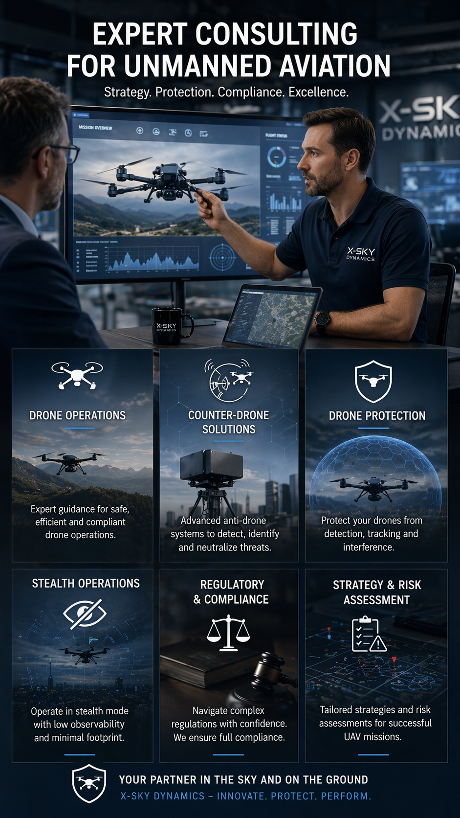
CONSULTING IN UNMANNED AVIATION (DRONES), ANTI-DRONE SYSTEMS
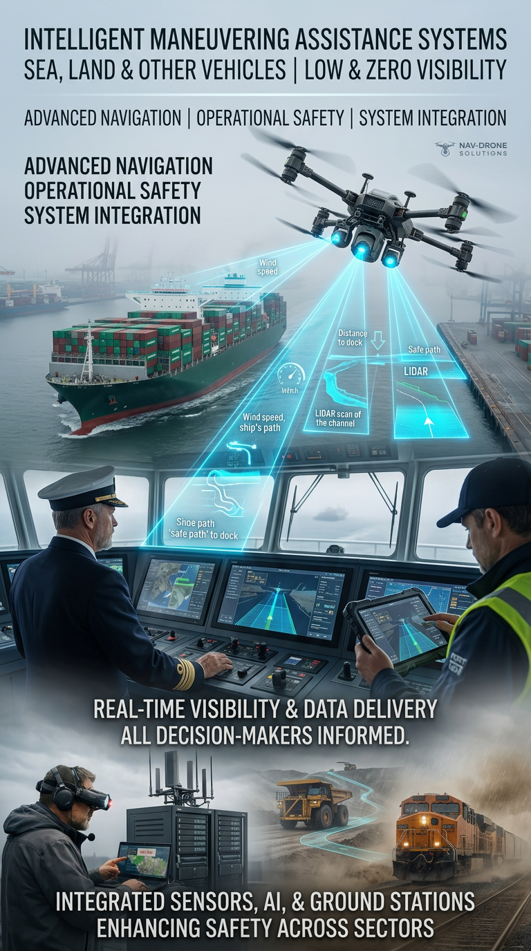
Systems for Assisting the Maneuvering in Low or Zero Visibility
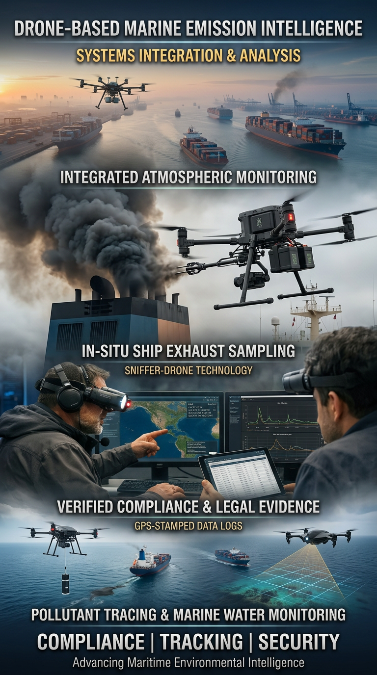
Drone Systems for Exhaust Gas Analysis
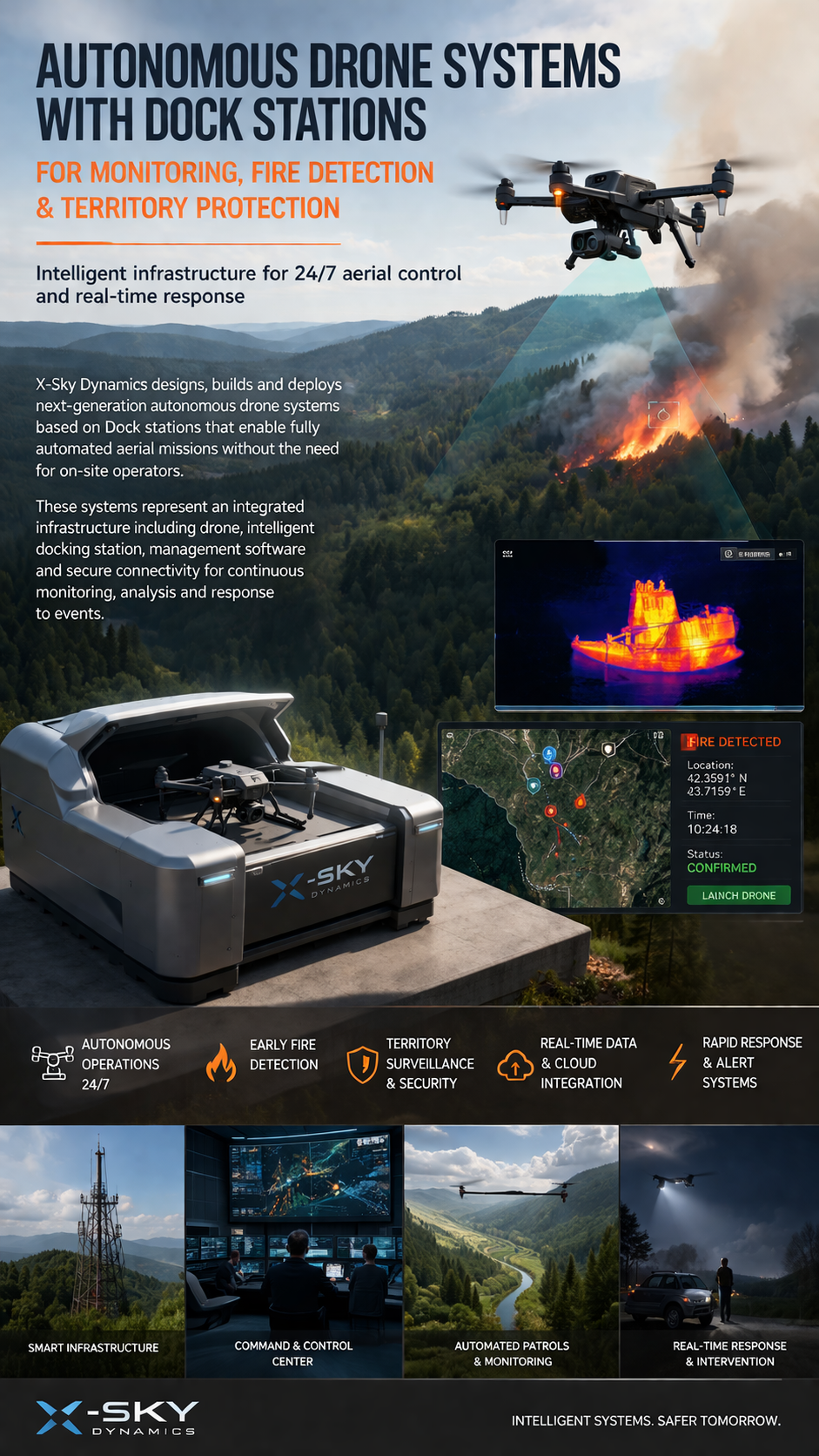
Dock Stations for Monitoring, Early Fire Detection
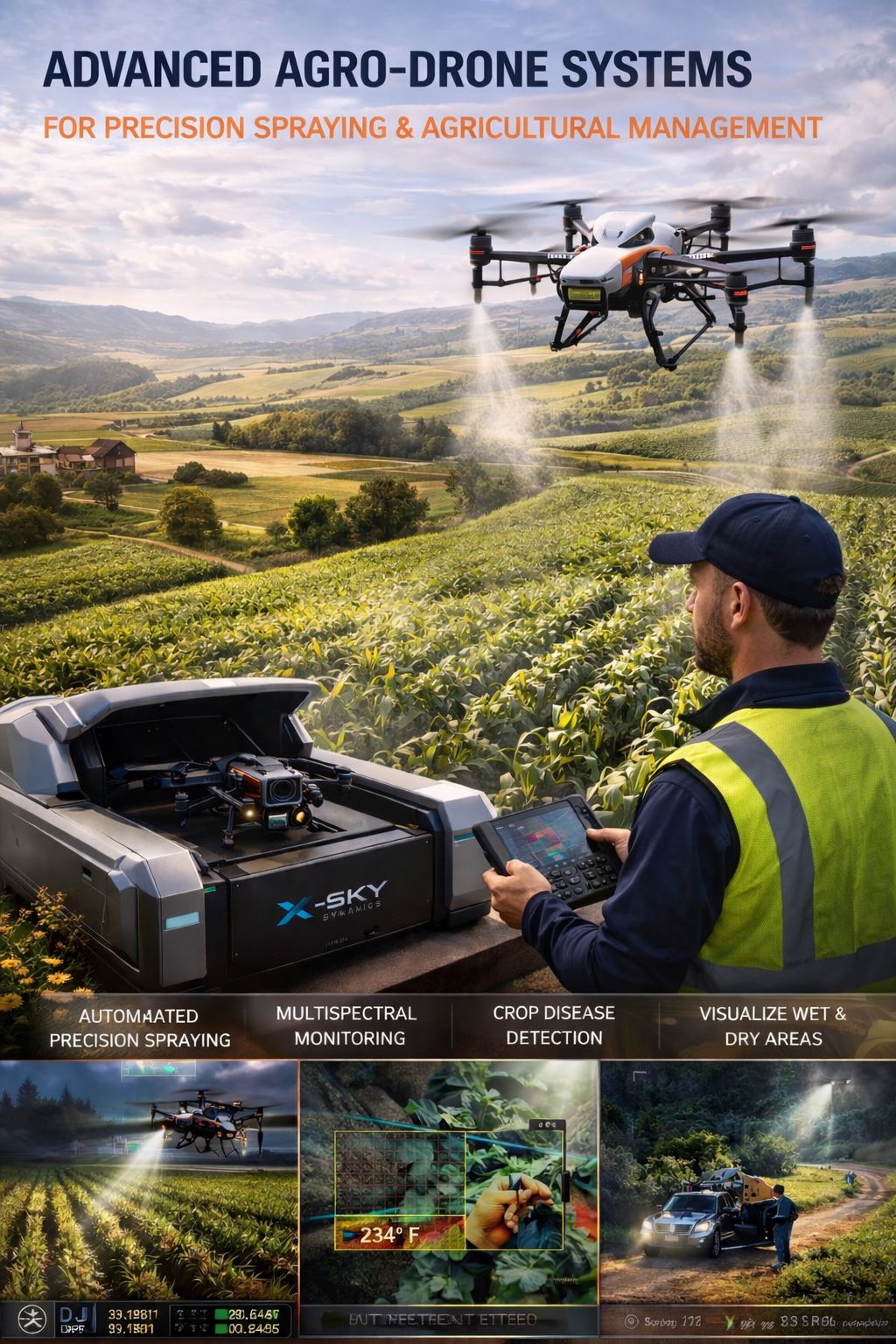
Agricultural Drone Systems for Precision Spraying, Spectral Monitoring
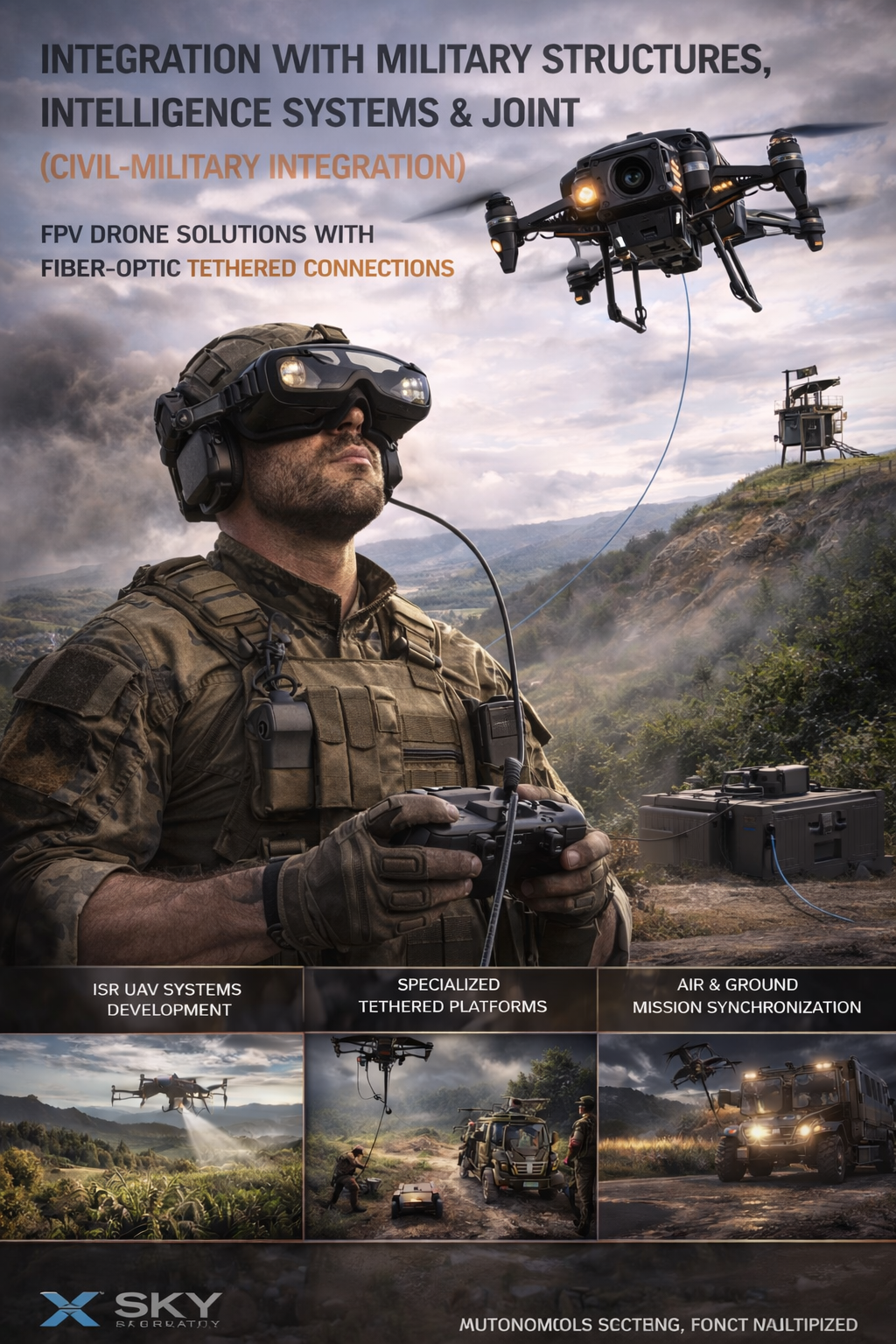
UAV – Drone Integration with Military
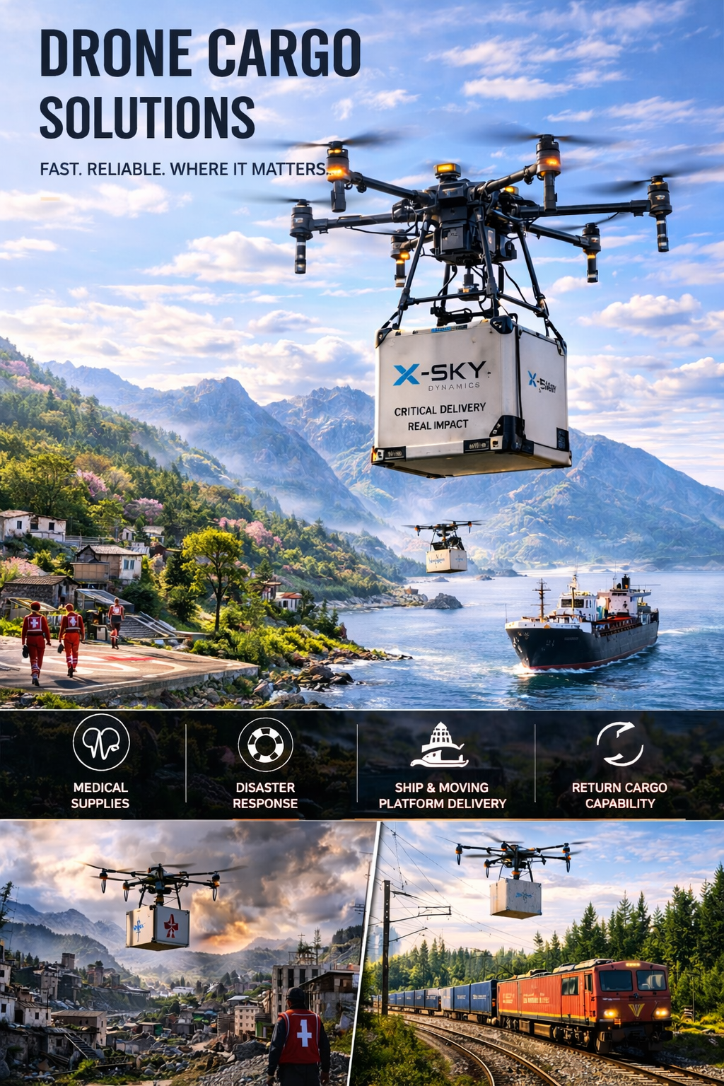
Cargo Transportation with Drones
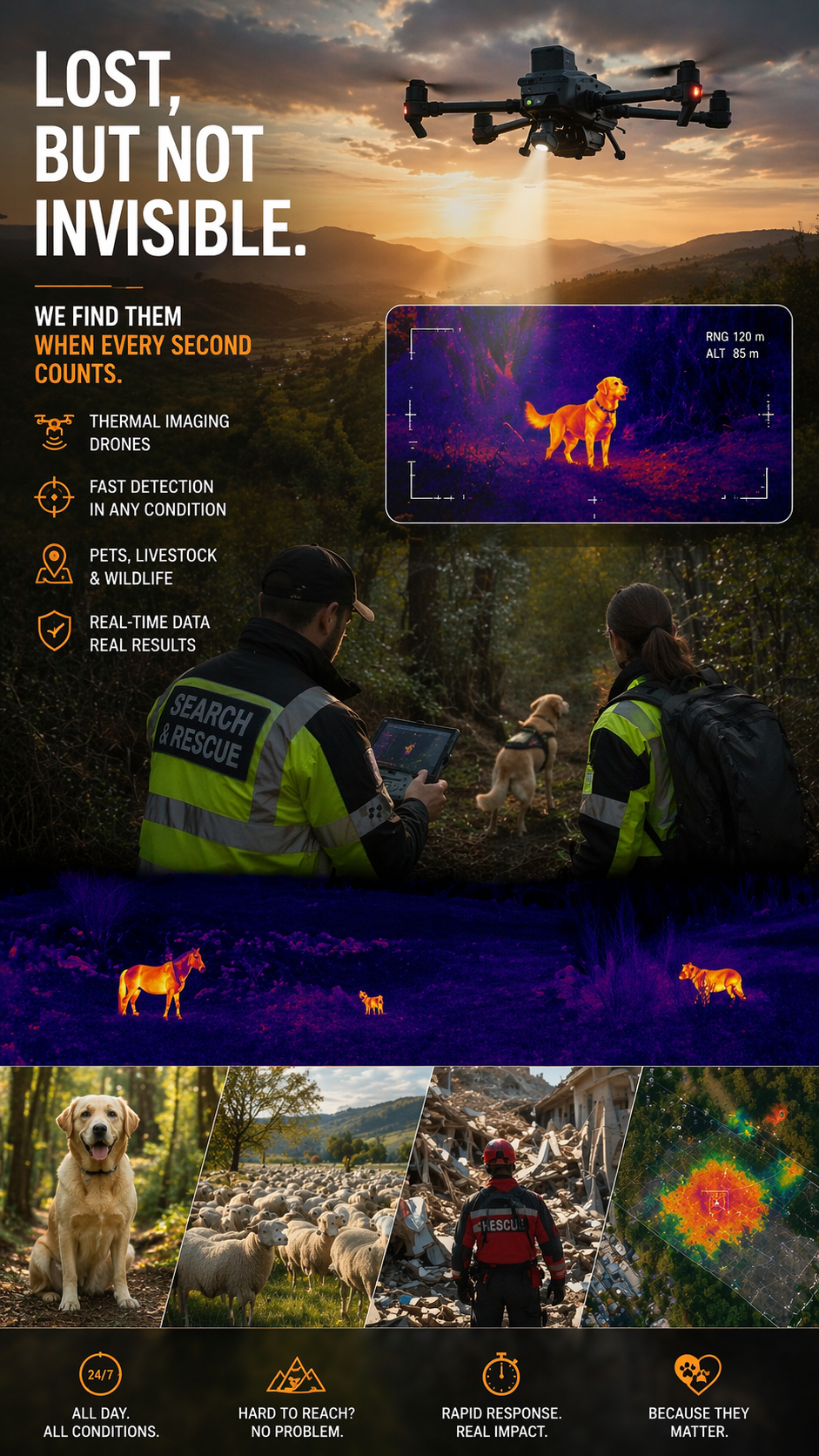
Search and Rescue of Pets and animals Using Drones
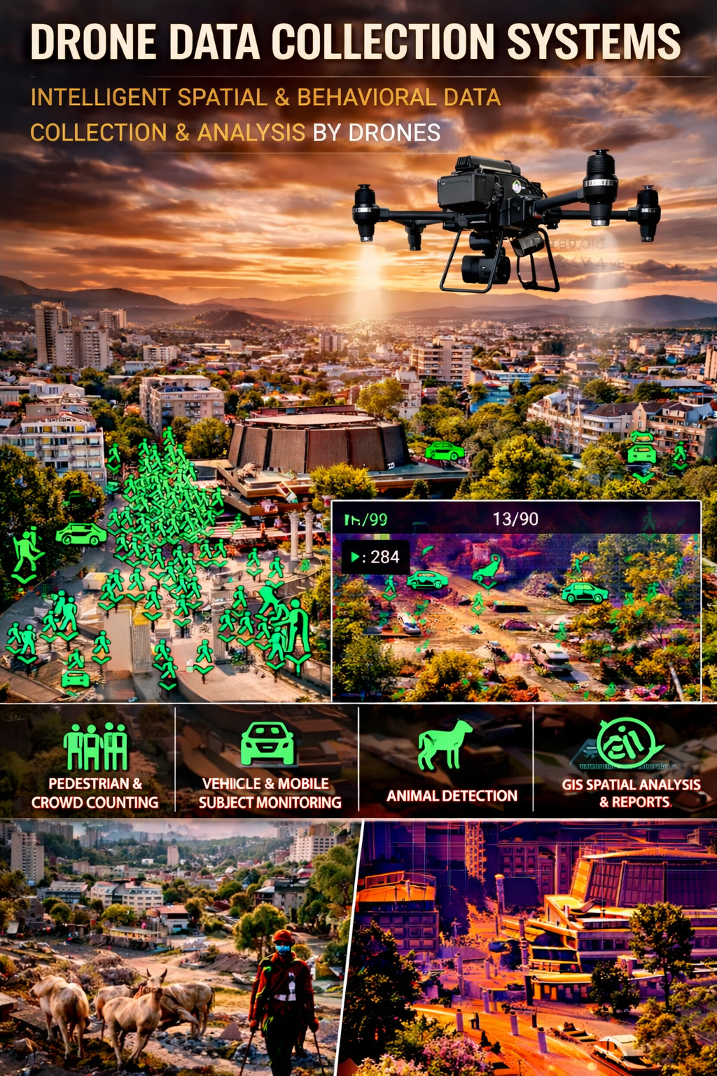
Drone Systems for Collecting Statistical Data
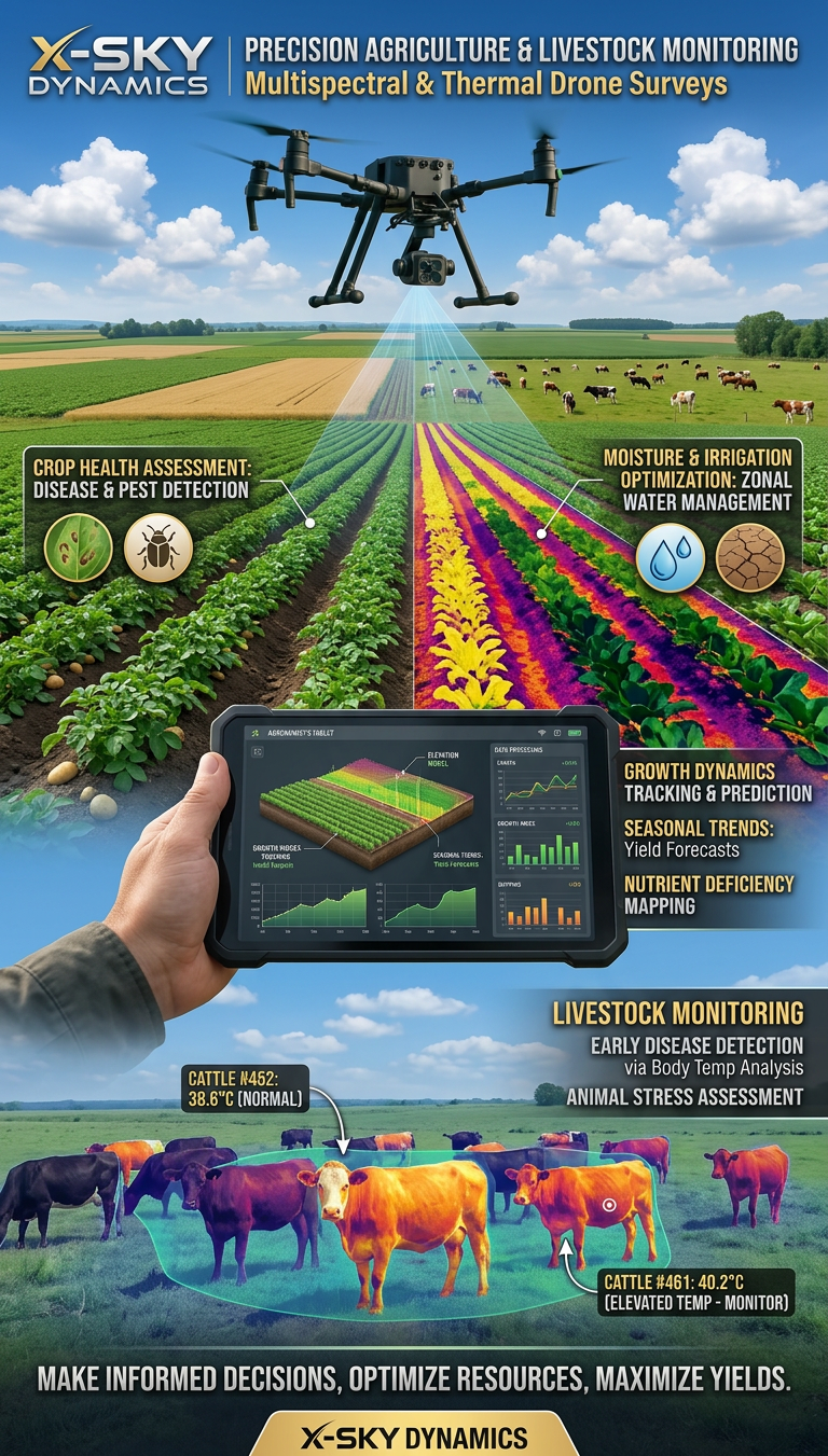
Multispectral and Thermal Drone Surveys for Agriculture
Innovative and High-Tech Drone Services
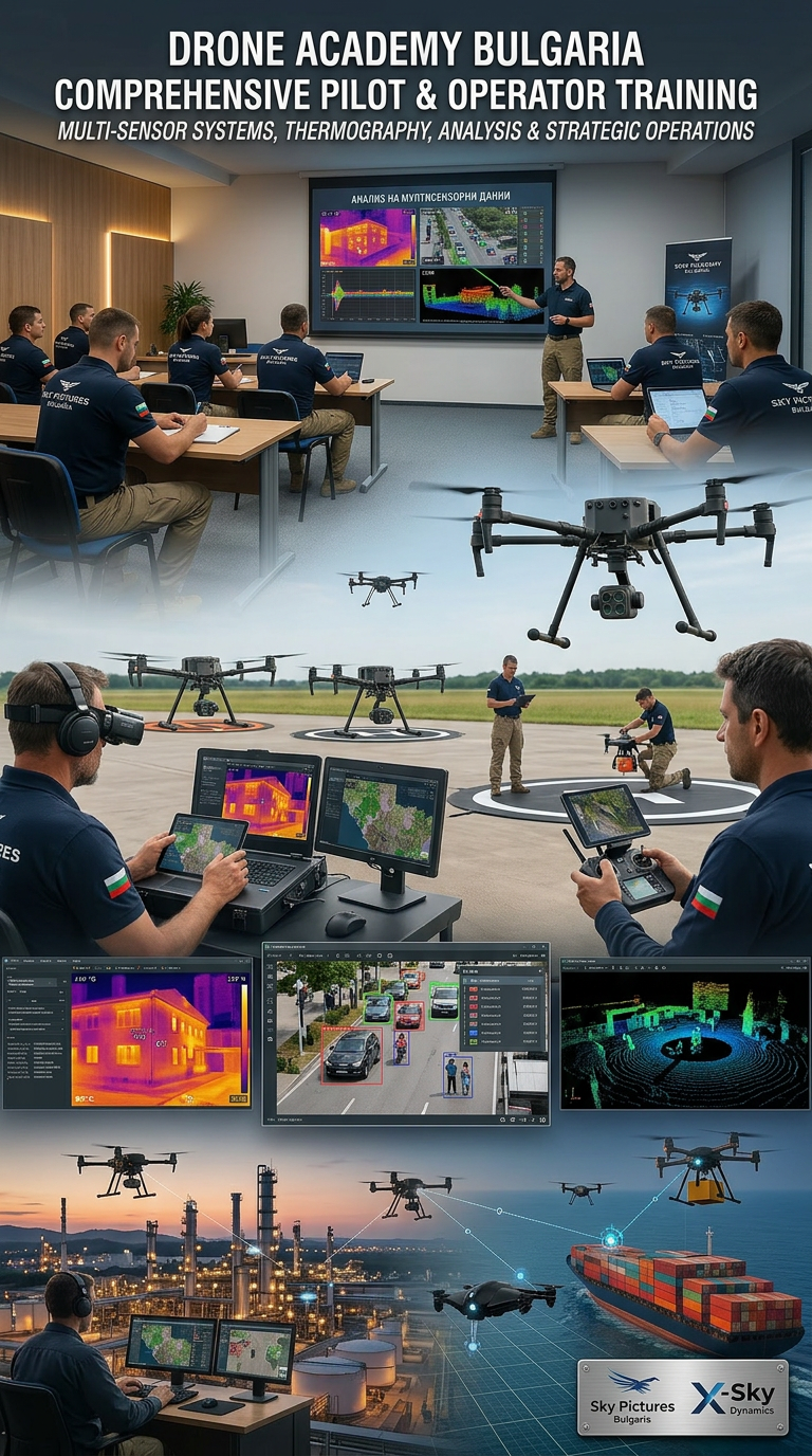
DRONE PILOTS AND OPERATORS TRAINING AND COURSES
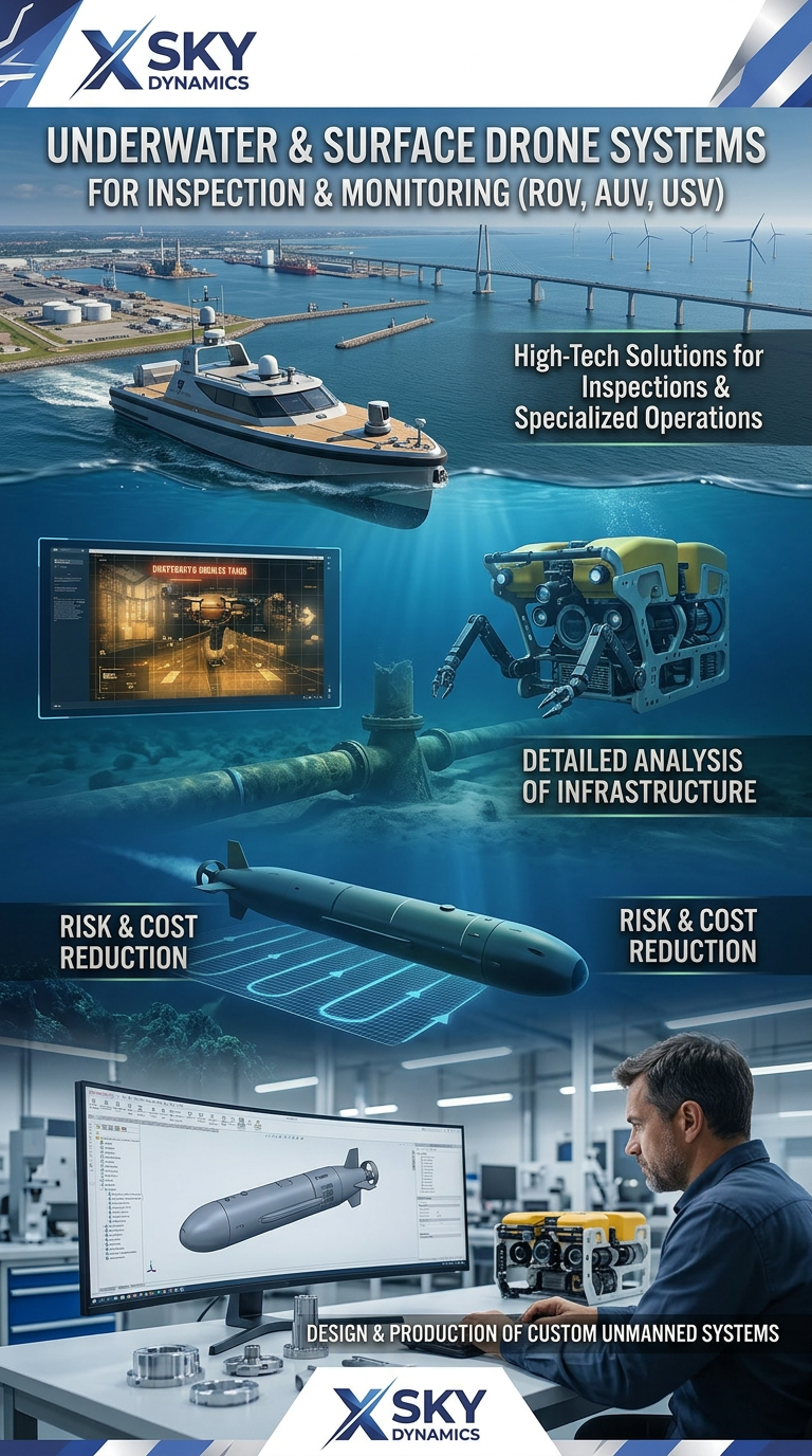
Underwater and Surface Drone Systems ROV, AUV, USV
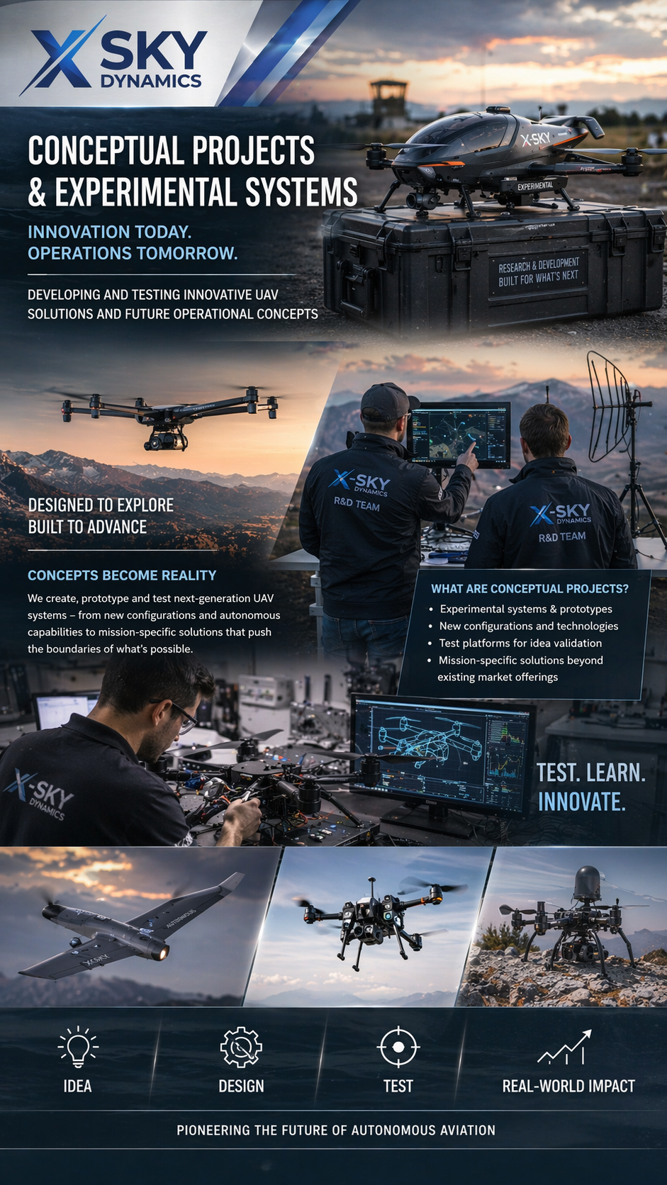
Concept Projects & Experimental UAV
Autonomous Drone Systems with Dock Stations
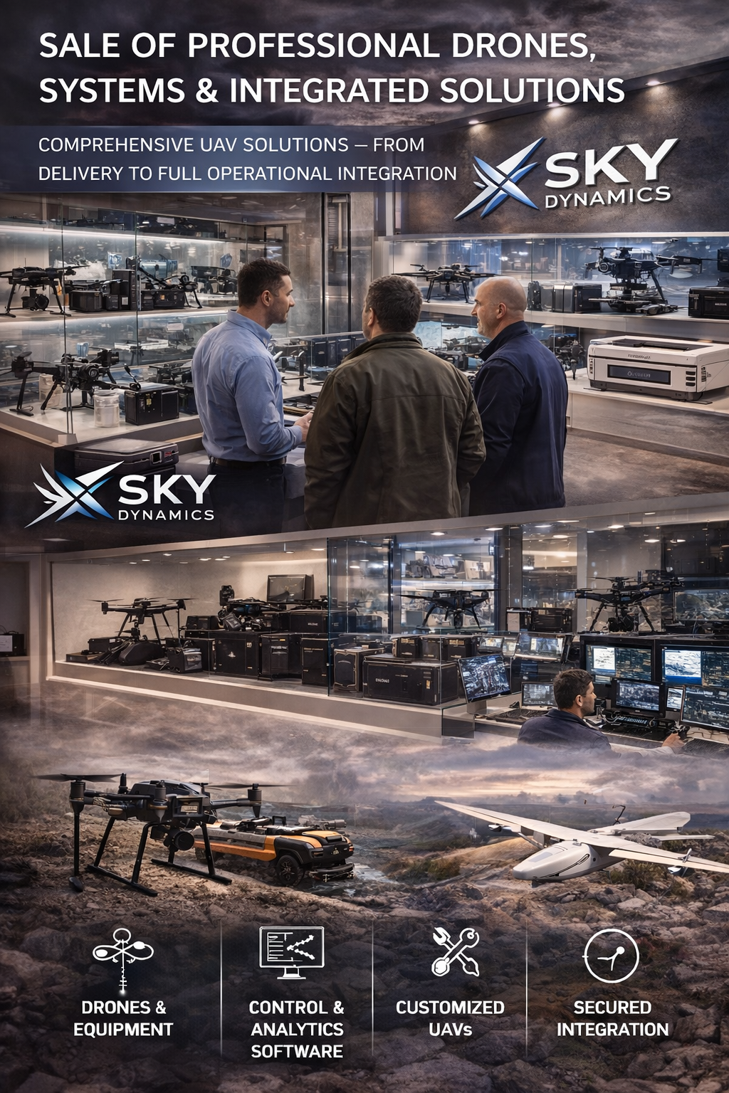
Sales of Professional Drones
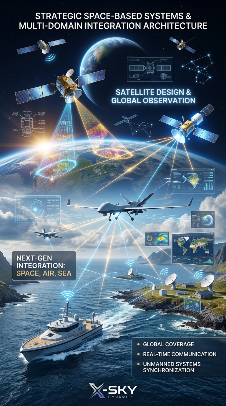
Satellite Imaging, Satellite Design and Integrated
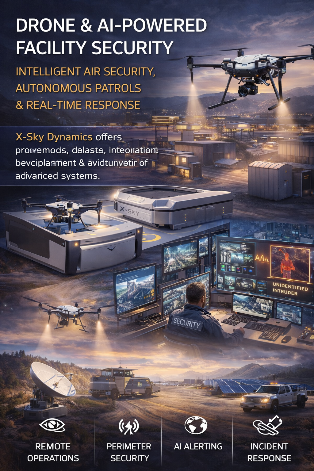
Security of Sites Through Drones AI Systems
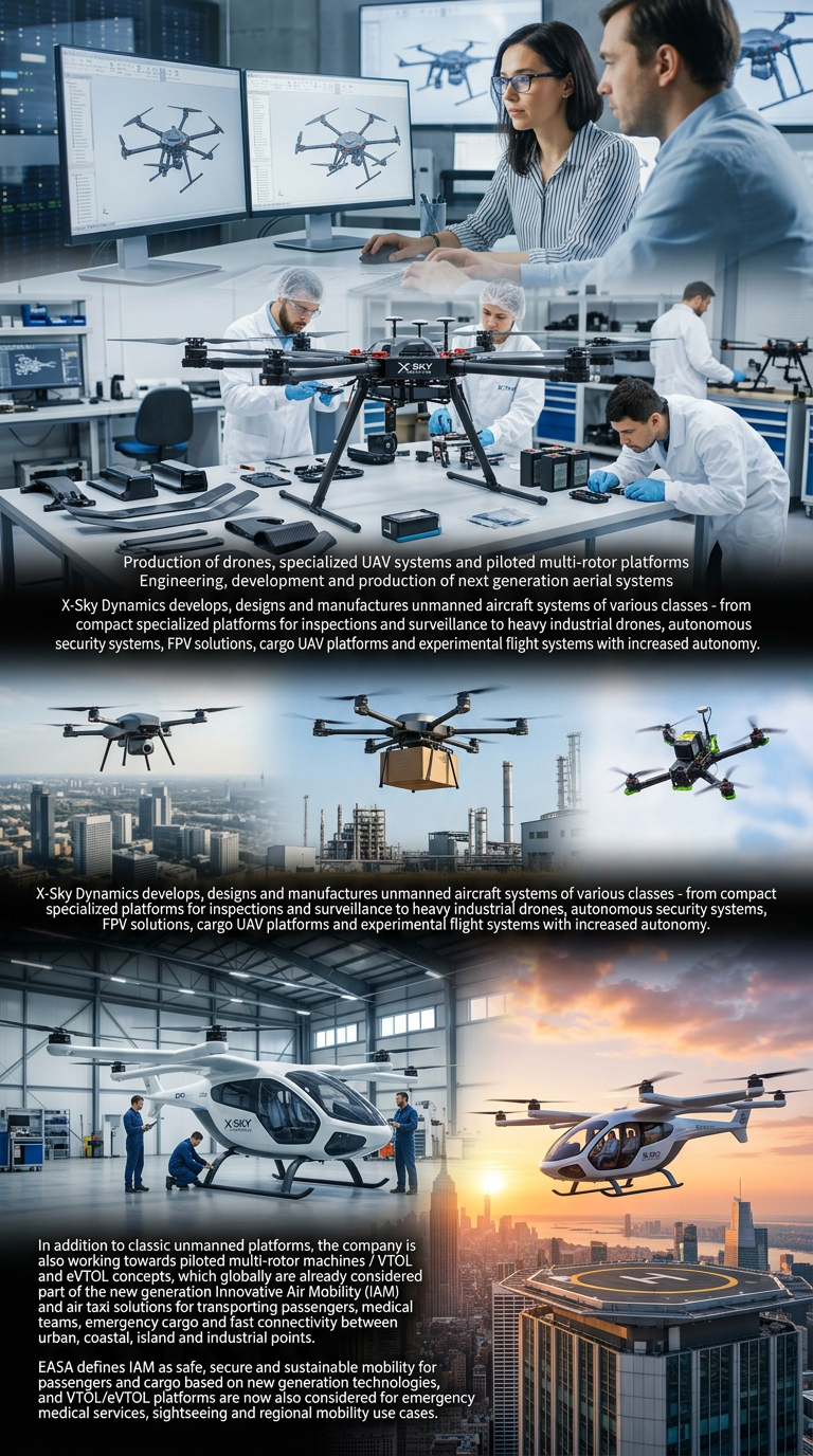
Drone Manufacturing and Manned Multirotor Platforms
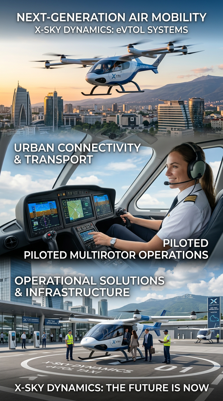
Air Taxis and eVTOL Systems
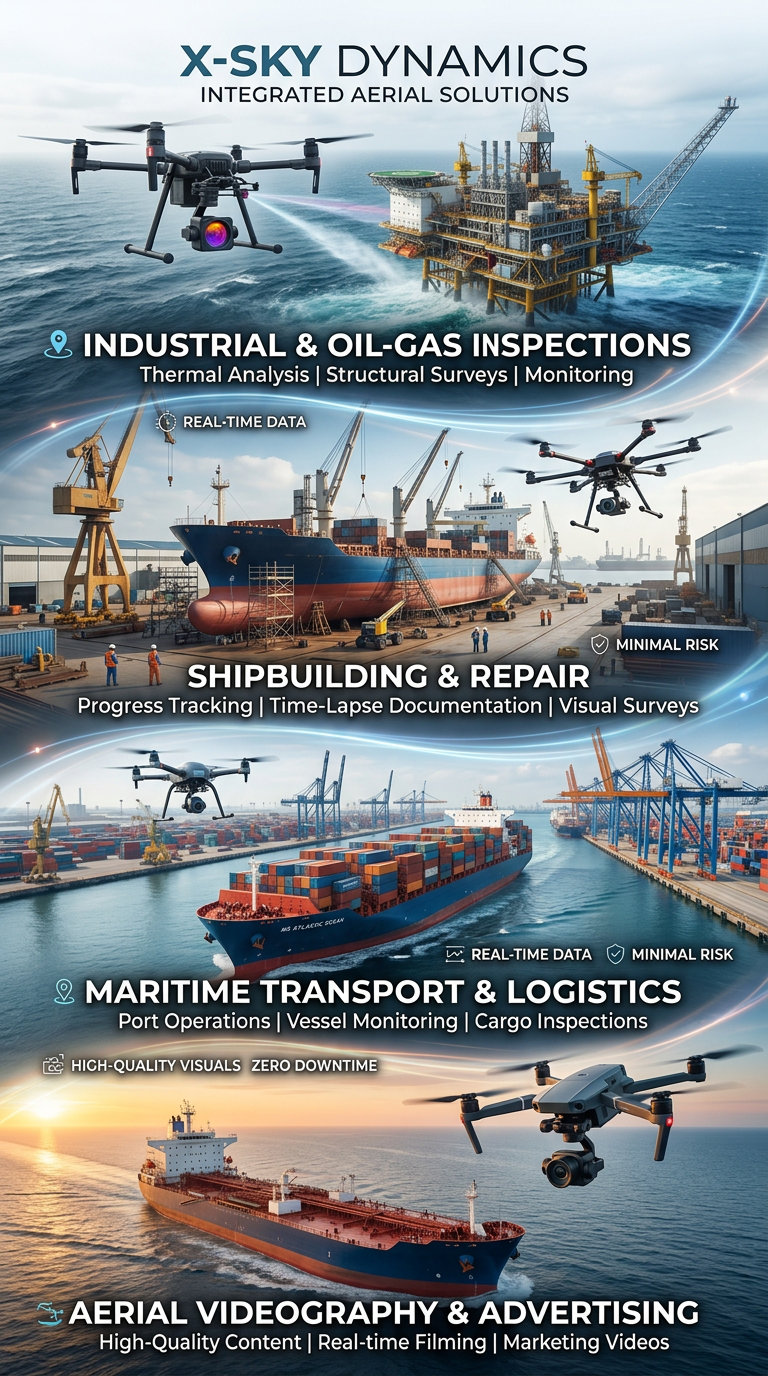
Drone and Video Services in Maritime Transport
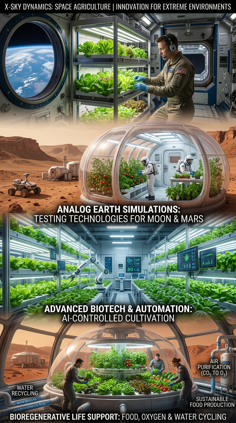
Space Agriculture, Agri-Systems for Extreme Environments

Cybersecurity, Cyber Defence and Protection of Critical Infrastructure
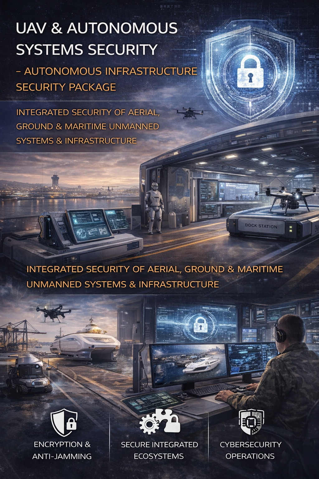
Cybersecurity and Protection of UAV and Autonomous Systems
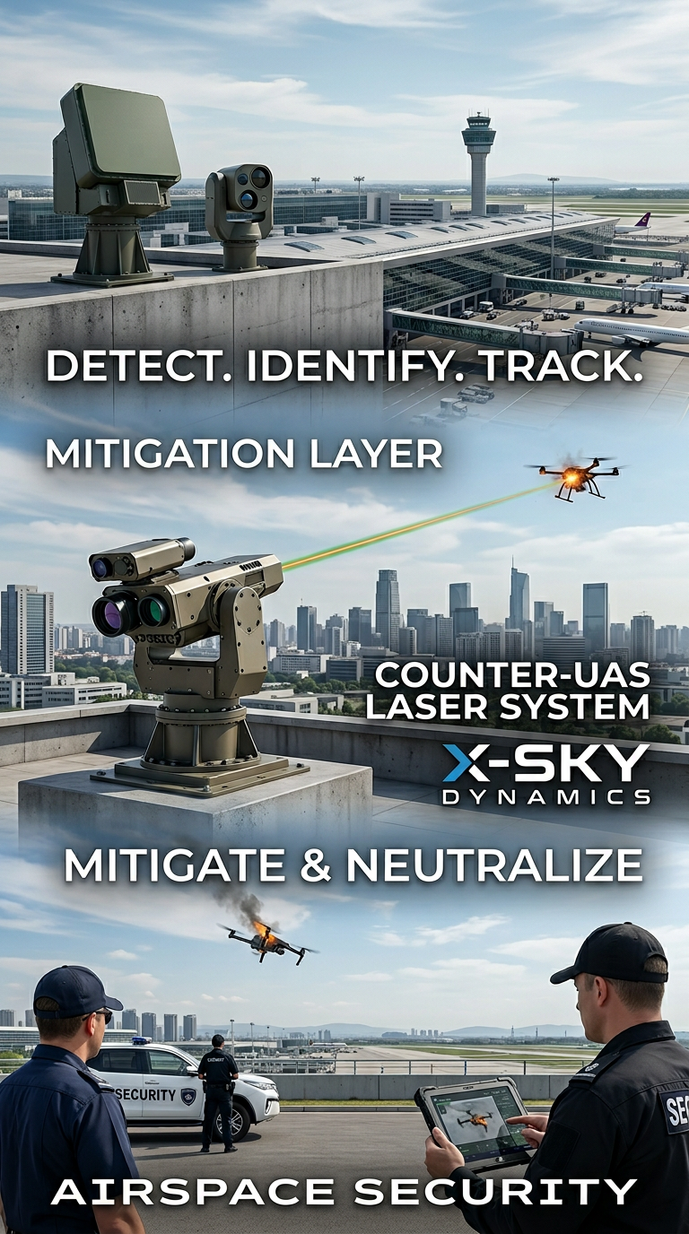
Counter-UAS, Laser and Kinetic Systems
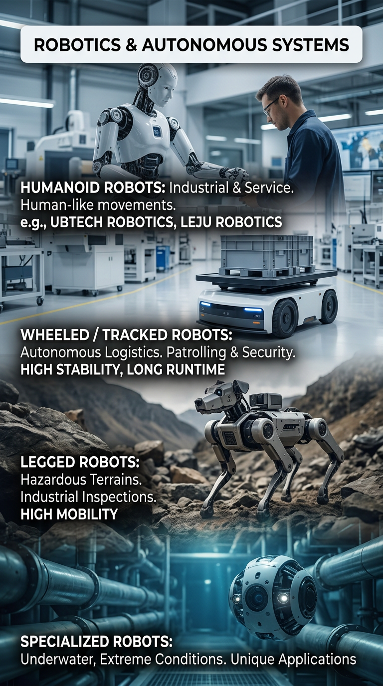
Robots and Autonomous Systems
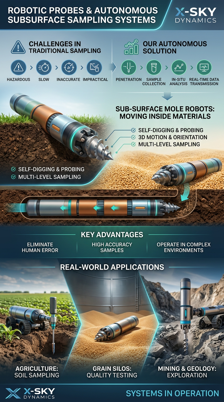
Robotic Probing Systems and Subsurface Technologies
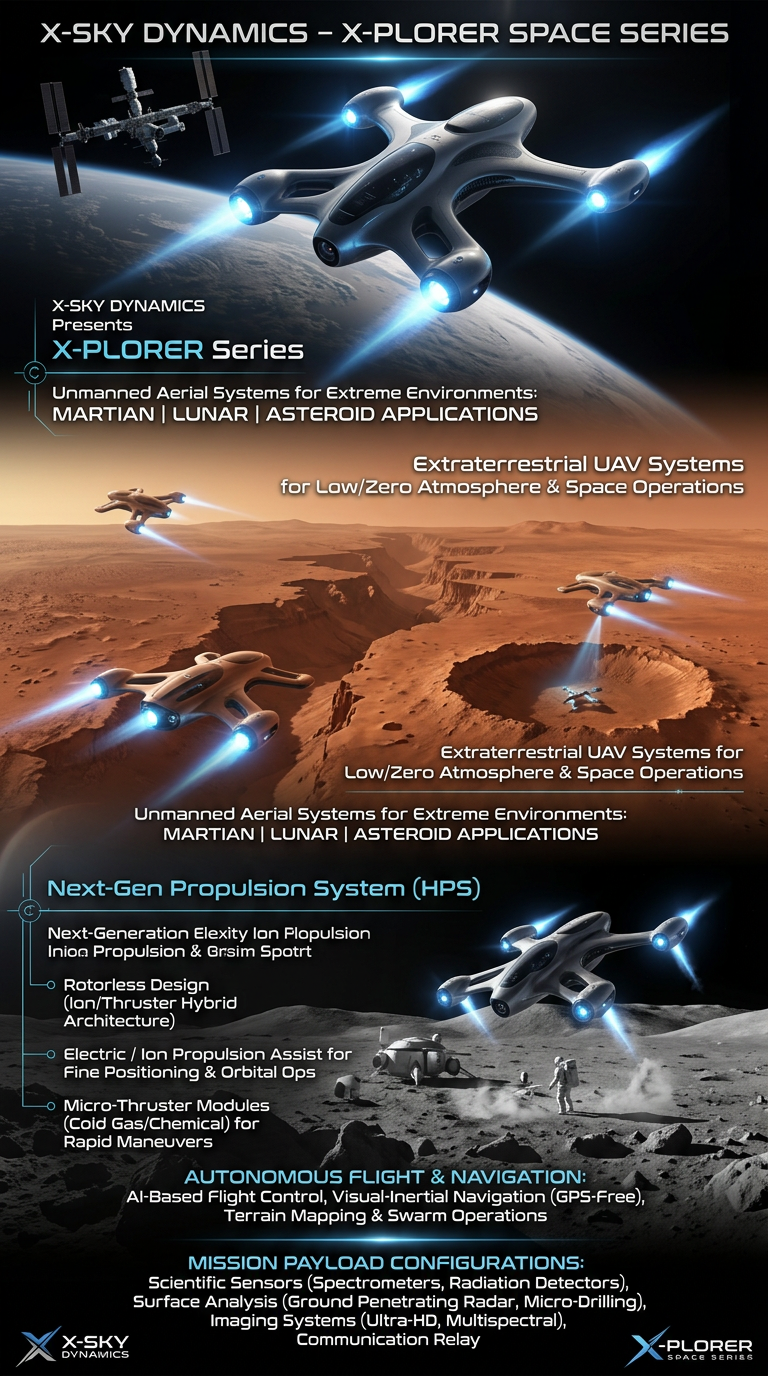
Space Drone systems SPACE X-PLORER SERIES

RAIGNV Partnership
Investors & Partners