[ SERVICES / PROFESSIONAL UAV CERTIFICATION ]
/ SERVICE #41
Professional Qualification & Certification Framework for UAV Thermography
Professional Qualification & Certification Framework for UAV Thermography, Geospatial Analysis and Critical Infrastructure Operations — UAV thermal inspections, Geospatial mapping and analysis, Operations in industrial and high-risk environments, Critical infrastructure inspections, Technical data analysis and interpretation, Professional reporting and expert assessment.
/ 01
Vision & Concept
Over the past decade, unmanned aerial systems (UAS/UAV) have become an essential tool across a wide range of industries, including energy, industrial operations, maritime environments, infrastructure inspection, emergency response, and public safety. Despite the rapid growth of the UAV industry, a significant gap still exists between basic operator training and the real-world requirements of industrial operations. The X-Sky Dynamics Professional Certification Framework has been developed as a professional qualification, assessment, and certification system designed to prepare specialists for real operational environments.
The primary objective of the program is to prepare professionals for:
The program is developed in alignment with internationally recognized best practices and principles used within professional qualification schemes and industry standards, including:
- UAV thermal inspections
- Geospatial mapping and analysis
- Operations in industrial and high-risk environments
- Critical infrastructure inspections
- Technical data analysis and interpretation
- Professional reporting and expert assessment
- ISO 18436-7 – Condition Monitoring and Diagnostics of Machines – Thermography
- American Society for Nondestructive Testing (ASNT) Recommended Practices
- ISO 9712 concepts for personnel qualification and certification
- European Union Aviation Safety Agency (EASA) operational frameworks for UAV systems
- Industry best practices in:
- Asset Integrity Management
- Predictive Maintenance
- Critical Infrastructure Inspection
- Remote Sensing & Geospatial Analysis
Our Positioning
“We certify professionals for real-world industrial UAV operations.”
Core Principles
This program is not simply a training course. It is a professional certification system designed to validate real-world knowledge, practical skills, and the ability to execute missions in industrial environments.
The framework is built around:
- Practical application
- Real-world operational scenarios
- Standardized procedures
- Quality assurance
- Risk management
- International applicability
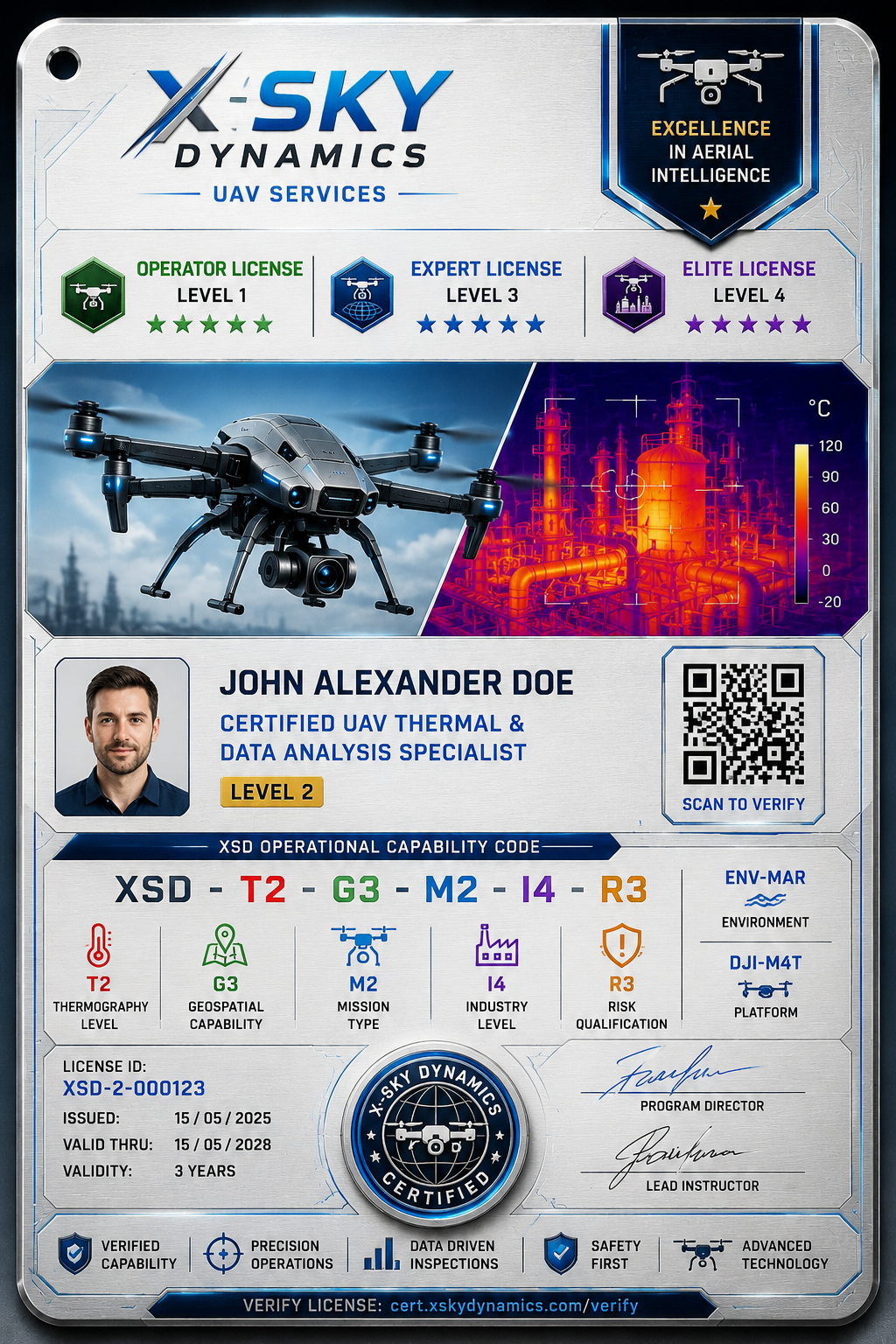
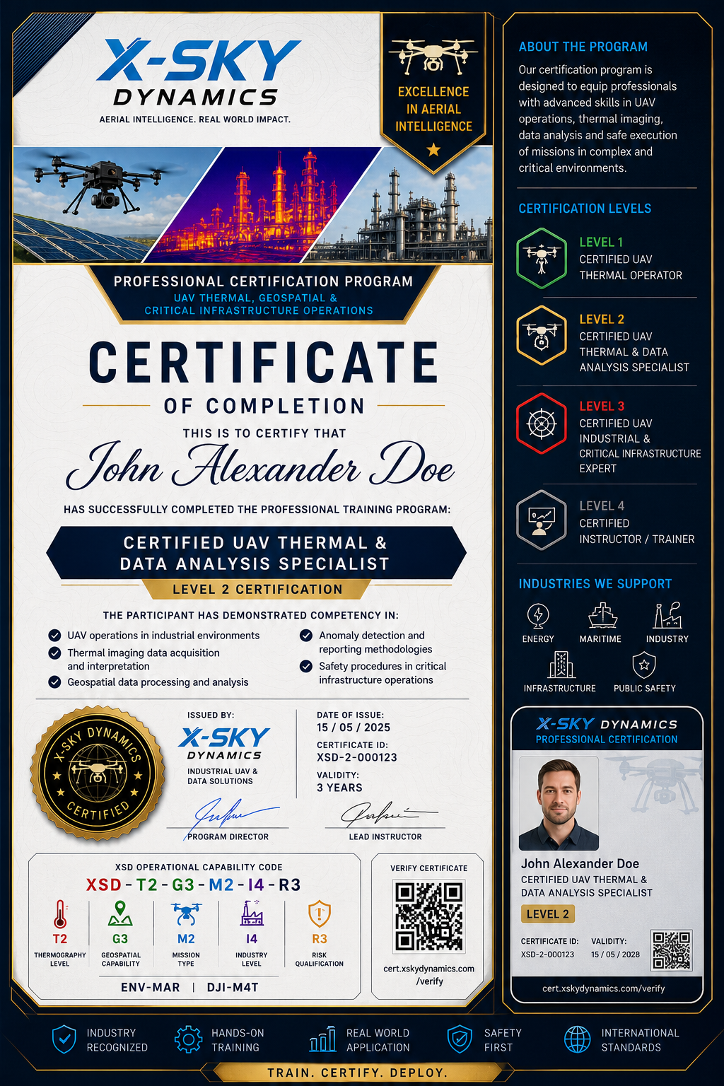
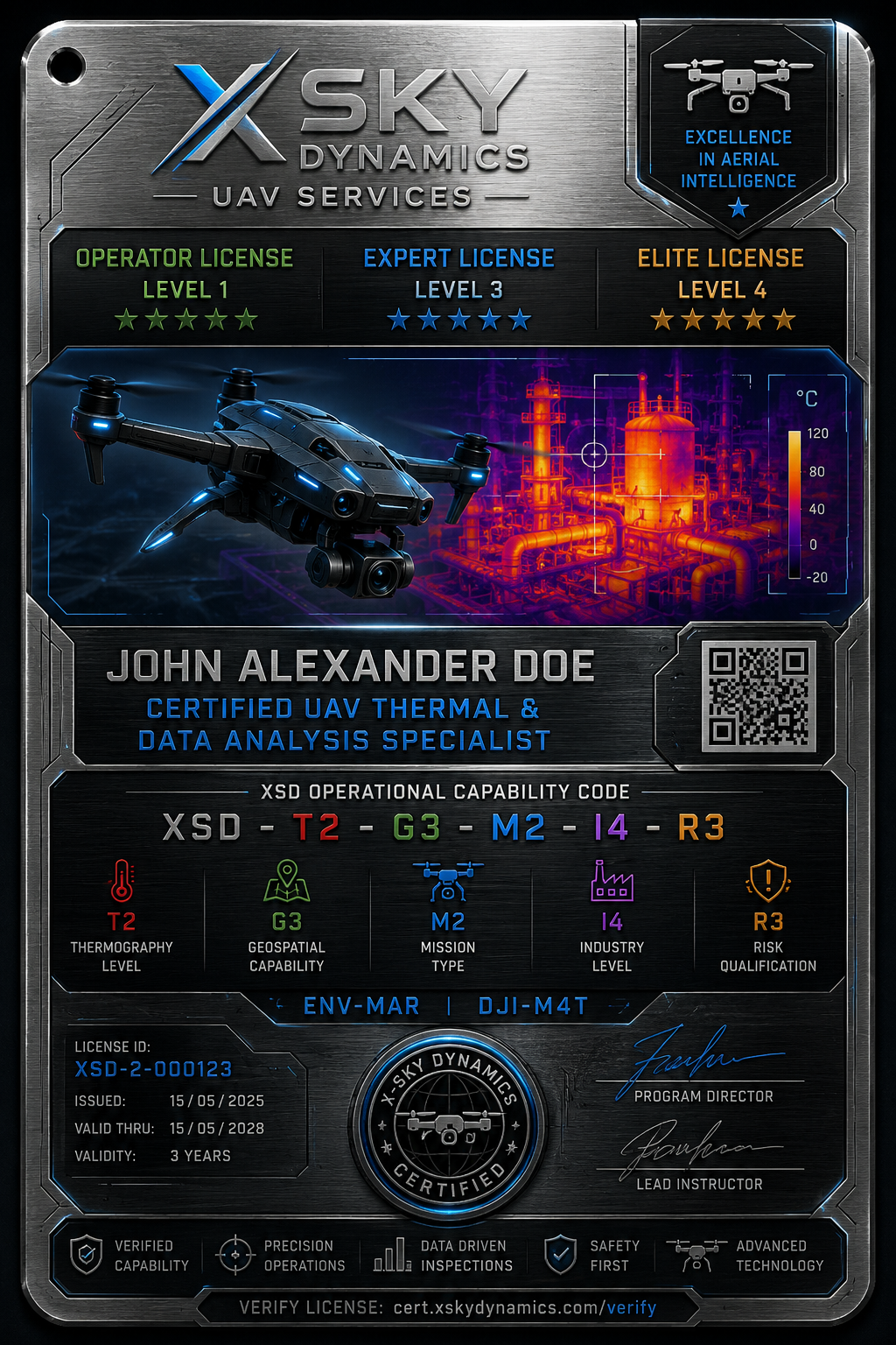
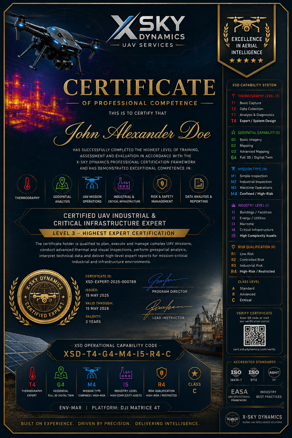
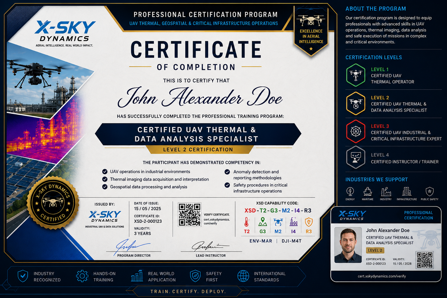
Certification Levels
Level 1 – Certified UAV Thermal Operator
Professionals certified at this level are capable of:
- Conducting safe UAV operations
- Operating thermal imaging equipment
- Acquiring inspection data
- Performing basic data quality assessments
- Following operational procedures and safety protocols
/ 02
Primary Focus
- Flight operations
- Data acquisition
- Inspection data collection
Level 2 – Certified UAV Thermal & Data Analysis Specialist
Professionals certified at this level are capable of:
- Analyzing thermal datasets
- Interpreting anomalies and thermal patterns
- Performing geospatial data processing
- Producing professional reports
- Working with GIS and photogrammetric products
Primary Focus
- Data analysis
- Diagnostics
- Technical reporting
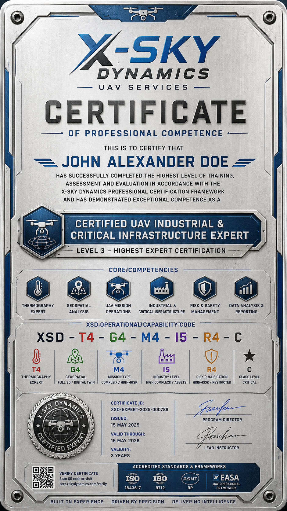
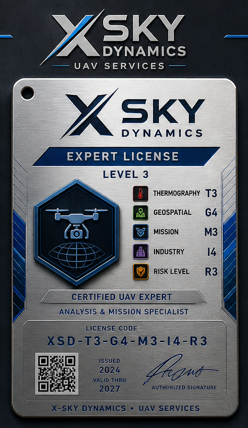
Level 3 – Certified Industrial & Critical Infrastructure Expert
Professionals certified at this level are capable of:
- Designing inspection programs
- Developing operational methodologies
- Managing complex missions
- Conducting risk assessments
- Implementing QA/QC procedures
- Integrating UAV solutions into industrial workflows
/ 03
Primary Focus
- Management
- Standardization
- Expert-level operations
Level 4 – Certified Instructor / Trainer
This level is intended for professionals who:
- Deliver training programs
- Assess and evaluate candidates
- Participate in program development
- Maintain certification standards
Training Modules
Module 1 – UAV Operations in Industrial Environments
- Mission planning
- Team coordination
- Operations in restricted and complex environments
- Industrial safety procedures
Module 2 – Thermal Imaging Fundamentals
- Principles of thermography
- Emissivity
- Reflected temperature
- Environmental effects
- Thermal camera configuration and operation
/ 04
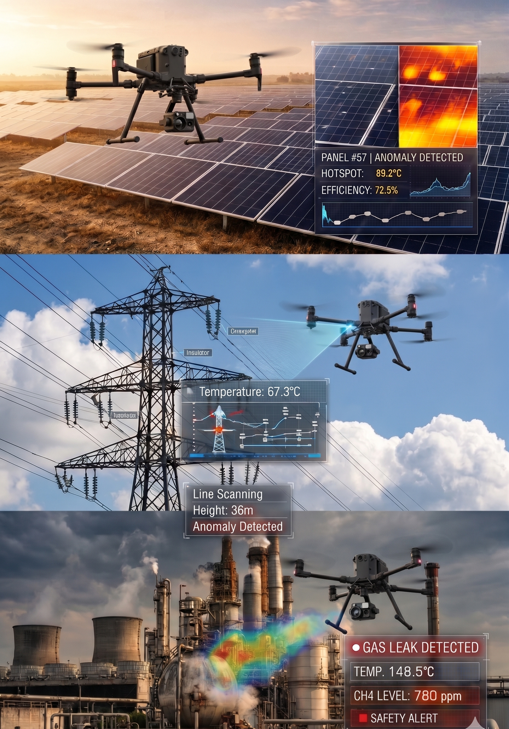
Module 3 – Advanced Thermal Analysis
- Defect detection
- Anomaly assessment
- Severity classification
- Industrial diagnostics
Module 4 – Geospatial Data & Mapping
- Orthomosaic generation
- DSM and DTM models
- 3D reconstruction
- Georeferencing
- GIS integration
Module 5 – Data Processing & AI Workflows
- Data processing methodologies
- Automated workflows
- Pattern recognition
- AI-assisted analysis
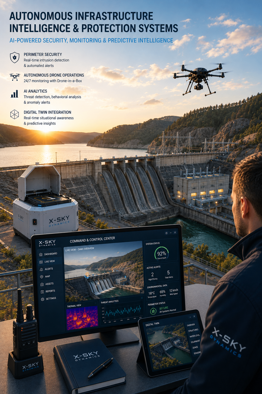
Module 6 – Critical Infrastructure Operations
Practical applications in:
- Solar PV installations
- Energy infrastructure
- Ports and terminals
- Shipyards
- Industrial facilities
- Critical infrastructure assets
Module 7 – Reporting & Deliverables
- Technical report preparation
- Data visualization
- Presentation of findings
- Client documentation
/ 05
Specialization Endorsements
Following completion of the core certification levels, participants may pursue additional specialization endorsements.
PV & Solar Inspection
- Hotspot detection
- String failure identification
- Bypass diode diagnostics
- Soiling analysis
Maritime & Shipyard Operations
- Vessel inspections
- Port operations
- Maritime infrastructure assessments
Industrial Facilities
- Manufacturing plants
- Warehousing facilities
- Energy systems
Search & Rescue & Public Safety
- Search and rescue operations
- Disaster response
- Emergency management
Oil & Gas Operations
- Pipeline inspection
- Storage tank assessment
- Production facility inspections
/ 06
Assessment System
Certification consists of three key components:
Theoretical Examination
- 40–60 examination questions
- Minimum passing score: 70–75%
Practical Examination
- Real inspection mission
- Field operations
- Data acquisition and documentation
Final Technical Report
- Data analysis
- Conclusions and recommendations
- Professional report presentation
Final Evaluation Weighting
- Theory – 40%
- Practical Assessment – 40%
- Final Report – 20%
Quality Management System
Each candidate follows a documented certification pathway, including:
/ 07
This structure ensures traceability, consistency, and standardization throughout the certification process.
- Candidate Application Form
- Training Attendance Log
- Flight Logbook
- Inspection Logbook
- Examination Record Sheet
- Certificate Register
- Re-Certification Register
Certification & Verification
Each successfully certified professional receives:
- Official Certificate
- Unique Serial Number
- Certificate ID
- QR Verification Code
- Online Verification System
Example:
XSD-2026-000145
Certificate validation:
cert.xskydynamics.com/verify
Re-Certification
To maintain professional competency, certifications remain valid for three years.
/ 08
Renewal requirements may include:
- Refresher examination
- Portfolio review
- Evidence of practical experience
- Audit of completed projects
Who Is This Program For?
- UAV Pilots and Operators
- Engineers
- Thermography Specialists
- Surveyors and Geospatial Professionals
- Maintenance Technicians
- Energy Sector Specialists
- Maritime Professionals
- Inspection Companies
- Government Agencies
- Universities and Training Institutions
Strategic Objective
The X-Sky Dynamics Professional Certification Framework is designed to establish a new benchmark for professional qualification and certification in the fields of UAV inspection, thermography, geospatial analysis, and critical infrastructure operations. The framework is structured to serve individual professionals, corporate organizations, universities, government agencies, and international partners. In the long term, this positions X-Sky Dynamics not only as a service provider and project operator, but also as an organization that develops standards, advances expertise, and contributes to the growth of the professional UAV industry.
XSD Operational Capability Framework
As part of the certification ecosystem, X-Sky Dynamics utilizes its proprietary Operational Capability Framework (XSD-OCF), designed to clearly define competencies, project complexity levels, and operational environments.
Each certified professional receives a unique Operational Capability Code describing competencies in:
This approach provides transparency, traceability, and standardization of professional qualifications.
- Thermography
- Geospatial Analysis
- Mission Profiles
- Industrial Environments
- Risk Categories
- Specialization Areas
Our Mission
The mission of the X-Sky Dynamics Professional Certification Framework is to establish a sustainable professional standard for preparing specialists capable of operating in real industrial environments using modern UAV technologies, thermography, geospatial intelligence, and analytical tools that support informed decision-making. We believe the future belongs to professionals who can do more than collect data — professionals who can transform data into reliable, verifiable, and actionable information for industry, infrastructure, and society.
[ Get in Touch ]
X-Sky Dynamics
- ✉xskydynamics@gmail.com
- ✉xsky@xskydynamics.com
- ☎+359 87 6975862
 WhatsApp: +359 87 6975862
 Viber: +359 87 6975862
- 📍Sofia, bul. "Yanko Sakazov"

[ SERVICES ]
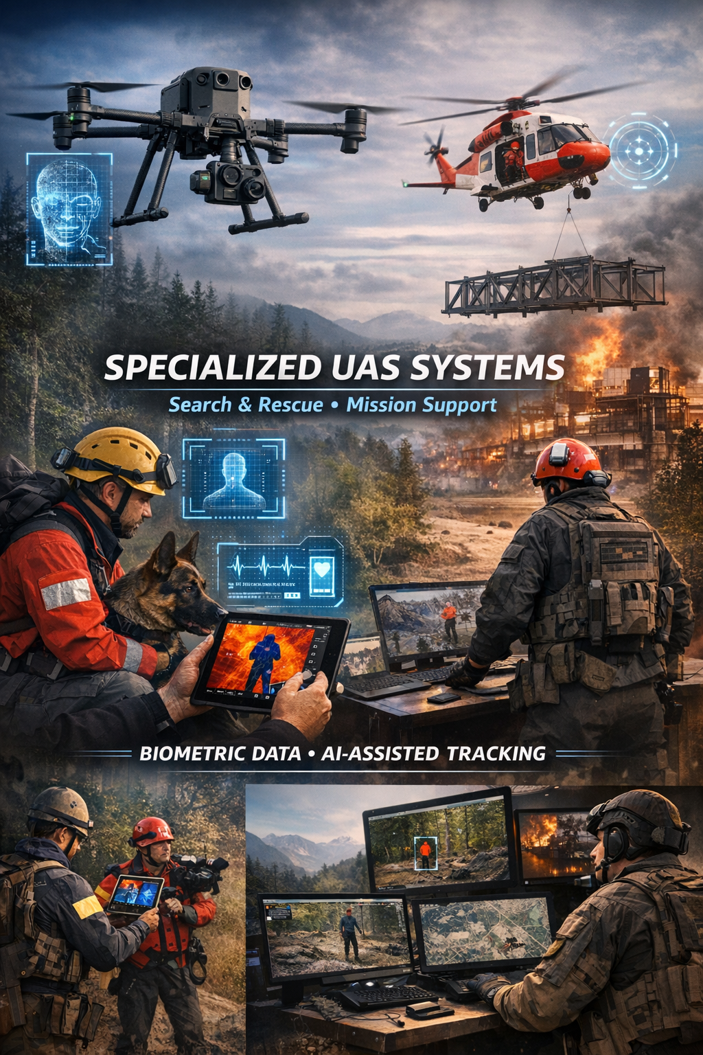
Specialized biometric UAS drone Systems for SAR
Search and Rescue via Drones
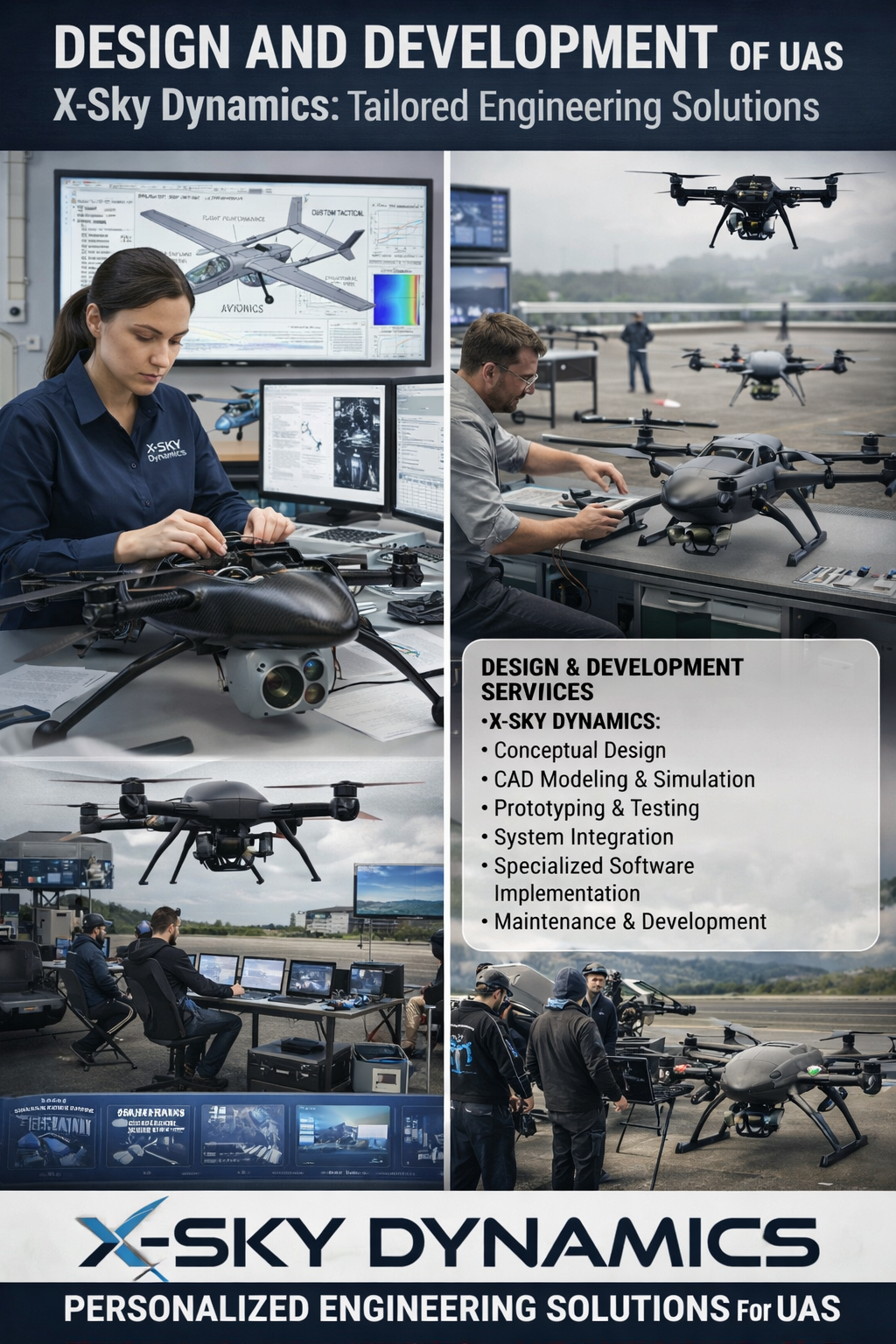
UAS Design, Engineering & Capabilities
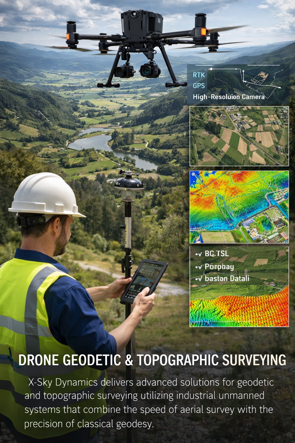
Geodetic and Topographic Surveying with UAV Systems
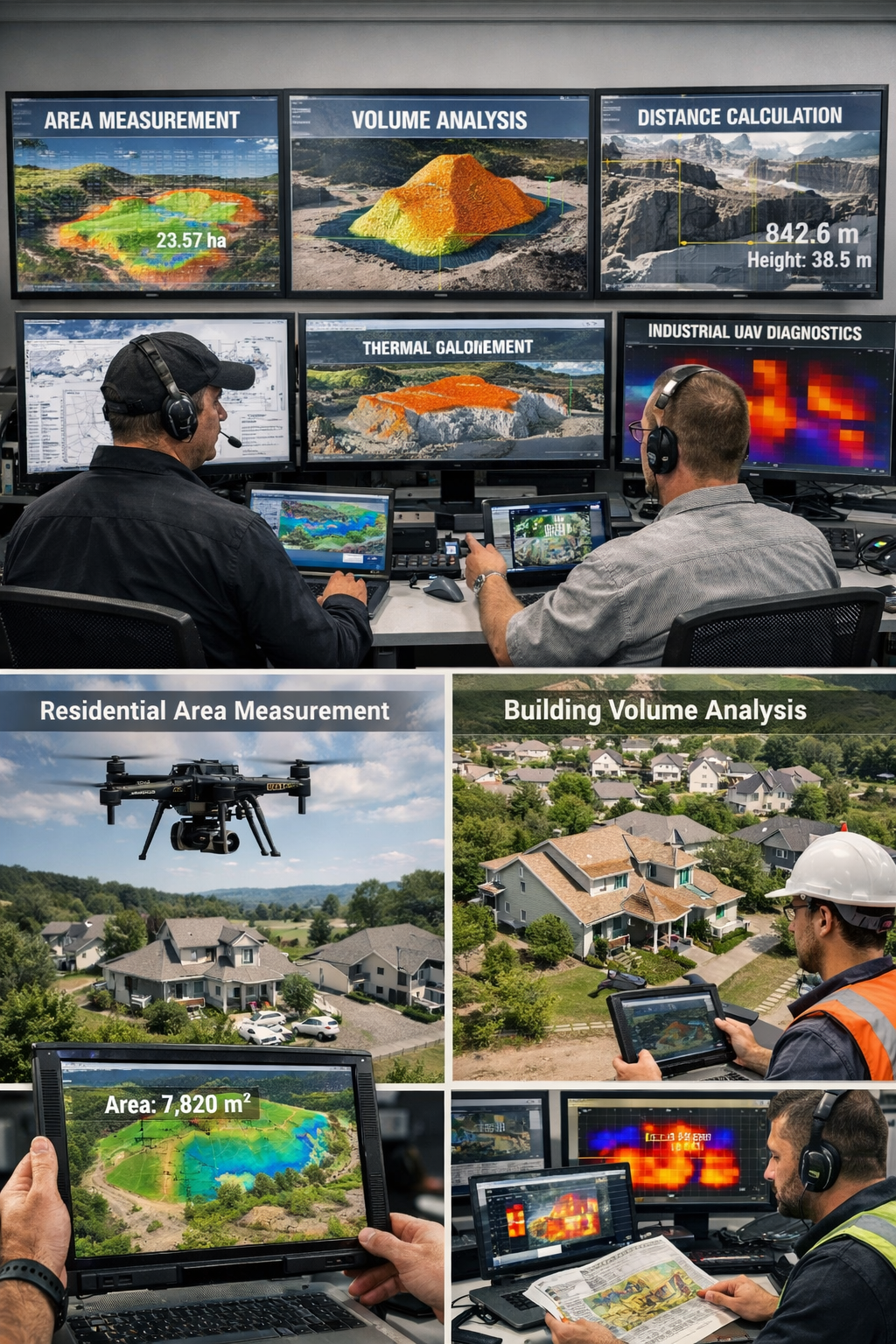
Measurement of Areas, Volumes, Distances with Drones
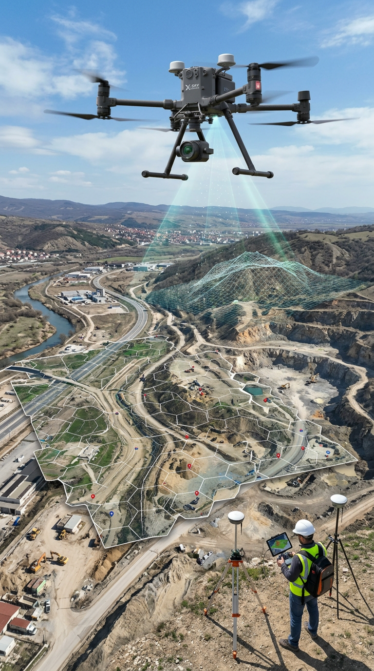
Mapping, Orthophoto, Geodetic UAV Systems
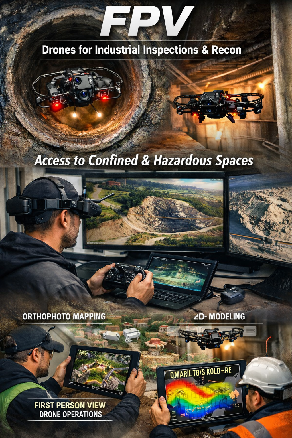
FPV Drone Inspections, Surveys
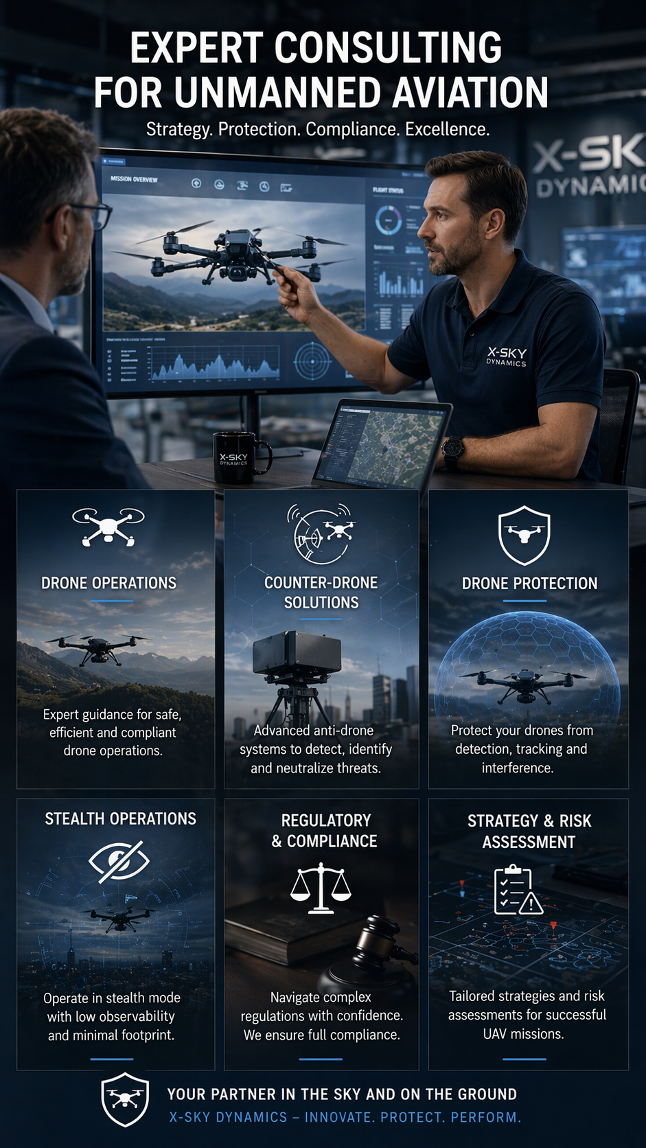
CONSULTING IN UNMANNED AVIATION (DRONES), ANTI-DRONE SYSTEMS
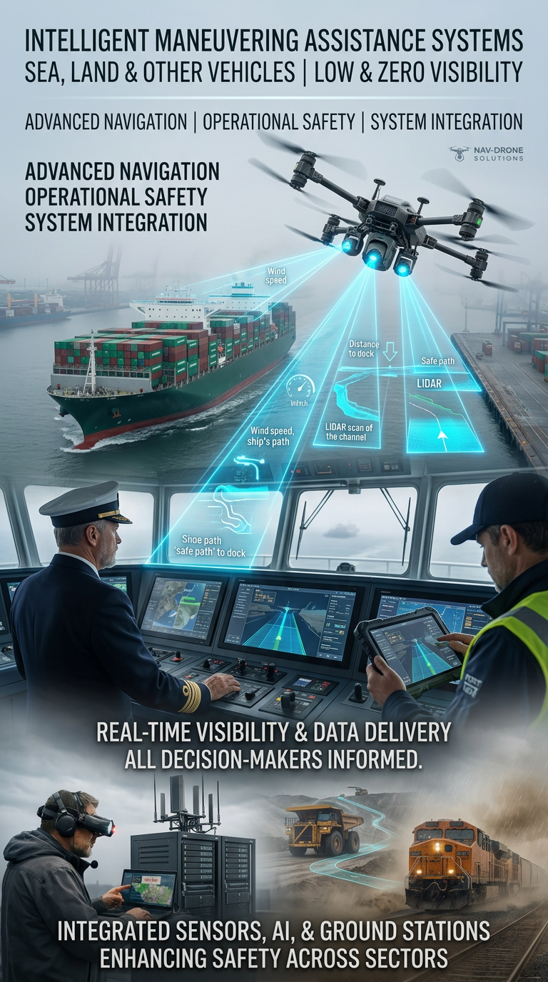
Systems for Assisting the Maneuvering in Low or Zero Visibility
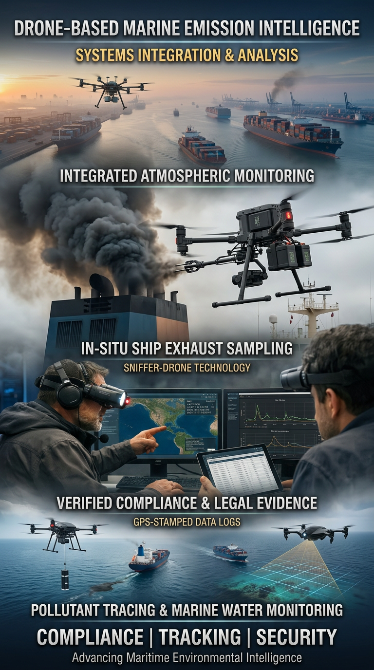
Drone Systems for Exhaust Gas Analysis
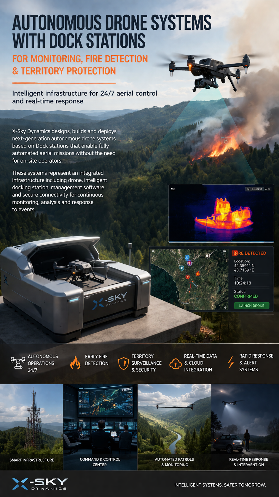
Dock Stations for Monitoring, Early Fire Detection
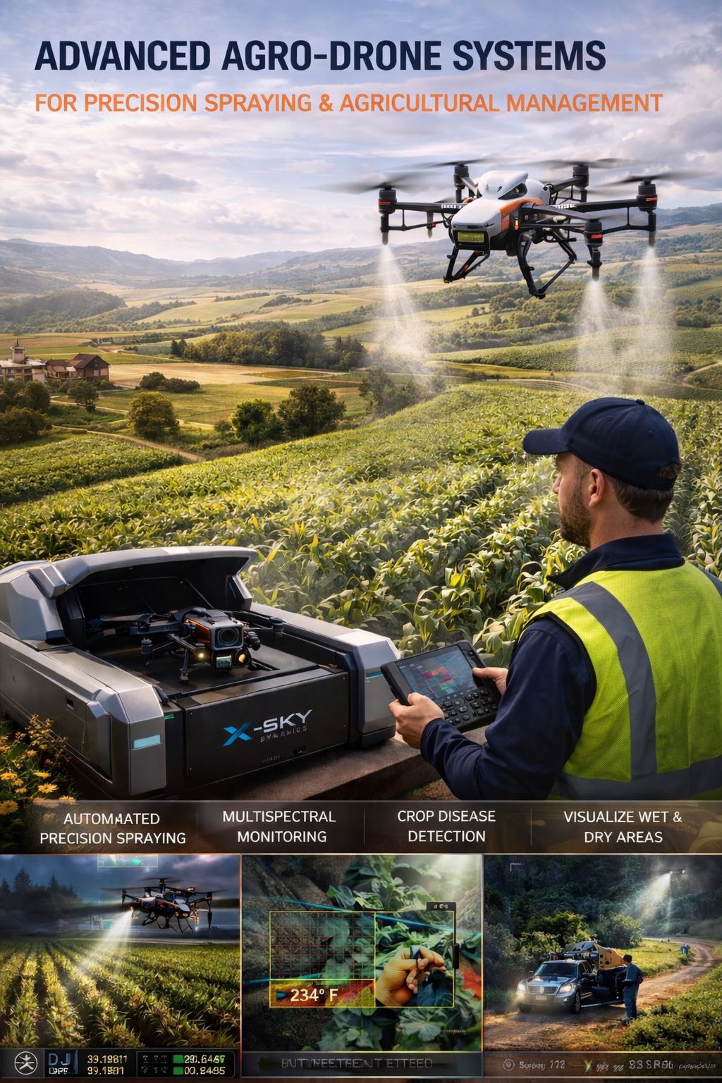
Agricultural Drone Systems for Precision Spraying, Spectral Monitoring
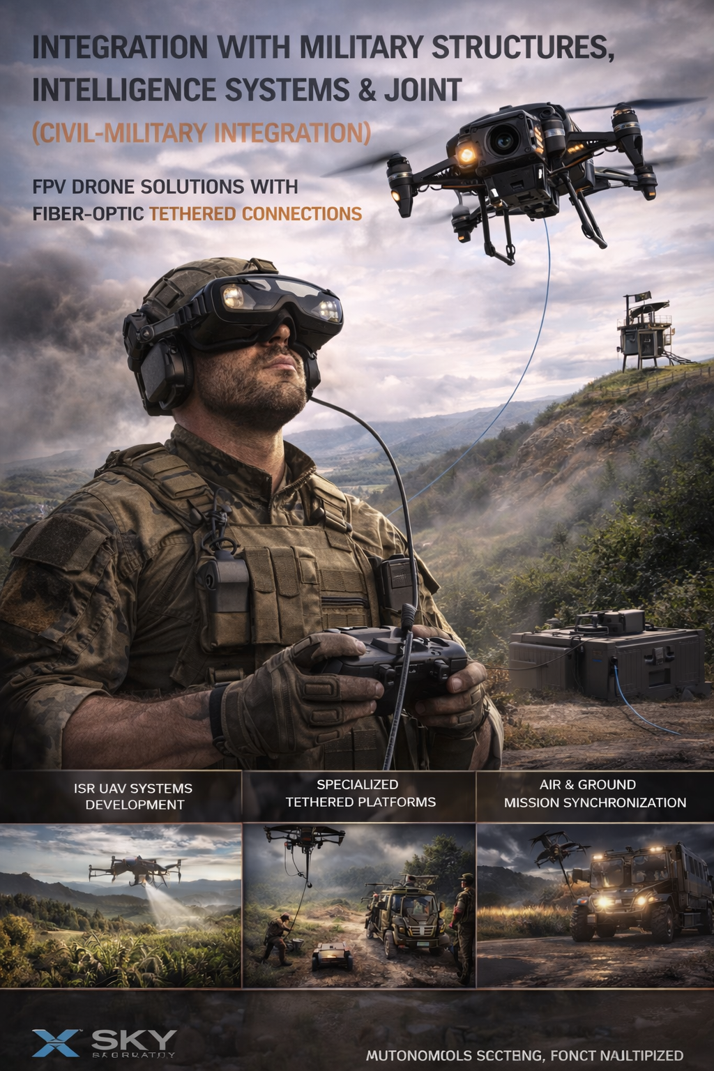
UAV – Drone Integration with Military
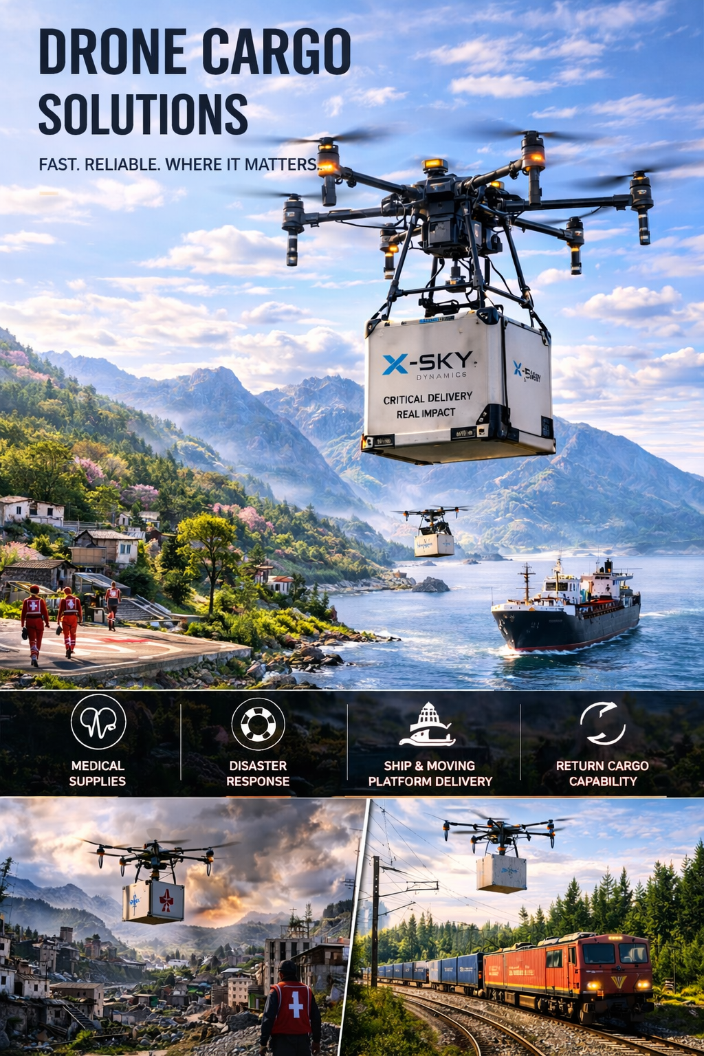
Cargo Transportation with Drones
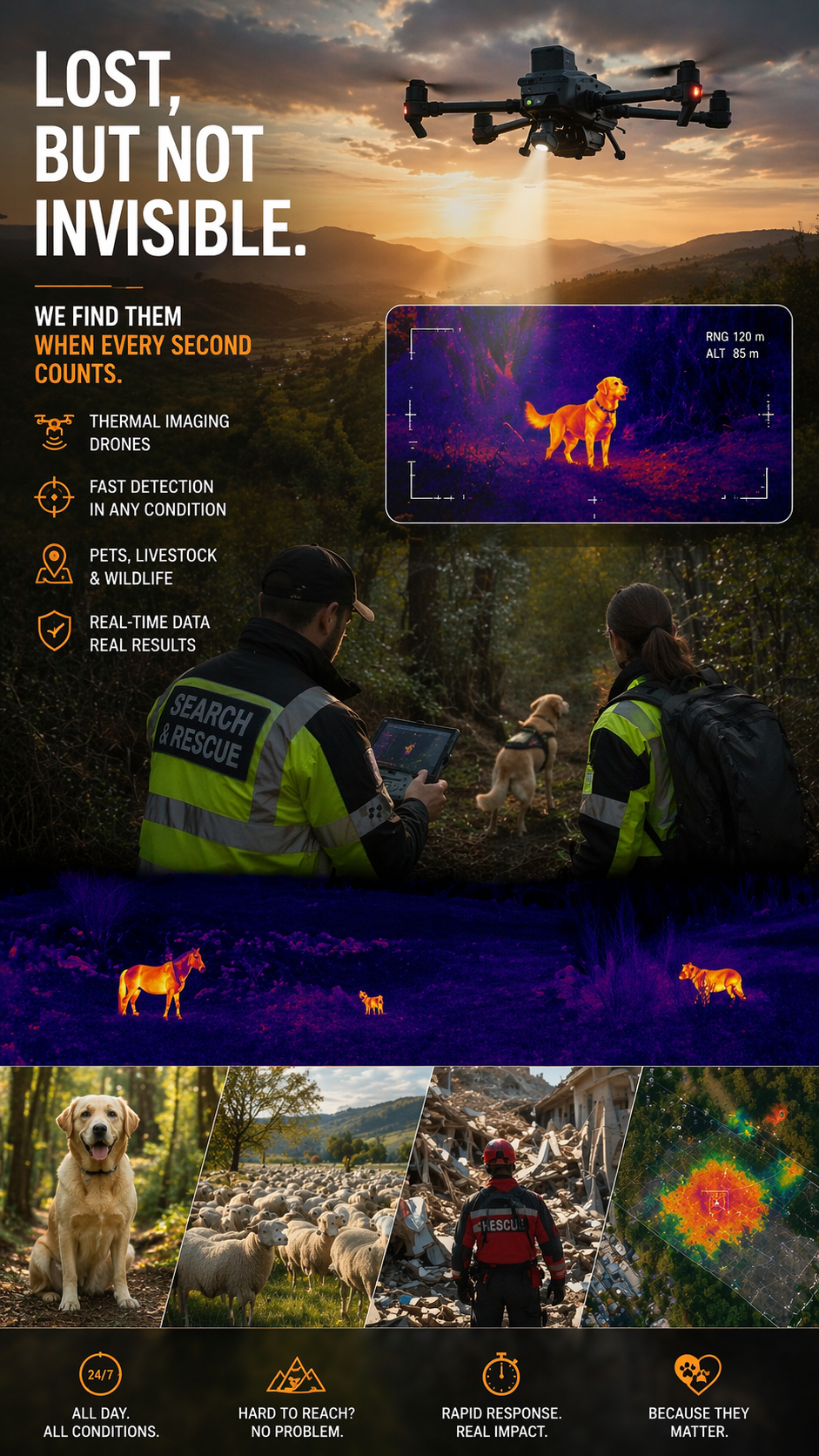
Search and Rescue of Pets and animals Using Drones
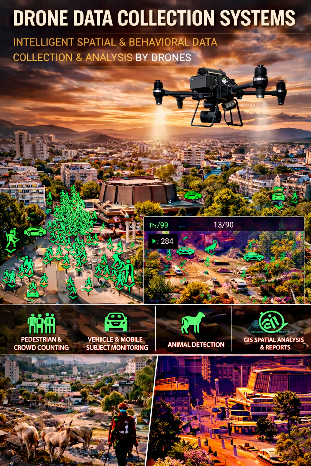
Drone Systems for Collecting Statistical Data
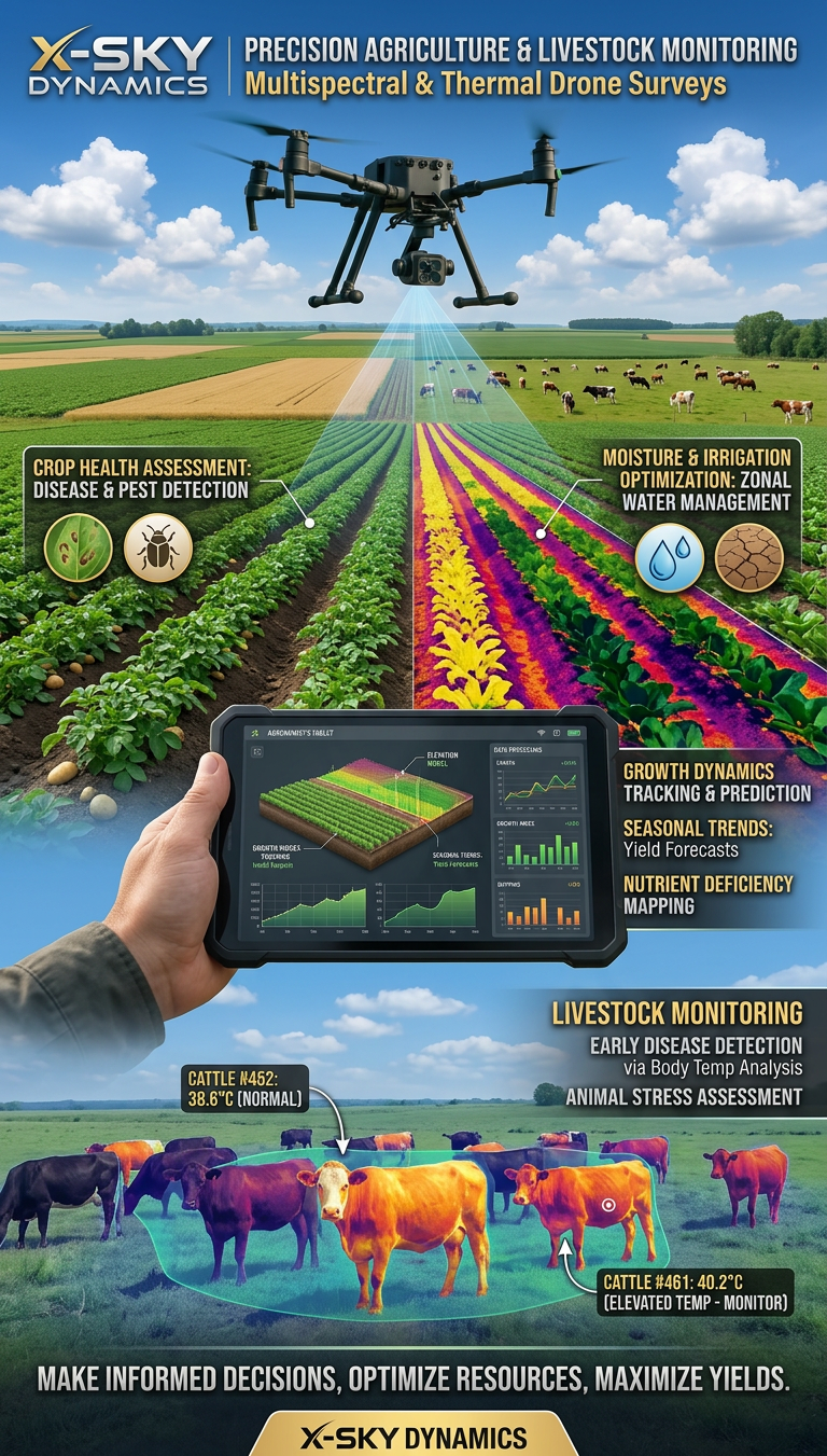
Multispectral and Thermal Drone Surveys for Agriculture
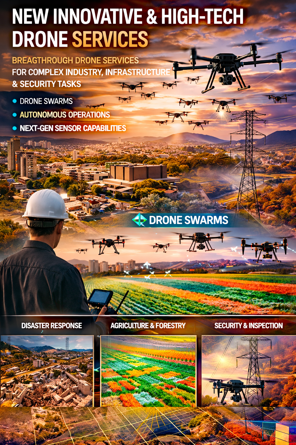
Innovative and High-Tech Drone Services
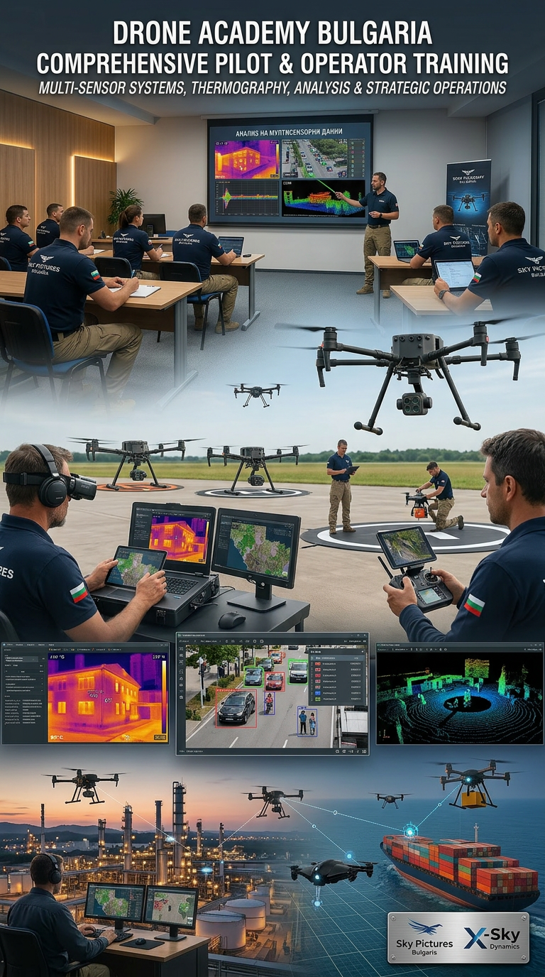
DRONE PILOTS AND OPERATORS TRAINING AND COURSES
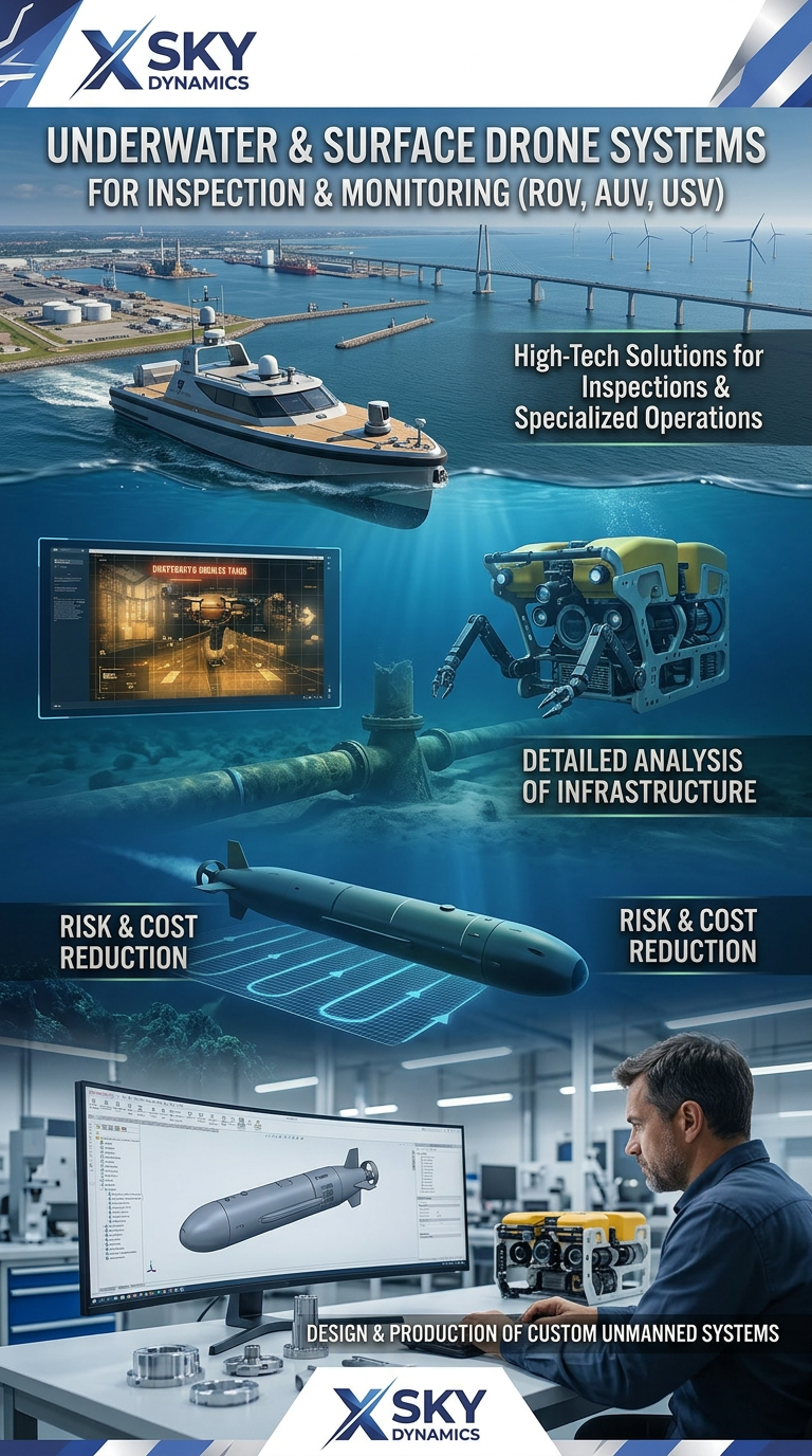
Underwater and Surface Drone Systems ROV, AUV, USV
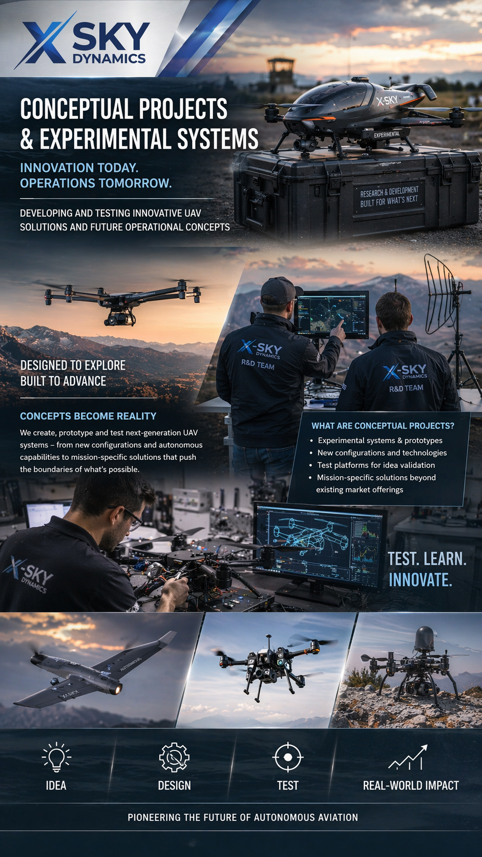
Concept Projects & Experimental UAV
Autonomous Drone Systems with Dock Stations
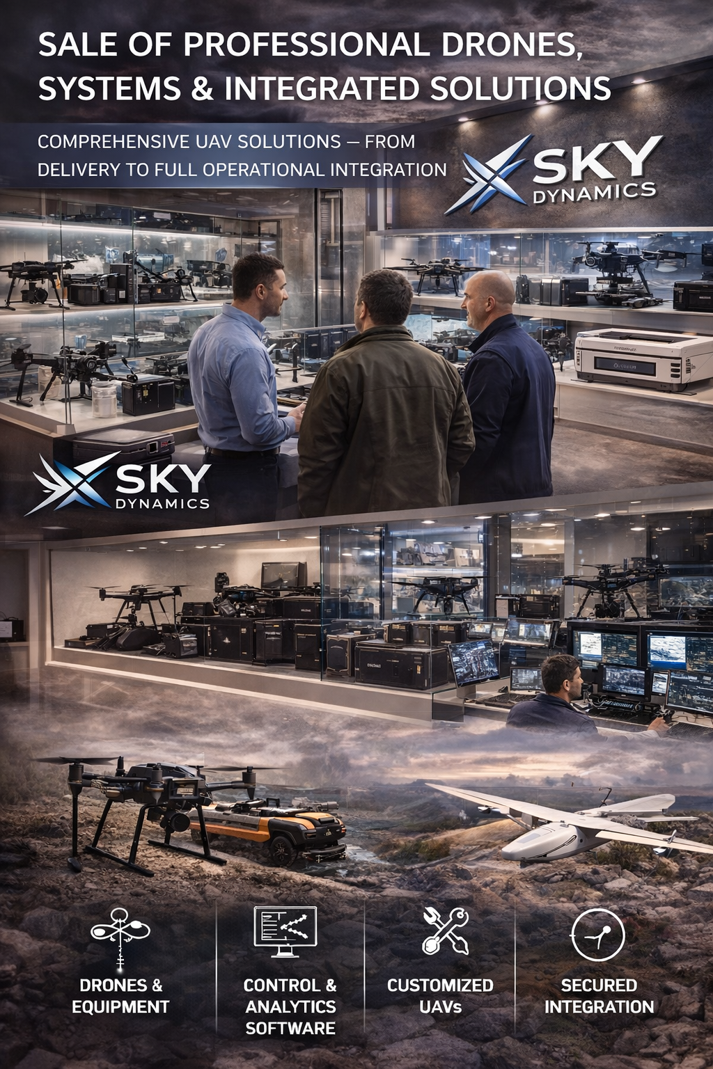
Sales of Professional Drones
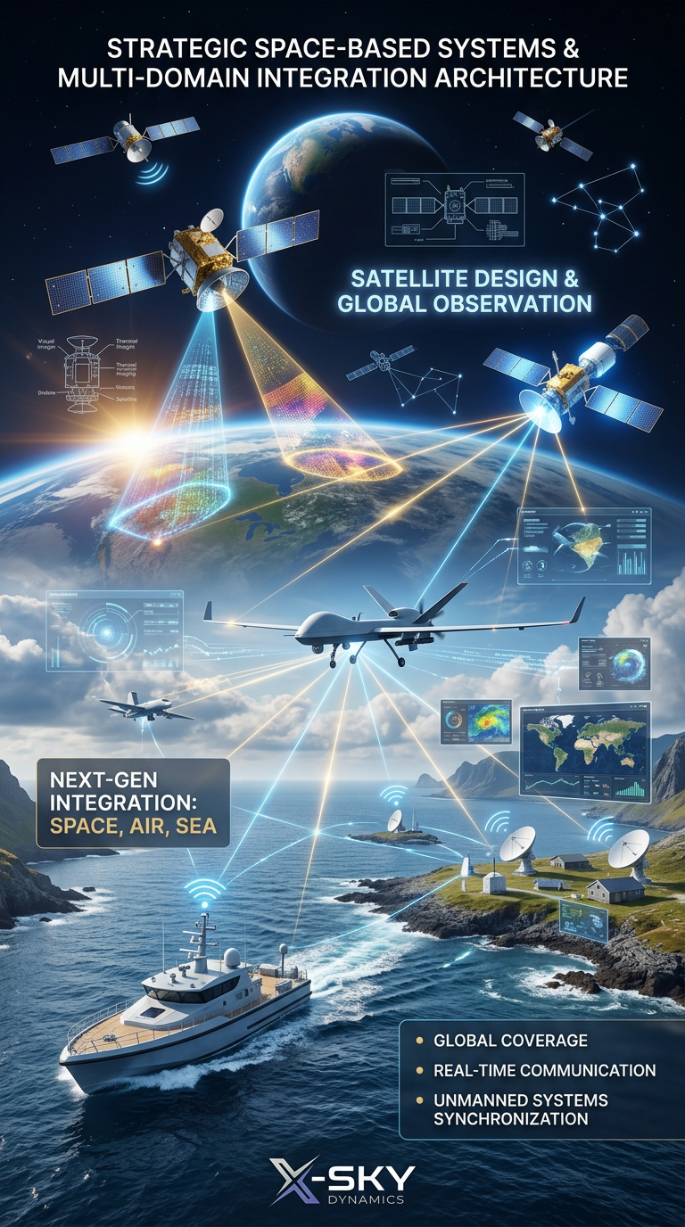
Satellite Imaging, Satellite Design and Integrated
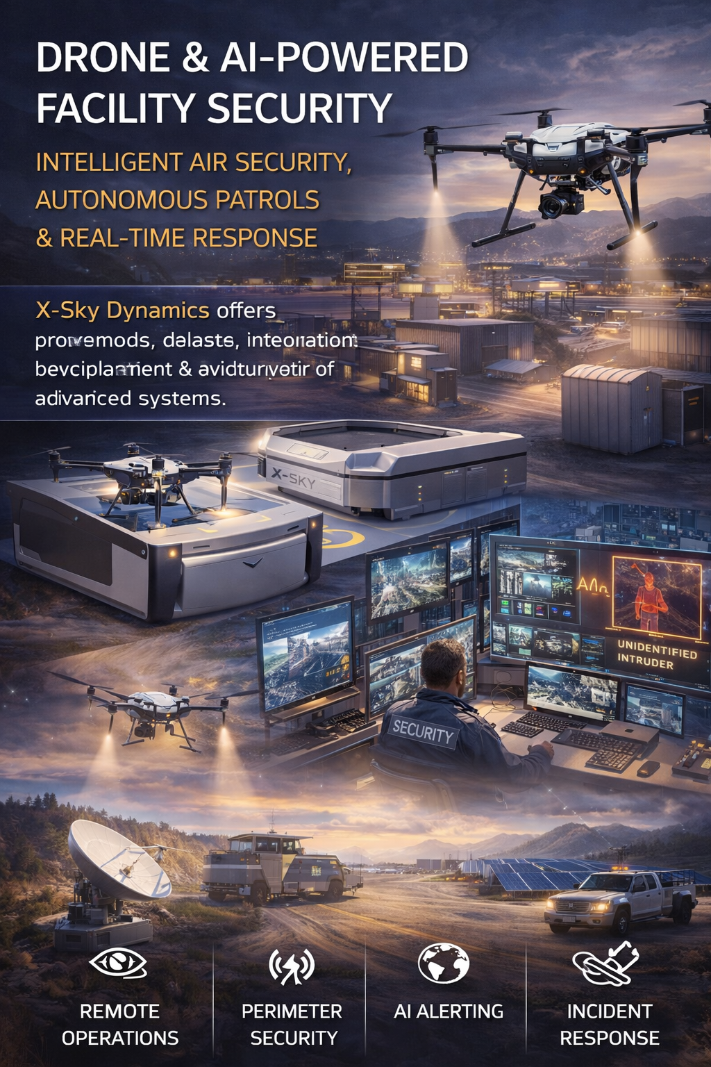
Security of Sites Through Drones AI Systems
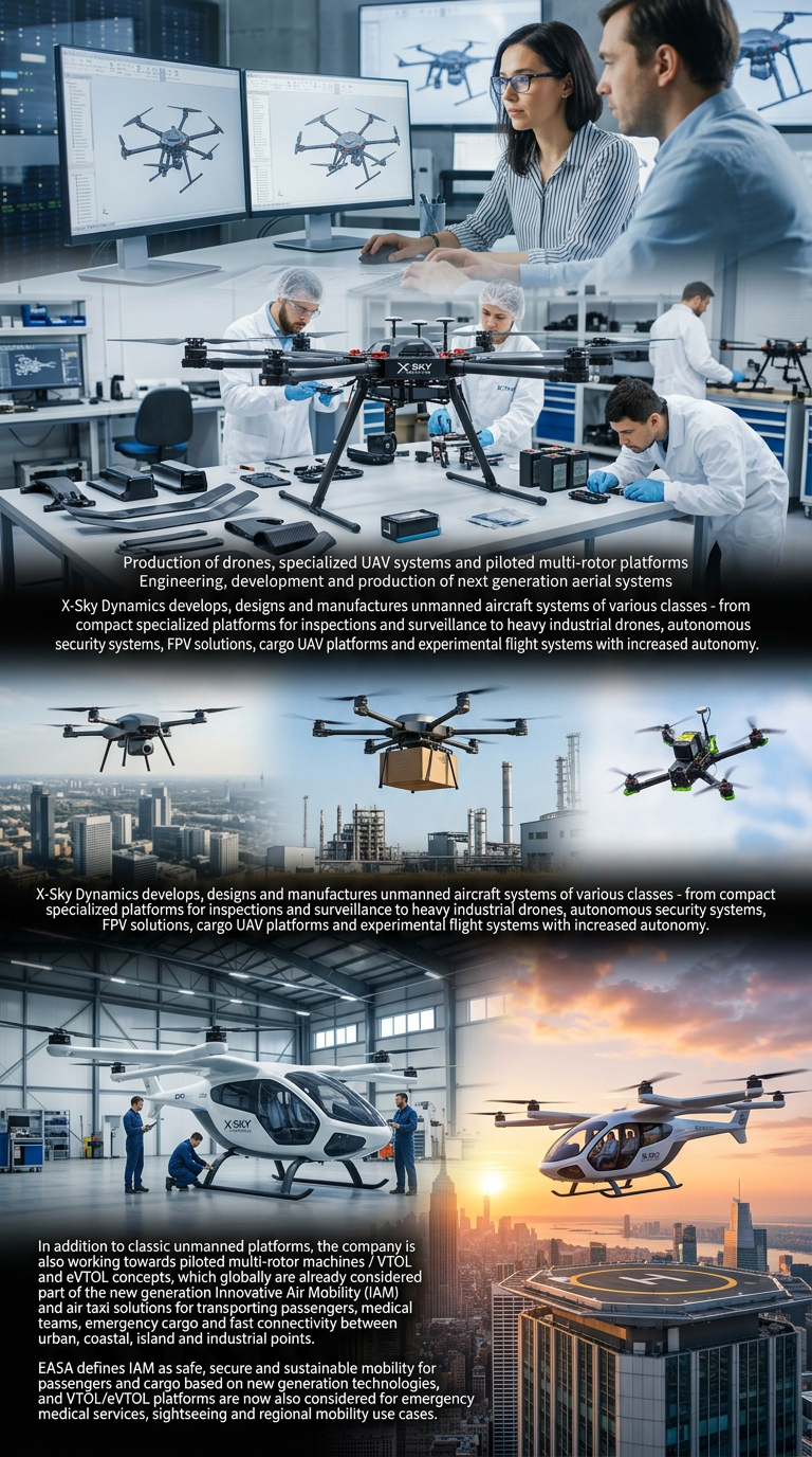
Drone Manufacturing and Manned Multirotor Platforms
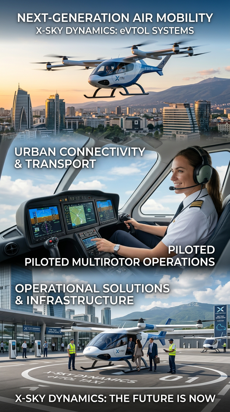
Air Taxis and eVTOL Systems
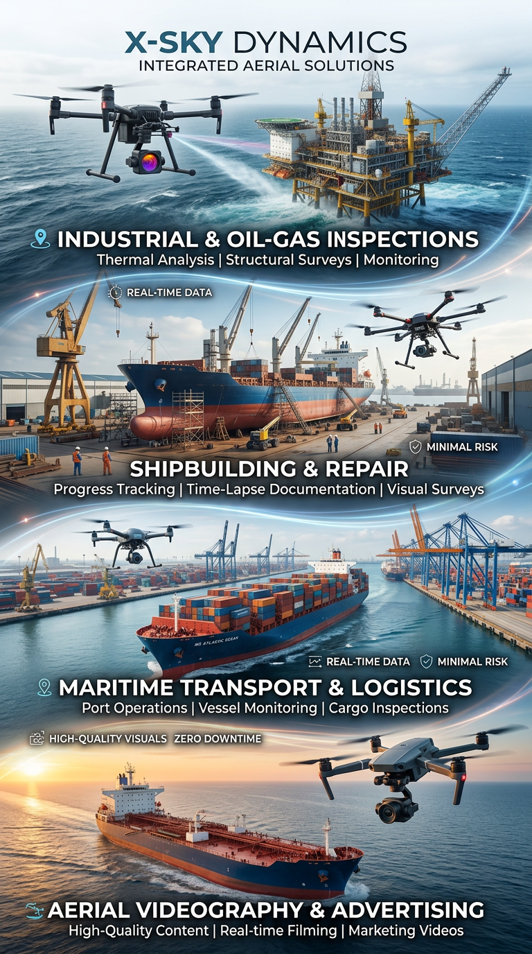
Drone and Video Services in Maritime Transport
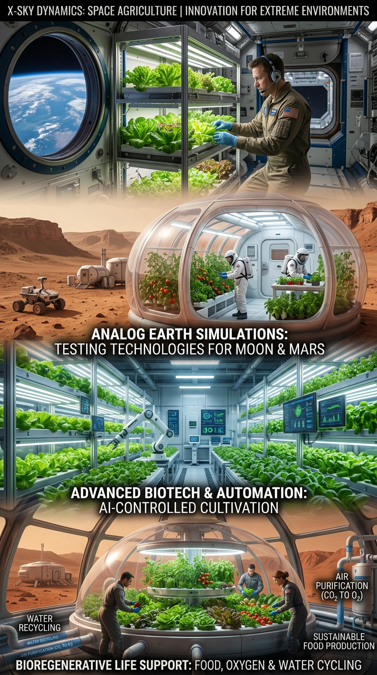
Space Agriculture, Agri-Systems for Extreme Environments

Cybersecurity, Cyber Defence and Protection of Critical Infrastructure
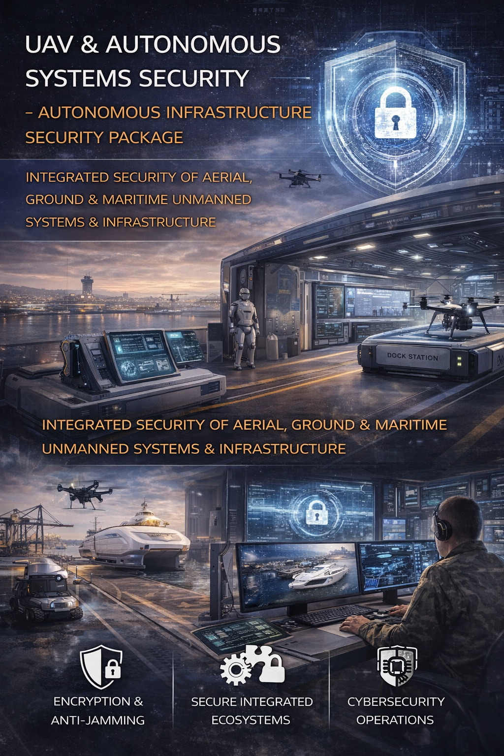
Cybersecurity and Protection of UAV and Autonomous Systems
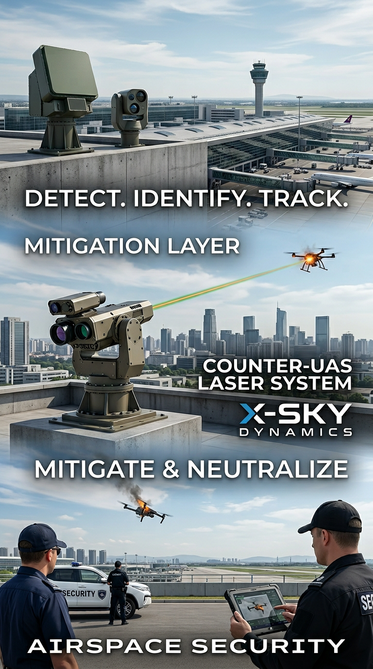
Counter-UAS, Laser and Kinetic Systems
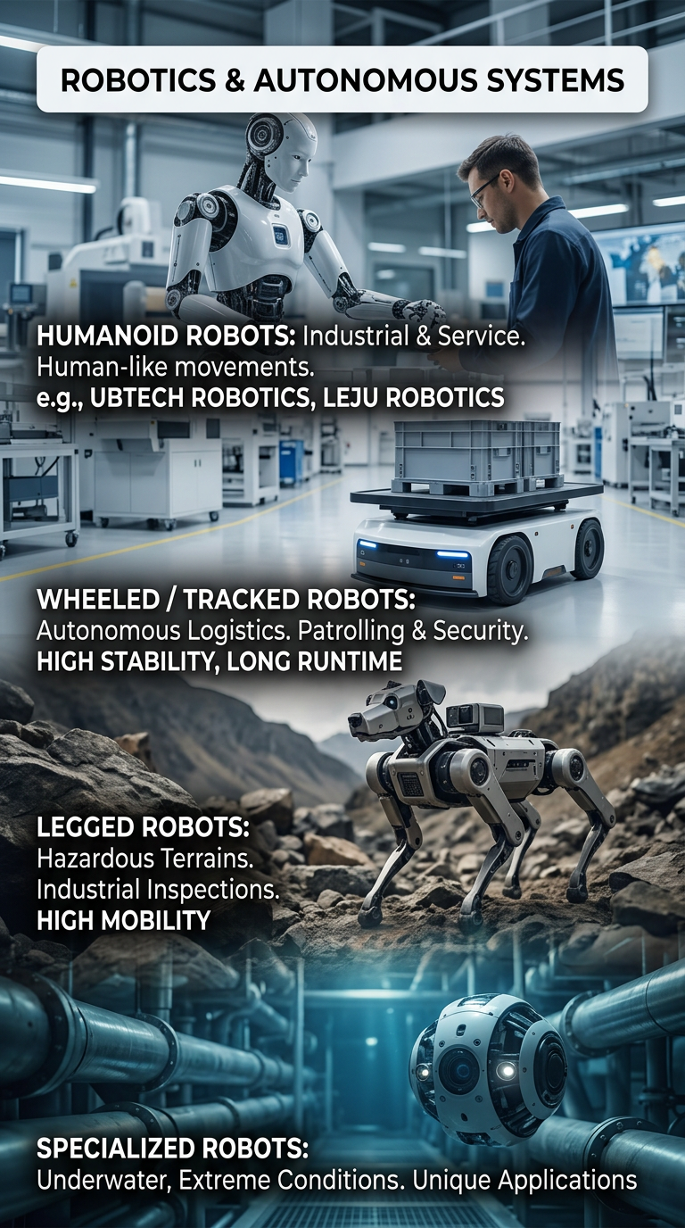
Robots and Autonomous Systems
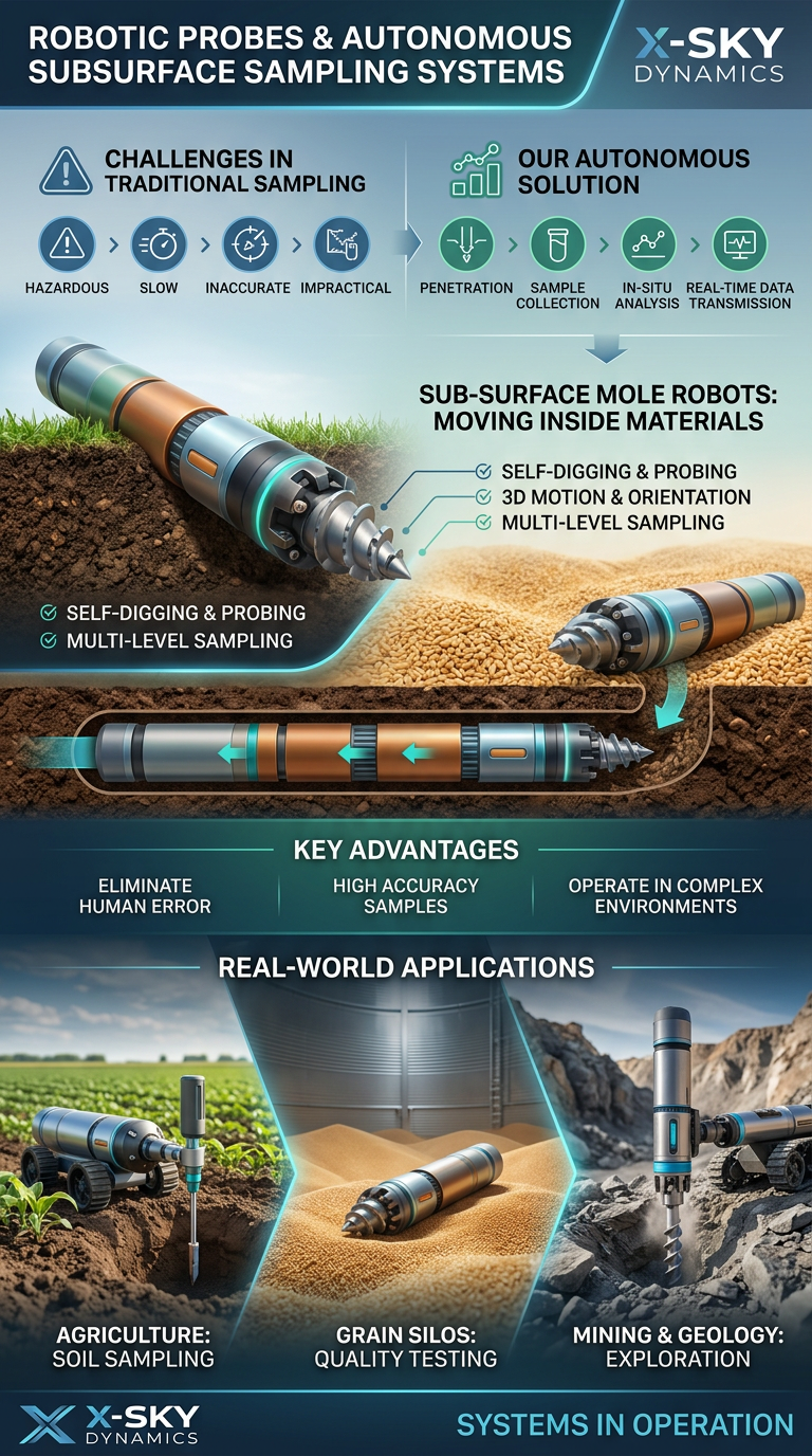
Robotic Probing Systems and Subsurface Technologies
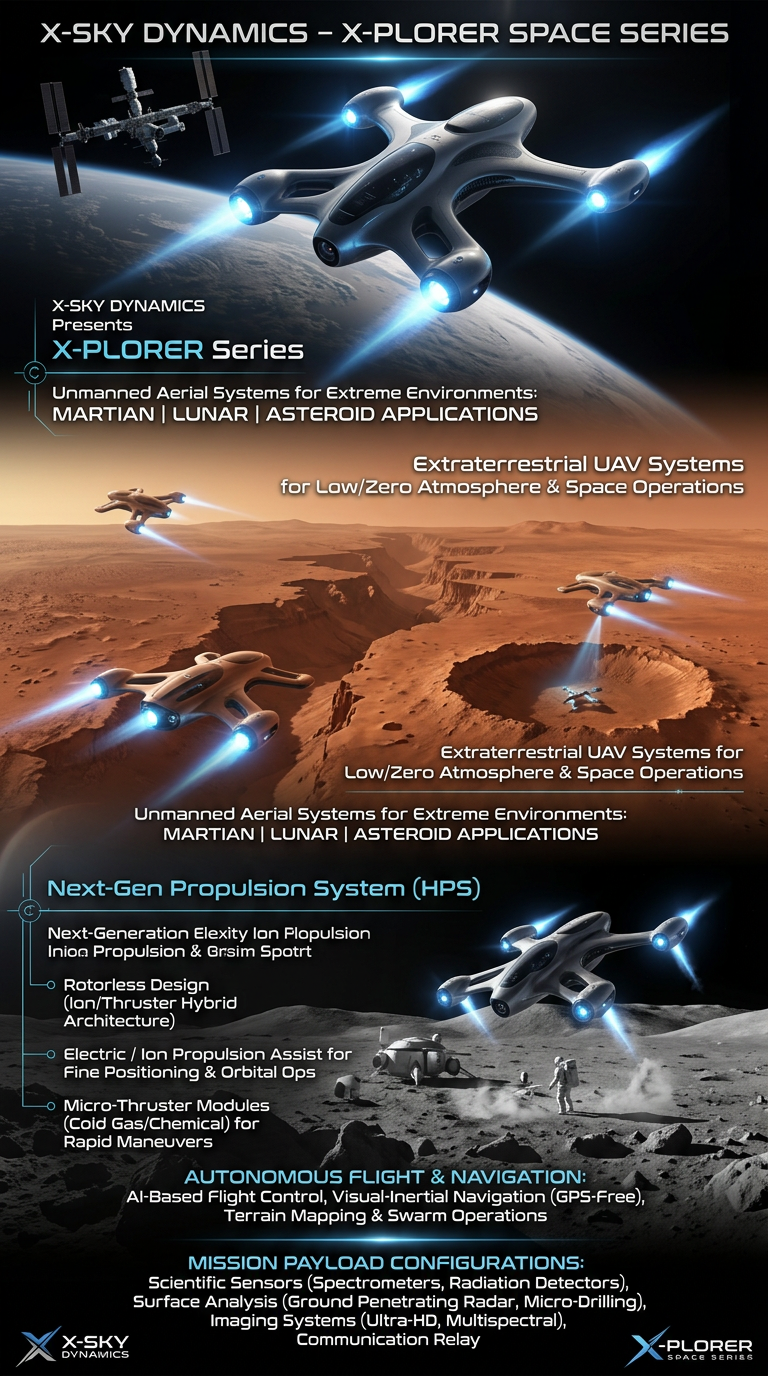
Space Drone systems SPACE X-PLORER SERIES

RAIGNV Partnership
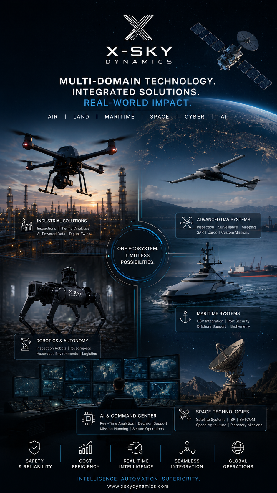
Investors & Partners

China ↔ EU Marketing
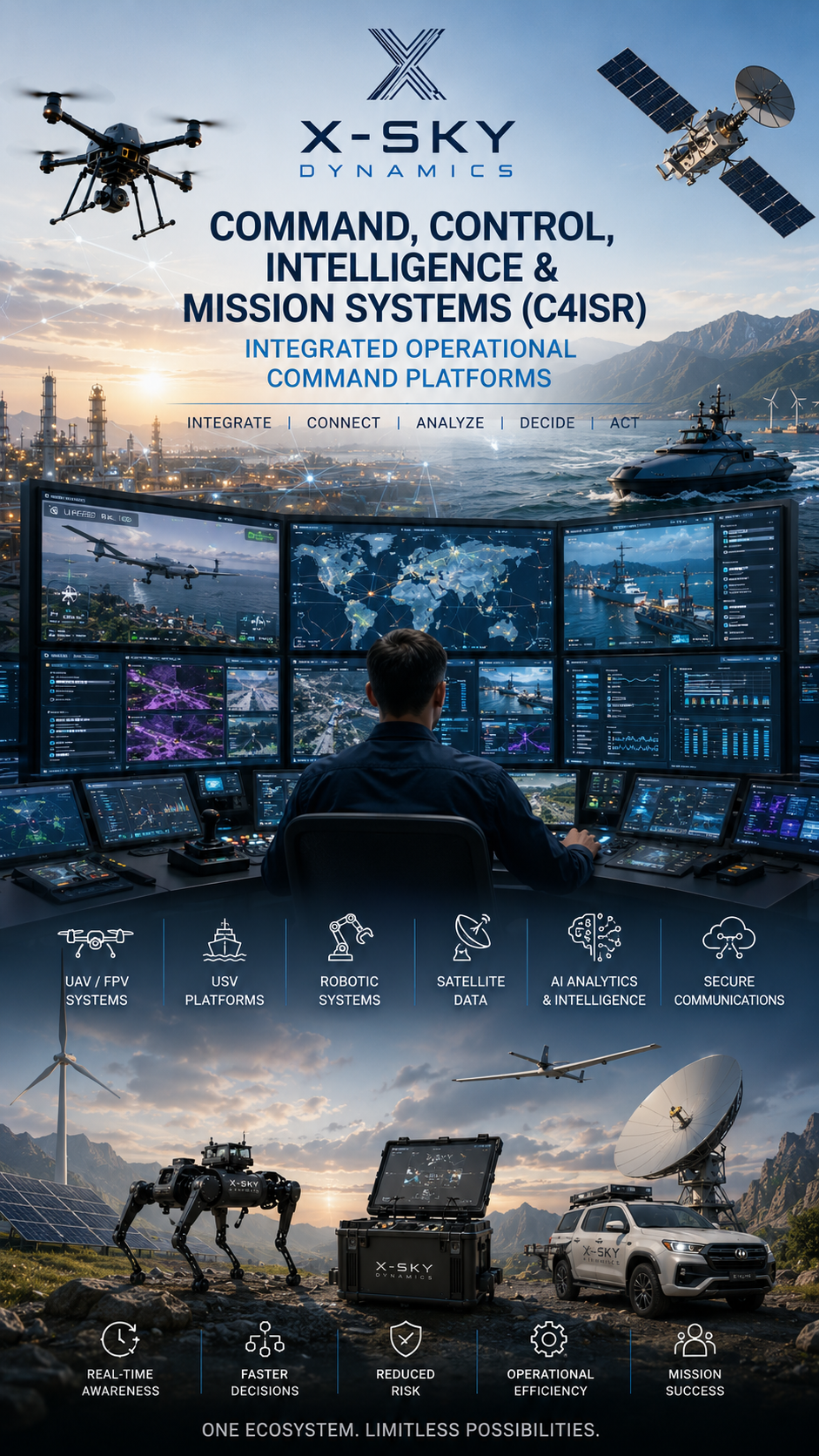
C4ISR Command Platforms
Professional UAV Certification